Planina Zajavornik - Vrh Razora
Starting point: Planina Zajavornik (1292 m)
| Latitude/Longitude: | 46,36290°N 13,94910°E |
| |
Walking time: 2 h 15 min
Difficulty: easy pathless terrain
Elevation gain: 601 m
Elevation difference along the route: 650 m
Map: TNP 1:50.000
Recommended equipment (summer):
Recommended equipment (winter): ice axe, crampons
Views: 5.591
 | 2 people like this post |
Access to starting point:
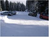
From the Ljubljana–Jesenice highway, take the Lesce exit and follow the road towards Bled, where at the traffic-light intersection signs for Pokljuka direct us to the right. This road, which in the lower part runs through some villages and later starts to ascend more steeply, we follow to Mrzli Studenec (mountain pasture, which is located a good 50 m behind the intersection where the road to Bohinj branches off left downhill). In the middle of the mentioned mountain pasture, from the main road a road branches off to the right which leads to Medvedova konta, the Pri Rupah monument and the Zajavornik mountain pasture. Here we turn right and in the following crossroads we follow the road in the direction of the Zajavornik mountain pasture. The road then brings us to the parking lot near the Zajavornik mountain pasture.
Route description:
From the parking lot, we head onto the footpath in the direction of Blejska koča mountain hut. The path, which initially ascends gently through the spruce forest, crosses a forest road slightly higher up, after which the path from the NOB monument (Pri Rupah) soon joins us from the left. The fairly wide path, which all the time runs embraced by spruce forests, brings us higher to the next junction, where we continue left towards Lipanca (right Medvedova konta). We continue the ascent along a very wide cart track, which in a gentle ascent brings us in a few minutes to the grazing area of Lipanca mountain pasture. Here the path turns right and leads us in moderate ascent along the right lower edge of the mentioned mountain pasture. There follows the crossing of a grassy slope and the path, which brings us back into the forest, makes a sharp right turn at the NOB memorial plaque, after which we reach the shepherd's hut and mountain hut on Lipanca mountain pasture.
From the hut we continue left towards Viševnik and Mrežce along the path from which a path towards Rudno polje soon branches off left downhill. We continue straight ahead and the moderately steep path brings us after a short ascent to the next junction, where we continue towards Viševnik (right steep path to Mrežce). The path then crosses a landslide-prone area in a gentle descent (in adverse conditions) and on the other side begins to ascend gently. The path ascends through increasingly sparse forest and soon brings us to the junction below the Mrežce summit.
We continue left (right to Mrežce 2 minutes) along the path which crosses the southern slopes of the lesser-known summit (Vrh Razora). At this point we also leave the marked path and head right onto the slopes of Vrh Razora. The direct ascent to the summit is blocked by a belt of dwarf pines through which we must force our way (on hot days watch out for snakes). Once we push through the belt of dwarf pines, we reach the panoramic and little-visited summit.
The ascent through the dwarf pines takes less than 10 minutes.

Photos:
 1
1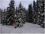 2
2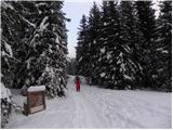 3
3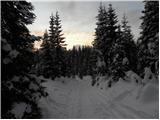 4
4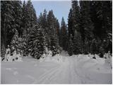 5
5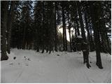 6
6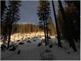 7
7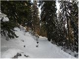 8
8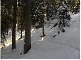 9
9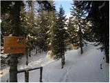 10
10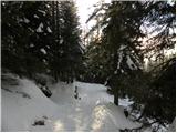 11
11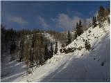 12
12 13
13 14
14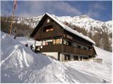 15
15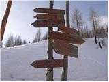 16
16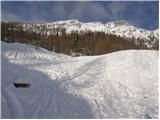 17
17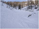 18
18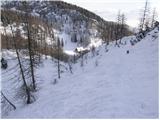 19
19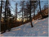 20
20 21
21 22
22 23
23 24
24 25
25 26
26 27
27 28
28 29
29 30
30 31
31 32
32 33
33 34
34 35
35 36
36 37
37 38
38 39
39 40
40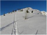 41
41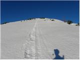 42
42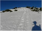 43
43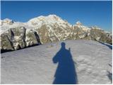 44
44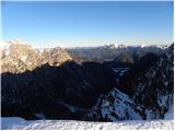 45
45
Discussion about the trip Planina Zajavornik - Vrh Razora
To post a comment you must log in:
If you do not yet have a username, you must first
register.