Planina Zajzera - Bivacco Suringar (Via Amalia)
Starting point: Planina Zajzera (1004 m)
| Latitude/Longitude: | 46,45650°N 13,46924°E |
| |
Route name: Via Amalia
Walking time: 5 h 45 min
Difficulty: very difficult marked way
Elevation gain: 1426 m
Elevation difference along the route: 1500 m
Map: Julijske Alpe - zahodni del 1:50.000
Recommended equipment (summer): helmet, self belay set
Recommended equipment (winter): helmet, self belay set, ice axe, crampons
Views: 4.913
 | 1 person like this post |
Access to starting point:
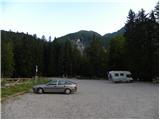
From Kranjska Gora over the border crossing Rateče we drive to Trbiž / Tarvisio. Further, we drive on the old road towards Videm / Udine. Already after a few kilometers from Trbiž / Tarvisio, the road into Ovčja vas / Valbruna branches off to the left. Here we turn left and we follow the road all the way to the mountain pasture Zajzera, where we park on a large parking lot.
Route description:
From the parking lot, we head onto the road which is closed to traffic following the signs Bivacco Mazzeni, Bivacco Stuparich. The road at first slightly descends and then leads through the forest. We soon come out of the forest to a wide riverbed of the stream, where a lot of sand is deposited. Here the path is somewhat less visible, and we cross the sandy terrain slightly to the right. The path then brings us to a junction, where we go right following the signs Bivacco Stuparich. With the help of some cairns we again cross a torrent to the right and then the path brings us into the forest. The path through the forest soon starts quite steeply ascending, then turns to the left and soon nice views open up to the mountain walls of Montaž. The path further leads by the riverbed of the stream past some bushes and dwarf pines and it brings us to a path junction. We continue to the left following the signs Stuparich, and right leads the path towards the mountain hut Grego.
The path here turns to the left and starts ascending in zig-zags through a thin forest on the left side of the valley. The path again brings us to a junction. We go left towards the bivouac Stuparich, and right leads the path towards the Dunjska dolina. Further, the path starts crossing the slope towards the east and then soon brings us to bivouac Stuparich.
From the bivouac, we return a few meters back where an inscription on a big rock points us right upwards (southwest). The path left downwards (southeast) leads towards the bivouac Mazzeni.
For a short time, we then ascend on a slightly overgrown path through bushes, and then the path brings us to the riverbed of a torrent. Here we turn to the left and ascend on the right side of the torrent riverbed upwards. Blazes here are rare, and numerous cairns help us. The path then turns to the right and crosses slopes below Montaž towards the west all the way to the entry into the climbing part of the path.
The climbing path at the beginning turns left into the wall and starts ascending in steep zig-zags along the steel cable, and some pegs also help us. On some spots, the path ascends almost vertically. The path then turns to the right and very steeply ascends along the steel cable upwards. Next follows a vertical ascent with the help of numerous brackets, which brings us to a narrow notch. Through the notch, we slightly descend and then follows a demanding vertical ascent left upwards. Besides the steel cable, some pegs also help us at the ascent.
The path further becomes a little less demanding and starts ascending along the steel cable on a quite wide gully upwards. The path then turns to the left and for a short time brings us on a gentle grassy slope, and then it again starts ascending on a rocky slope upwards. Further, the path a few more times quite steeply ascends along the steel cable, and some brackets also help us. The path then brings us below Severni stolp (Torre Nord), where it turns to the right. Here we cross steep slopes towards the west, in early summer there are often snow patches here. Next follows an ascent on steep grassy slopes and then ascent along the steel cable on a slightly crumbly slope. Such a path then brings us to a narrow ridge from where beautiful views also open up towards the west. Next follows a short ascent on the ridge and then the path turns on the west side and starts descending on a steep grassy slope. Further, the path for some time crosses slopes towards the south, and then turns to the left and ascends a little steeper on a rocky slope upwards. To the bivouac Suringar then follows only a short crossing on the ledge to the right.

Photos:
 1
1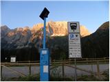 2
2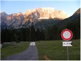 3
3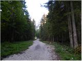 4
4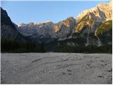 5
5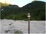 6
6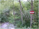 7
7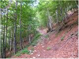 8
8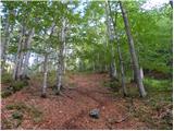 9
9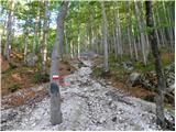 10
10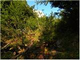 11
11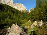 12
12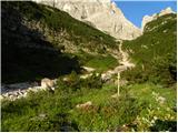 13
13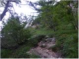 14
14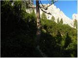 15
15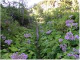 16
16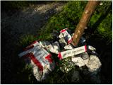 17
17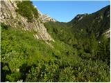 18
18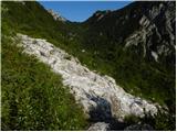 19
19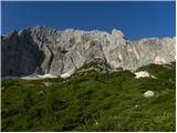 20
20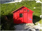 21
21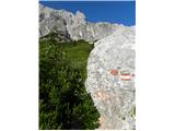 22
22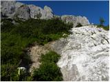 23
23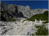 24
24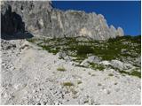 25
25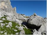 26
26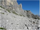 27
27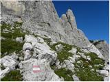 28
28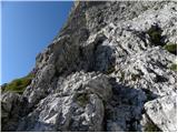 29
29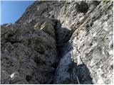 30
30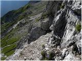 31
31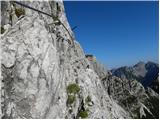 32
32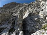 33
33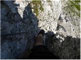 34
34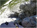 35
35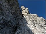 36
36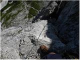 37
37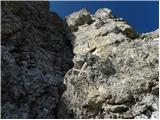 38
38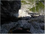 39
39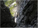 40
40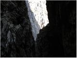 41
41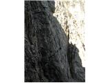 42
42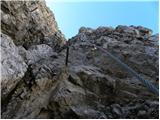 43
43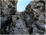 44
44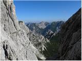 45
45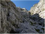 46
46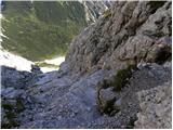 47
47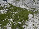 48
48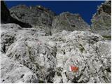 49
49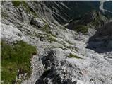 50
50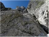 51
51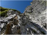 52
52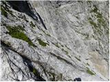 53
53 54
54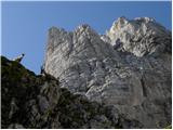 55
55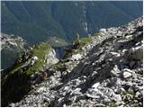 56
56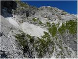 57
57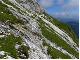 58
58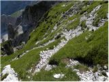 59
59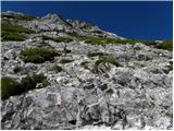 60
60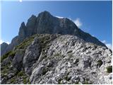 61
61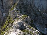 62
62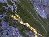 63
63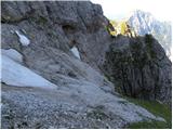 64
64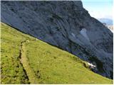 65
65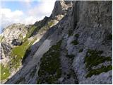 66
66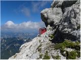 67
67
Discussion about the trip Planina Zajzera - Bivacco Suringar (Via Amalia)
To post a comment you must log in:
If you do not yet have a username, you must first
register.