Planinska Ravna - Boskovec (via Hleviška planina)
Starting point: Planinska Ravna (1140 m)
Route name: via Hleviška planina
Walking time: 1 h 30 min
Difficulty: easy marked way
Elevation gain: 447 m
Elevation difference along the route: 500 m
Map: Kamniške in Savinjske Alpe 1:50.000
Recommended equipment (summer):
Recommended equipment (winter):
Views: 11.170
 | 1 person like this post |
Access to starting point:
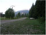
First, we drive to Mozirje, where at the roundabout, we go in the direction of Golte and Šmihel. A little further, we come to an intersection at the inn, where we turn slightly right in the direction of Šmihel (left cableway Golte). We follow the road ahead to the village, where on the right side of the road, we notice a church. Only a little further, we come to the intersection, where we go left in the direction of the mountain hut Mozirska koča, Golte (Here from the right joins the road from Koroška side by which access is possible for Korošci). The road then soon brings us to the next intersection, where we go left on the lower road. The road then soon becomes a macadam, and we follow it to a large parking lot before the gate. The parking lot is on the right side of the road and is partly overgrown with grass.
Route description:
At the beginning of the parking lot, we notice signposts, which point us to the right on a footpath in the direction of the mountain hut Mozirska koča. The path which goes immediately into the forest is moderately ascending and after a few minutes brings us to a smaller crossing, where we have two options to continue. We can continue straight on a steep or right on a gentle path. Both paths after a few minutes join and higher bring us to a nice vantage point, by which there is a bench. Next follows only a good 10 minutes of a moderate ascent to the mountain hut Mozirska koča.
From the mountain hut, we continue left on the road to the chapel where there is a crossing. We continue slightly right (between the chapel and the path Severjeva pot) in the direction of the path Pot po Golteh. The path which is further ascending through the forest quickly brings us to the ice cave (cave in which snow persists late into the summer). After the next few minutes of ascent we come out of the forest on the ample mountain pasture Hleviška planina. Here the path turns right and in a gentle diagonal ascent brings us on a worse road. We continue on the mountain pasture ahead to a smaller saddle, where there is the next crossing. Here we go right on a footpath in the direction of Boskovec (straight downwards Smrekovec) and the path which ascends and then descends a few times we follow to a crossing a few minutes below the summit (path is mostly ascending). Here we continue left and we follow a moderately steep path to the top which we reach after a few dozen steps of additional walking.
Planinska Ravna - Mozirska koča 30 minutes, Mozirska koča - Boskovec 1:00.

Photos:
 1
1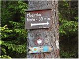 2
2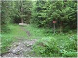 3
3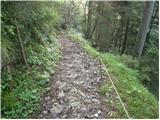 4
4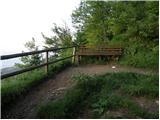 5
5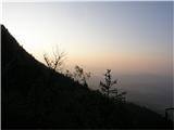 6
6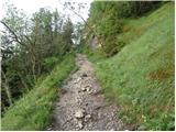 7
7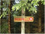 8
8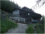 9
9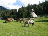 10
10 11
11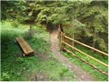 12
12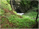 13
13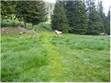 14
14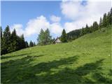 15
15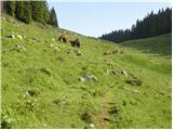 16
16 17
17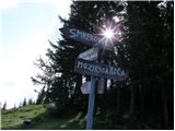 18
18 19
19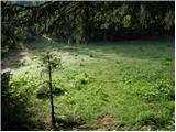 20
20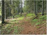 21
21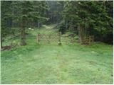 22
22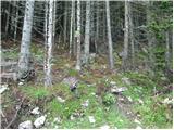 23
23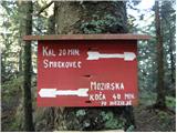 24
24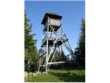 25
25
Discussion about the trip Planinska Ravna - Boskovec (via Hleviška planina)
To post a comment you must log in:
If you do not yet have a username, you must first
register.