Planinski dom Maks Plotnik - Okić (Žohar's climbing trail)
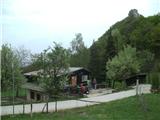
Starting point: Planinski dom Maks Plotnik (411 m)
Route name: Žohar's climbing trail
Walking time: 25 min
Difficulty: very difficult marked way
Elevation gain: 88 m
Elevation difference along the route: 88 m
Map:
Recommended equipment (summer): helmet, self belay set
Recommended equipment (winter):
Views: 3.313
 | 1 person like this post |
Access to starting point:
a) Via the Brežice/Bregana border crossing we drive into Croatia, leaving the motorway at the Samobor exit. When we arrive in the town, we head south towards Zagreb. At the petrol station at the southern exit from the town, we turn right and continue towards the villages of Mirnovec and Kladje. When the road brings us to the pass with serpentines, we turn right into Konščica village and then drive westwards towards Terihaji village. Further on, we will notice signs for Dom pod Okićem (the street is called Starogradska ulica) by the road, directing us left.
b) From Prekmurje and the Maribor area, we first drive to the Gruškovje/Macelj border crossing and continue on the motorway to the Jankomir junction, turning left towards Ljubljana and Samobor. We leave the motorway at the Samobor exit, then continue as per the above description.
Since the parking lot next to the hut is too small for all visitors and also quite difficult to reach orientation-wise, I recommend arriving at the hut on foot from Novo Selo Okićko.
Route description:
From the Maks Plotnik Hut we go slightly east and reach a junction. Left goes the easier path, right downhill goes the path towards the settlements Sveti Martin and Novo Selo Okićko (Podgrađe), we go straight. The path first goes across a gentle meadow and then enters the forest. In the forest the ground becomes increasingly rocky, we reach a junction where Dragojlin's path branches off downhill, we go left uphill.
After the junction the path becomes more demanding, we climb up and down the rocks and reach the start of the climbing section.
The most difficult part of the path is right at the beginning, where we first cross an exposed cliff. Then the path goes vertically upwards along the steel cable. Some pitons assist us. After overcoming about ten vertical meters of ascent the path turns slightly left and levels out a bit. Here the hardest part ends.
Now a new steep section awaits us with one quite demanding rocky step. The steel cable and some pitons assist us all the time. When this section ends, the protections also end. An exceptional view to the southeast opens behind us.
After leaving the protections, Žohar's path will soon end too. Now we join Dragojlin's path and overcome a few technically undemanding rocks and then reach the place where we join the easy path. To the summit and the old Okić castle it is just a few minutes from here.
Unfortunately, the old Okić castle is a ruin. Since the forest has overgrown it, there is no beautiful view from the very summit.
The path is named after Dragutin Belačić - Žohar, an alpinist from Samobor.

Photos:
 1
1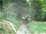 2
2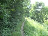 3
3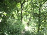 4
4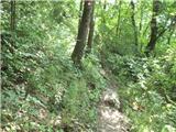 5
5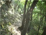 6
6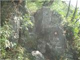 7
7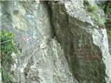 8
8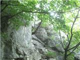 9
9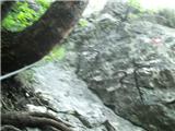 10
10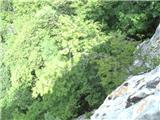 11
11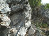 12
12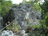 13
13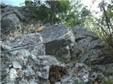 14
14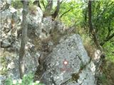 15
15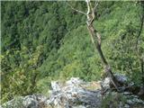 16
16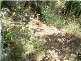 17
17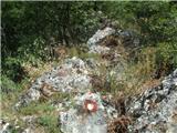 18
18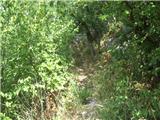 19
19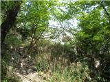 20
20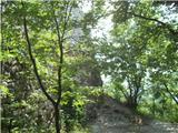 21
21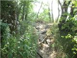 22
22
Discussion about the trip Planinski dom Maks Plotnik - Okić (Žohar's climbing trail)
|
| zeldok22. 09. 2017 |
Too bad the pictures are of poor quality.
|
|
|
|
| zeldok22. 09. 2017 |
And one more thing, Dragojlina staza starts a good 200 meters lower and is quite steep and slippery on that section.
|
|
|
|
| Loerst14. 06. 2026 00:20:23 |
Quick note - there are really only about 5 parking spaces next to the hut, but behind it there is a huge meadow (for +100 vehicles, even for buses if necessary), where you can park for 2 EUR/day. This only applies during the peak season, outside of it there is no one anywhere to charge.
Feratica is very short, but charming, of difficulty around B, suitable for the first such steps. The protections are flawless (June '26). The castle at the top is interesting, descent via the normal path.
In the era of Google Maps, there are no (more) problems even with initial navigation to the mountain hut.
|
|
|
To post a comment you must log in:
If you do not yet have a username, you must first
register.