Plaz Črlovec - Vrtaški vrh (upper path)
Starting point: Plaz Črlovec (920 m)
| Latitude/Longitude: | 46,43110°N 13,87840°E |
| |
Route name: upper path
Walking time: 3 h 50 min
Difficulty: partly demanding unmarked way, easy marked way
Elevation gain: 978 m
Elevation difference along the route: 1055 m
Map: TNP 1:50.000
Recommended equipment (summer): helmet
Recommended equipment (winter): helmet, ice axe, crampons
Views: 1.300
 | 1 person like this post |
Access to starting point:
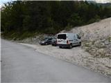
We drive to Mojstrana, then we follow the signs for the Vrata valley. Along the road through the Vrata valley we drive to the road sign 8 km or some 10 meters ahead to the gully Plaz Črlovec, where the described path begins. Parking in the area of TNP is allowed only on marked parking spots.
Route description:
From the gully Plaz Črlovec we return along the road some 10 meters back, then we continue on a side road that continues towards the northeast. The path ahead leads us past a gate, after the gate an unmarked path branches off to the left, which leads towards Kukova špica and Njivice. We continue on the mentioned path (straight Planina Višek and Vrtaška planina via the lower path) and begin to ascend on the right side of the gully Veliki Črlovec. A little higher, a path joins us from the left that leads across the gully (the start is at the gully Plaz Črlovec, directly from the road leading towards Aljažev dom v Vratih, or where the starting point is indicated), but we follow the best-beaten path, as there are quite a few junctions, mainly shortcuts or longer turns of the built path. Higher up, the path moves onto the ridge that formed between Veliki and Mali Črlovec, the transitional panoramic path returns to the forest, through which it ascends in a few more zigzags. Still in the forest, at an altitude of approximately 1500 meters we arrive at a junction, where we continue right (left, where we notice the inscription "KUK" on a tree, Kukova špica).
From the junction we ascend for a few more minutes through the forest, then the path turns increasingly to the right and quickly brings us to the gully Mali Črlovec, where we cross a few gullies. Greater caution is needed on steep sections, and the passage from the last, largest gully of Mali Črlovec is somewhat awkward. This is followed by an ascent through a belt of dwarf pines, where due to a landslide the path makes a small "detour". Ahead of us is a short traverse and we arrive at a small junction, where we continue left on the upper path (straight middle path leading to Vrtaška planina).
Further on we mostly ascend diagonally to the right, and the path occasionally makes another switchback. Higher up we cross a few scree slopes, then the path stops ascending for a while, continuing with some shorter ascents and descents. After a longer traverse, where the trail is relatively easy to follow the whole time, the trail begins to fade. We continue somewhat to the left and across the pasture fence reach the lower edge of Njivice, where we also notice the PP sign (path Planica - Pokljuka), and some 10 steps further we step onto the marked path.
On the marked path we continue slightly left (right Vrtaška planina) and ascend through a pleasant little valley to the marked junction at Njivice.
From the junction we continue right in the direction of Vrtaški vrh (straight Sleme), where the trail across the grassy slope is initially not very easy to follow, but once we reach the belt of dwarf pines, it is easy to follow. We ascend through the dwarf pines for a few minutes, then at an unmarked junction we continue left and in a few minutes of further walking we reach Vrtaški vrh.
Starting point - junction for Kukova špica 1:50, junction for Kukova špica - Njivice 1:40, Njivice - Vrtaški vrh 0:20.
The description refers to the condition in 2018 (August), and the pictures are from various periods.

Photos:
 1
1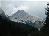 2
2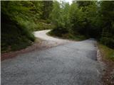 3
3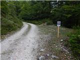 4
4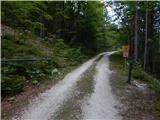 5
5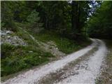 6
6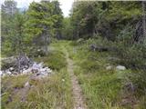 7
7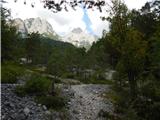 8
8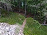 9
9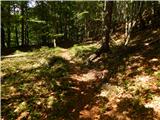 10
10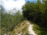 11
11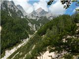 12
12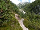 13
13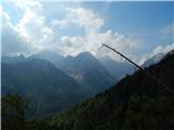 14
14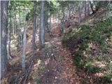 15
15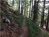 16
16 17
17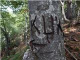 18
18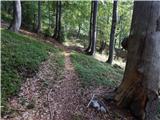 19
19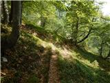 20
20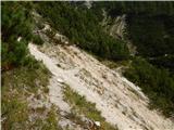 21
21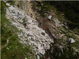 22
22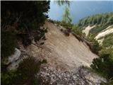 23
23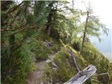 24
24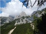 25
25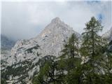 26
26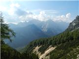 27
27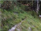 28
28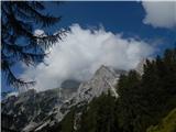 29
29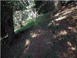 30
30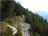 31
31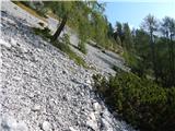 32
32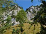 33
33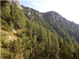 34
34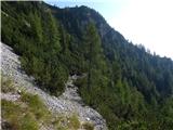 35
35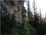 36
36 37
37 38
38 39
39 40
40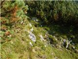 41
41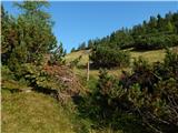 42
42 43
43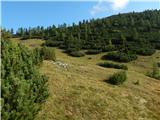 44
44 45
45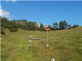 46
46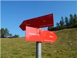 47
47 48
48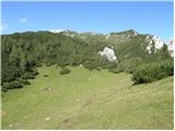 49
49 50
50 51
51 52
52 53
53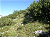 54
54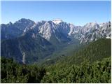 55
55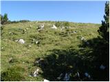 56
56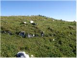 57
57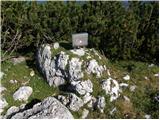 58
58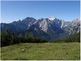 59
59 60
60
Discussion about the trip Plaz Črlovec - Vrtaški vrh (upper path)
|
| Jusk12. 11. 2019 |
On Sunday 10.11 I was on this trail, but at around 1500m altitude I turned back because I could no longer follow the path, at that height there was about 10cm of snow. It's a nice serpentine path though, I'll continue it in spring when there's no snow
|
|
|
|
| Jusk17. 10. 2020 |
the trail is very damaged after last week's snowfall, approximately from there onwards where pictures 16 and 17 are. Really a lot of fallen trees on the trail heavy snow did its thing heavy snow did its thing
|
|
|
To post a comment you must log in:
If you do not yet have a username, you must first
register.