Poče - Porezen (gentle path)
Starting point: Poče (653 m)
| Latitude/Longitude: | 46,15370°N 13,98460°E |
| |
Route name: gentle path
Walking time: 2 h 45 min
Difficulty: easy marked way
Elevation gain: 977 m
Elevation difference along the route: 977 m
Map: Škofjeloško in Cerkljansko hribovje 1:50.000
Recommended equipment (summer):
Recommended equipment (winter): ice axe, crampons
Views: 14.116
 | 1 person like this post |
Access to starting point:
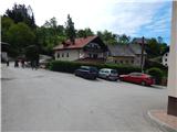
A) From the regional road Idrija - Tolmin, at the settlement Straža in the hamlet Želin at the traffic-light crossroads we turn right in the direction of Cerkno (if coming from the direction of Tolmin we turn left). Further, we drive through the valley of the river Cerknica, past the Petrol gas station all the way to Cerkno, where at the crossroads behind the church of St. Jernej (by the church there is also a cemetery and a parking lot) we continue left in the direction of Železniki, ski slope Cerkno, hospital Franja and the center of Cerkno. At the next marked crossroads we continue left in the direction of the settlement Zakojca and Gorje. Further, we drive through the settlement Trebenče and past a larger picnic area, to a marked crossroads, where we turn right in the direction of the village Poče (left Gorje). After a further shorter ascent we reach the fire station at the beginning of the village Poče, where there is a turning point for buses and next to it the NOB monument. The beginning of the footpath is a little further in the center of the village. Some options for parking are in the center of the village, or we can ask locals where we can leave the vehicle.
B) From the road Škofja Loka - Žiri, after the settlement Trebija we turn right in the direction of Sovodenj and Cerkno (from the direction Žiri still before Trebija we turn left), from where we first drive to Sovodenj, and from there over the pass Kladje (the pass is located in the settlement Podlanišče) we start descending towards Cerkno. In Cerkno at the first larger crossroads we continue straight (right we come to the center of the town and to the church of St. Anne), then in the second, about 300 m further we turn right in the direction of Železniki, ski slope Cerkno, hospital Franja and the center of Cerkno. At the next marked crossroads we continue left in the direction of the settlement Zakojca and Gorje. Further, we drive through the settlement Trebenče and past a larger picnic area, to a marked crossroads, where we turn right in the direction of the village Poče (left Gorje). After a further shorter ascent we reach the fire station at the beginning of the village Poče, where there is a turning point for buses and next to it the NOB monument. The beginning of the footpath is a little further in the center of the village. Some options for parking are in the center of the village, or we can ask locals where we can leave the vehicle.
C) From the road Škofja Loka - Podbrdo, at the place Zali Log we continue left in the direction of Davča and ski slope Cerkno (if coming from the direction Podbrdo or Soriška planina, at the end of the settlement we continue right). The road ahead first ascends to Davča, and from there it starts descending towards Cerkno. In the center of Cerkno, at the post office we turn right towards Zakojca and Gorje. Further, we drive through the settlement Trebenče and past a larger picnic area, to a marked crossroads, where we turn right in the direction of the village Poče (left Gorje). After a further shorter ascent we reach the fire station at the beginning of the village Poče, where there is a turning point for buses and next to it the NOB monument. The beginning of the footpath is a little further in the center of the village. Some options for parking are in the center of the village, or we can ask locals where we can leave the vehicle.
Route description:
From the center of Poče we continue left in the direction of Porezen (right Porezen over Labinjske lehe), where we first walk past a few houses, then the asphalt ends, and we continue the path on a macadam road. The road a little further approaches another house, and still before the house (the turn-off of the path is at the hayrack) we continue left on the path that ascends across the meadow to a forest road a few minutes away. When we reach the road we follow it to the left, and we walk along it in the direction of Porezen. Occasionally some views open up on Cerkljansko hribovje, then we already arrive at a smaller crossroads, from where we continue straight on the footpath that continues between both roads. After a short ascent we return to the right branch of the road, which is increasingly similar to a cart track (widening of the cart track 2014). The path ahead leads us past a smaller waterfall, then we arrive at a partly marked junction, where the signs for Porezen direct us sharply right.
Here we continue straight (sharply right Porezen - steep path) and continue the path on a relatively wide cart track that ascends transversely across occasionally steeper slopes. The cart track ends a little further, and the path behind the older, partly stone bajta turns into a footpath that ascends transversely above the gully of the stream Zapoška. During the ascent we can also notice signs that we are walking on the Slovenian geological trail. A little further the path turns slightly to the right and ascends transversely across a steep and especially slippery when wet slope. The path further crosses a few more gullies, among others it also leads us past the turn-off of the path to drinking water. Follows a somewhat awkward crossing of a grassy gully, as erosion has carried away the grass or a short section of the path, so some caution is needed at the crossing, otherwise the passage is not too difficult, as it is not an exceptionally steep slope. A little further the path turns right and once again, this time without issues, crosses the now widened gully. The marked but due to high grass somewhat harder to follow path then ascends relatively steeply in a few zigzags towards the ridge of Porezen. During the ascent the path leads us also past a smaller spring, then we soon reach the ridge, where we join the steep path from Cerkno and Poče and also some other paths that lead to the summit.
When we reach the initially still indistinct ridge we continue left, then already after some 10 steps we arrive at a smaller junction, where the path splits into two parts. More trodden is the "steep path" that continues along the ridge, and we continue right in the direction of Davča and after a minute of further walking step onto the road that leads towards the Dom na Poreznu (here it is no longer an official separation of the steep and gentle path from Poče, but if we have chosen the gentle one we can also continue this part on the "gentle path" (otherwise, if we continue along the ridge we will first reach the summit of Porezen and from there to the hut)).
When we step onto the road the path leads us still through a strip of forest, then gradually we arrive at open slopes from which a nice view opens towards Blegoš, Kamniško-Savinjske Alpe and Karavanke. When a few minutes higher we reach the northeastern ridge of Porezen, a marked path from Petrovo Brdo joins from the right. Here we continue left and with a view of the Julian Alps, especially the ridge of Spodnjih Bohinjskih gora, in some 10 steps of further walking we arrive at the Dom na Poreznu.
Behind the hut we notice signs for the summit of Porezen, which direct us onto an ascending path, along which in a few minutes of transverse ascent we climb to the 1630 m high summit, from which a nice view opens up.

Photos:
 1
1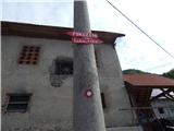 2
2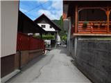 3
3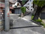 4
4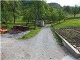 5
5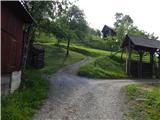 6
6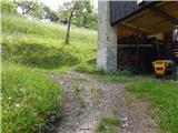 7
7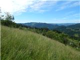 8
8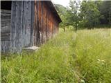 9
9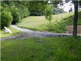 10
10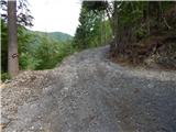 11
11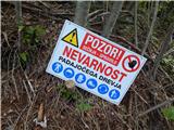 12
12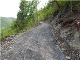 13
13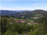 14
14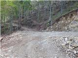 15
15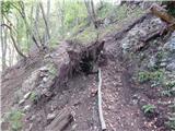 16
16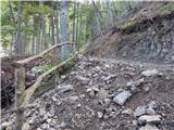 17
17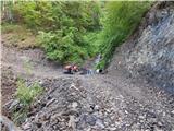 18
18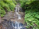 19
19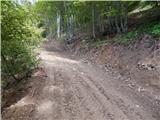 20
20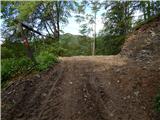 21
21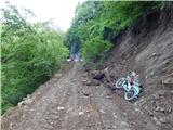 22
22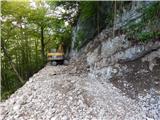 23
23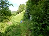 24
24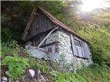 25
25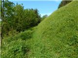 26
26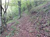 27
27 28
28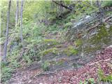 29
29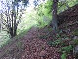 30
30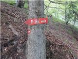 31
31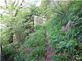 32
32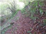 33
33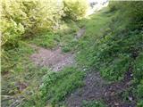 34
34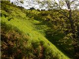 35
35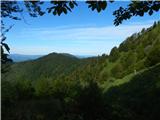 36
36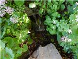 37
37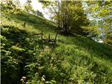 38
38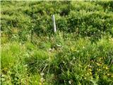 39
39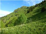 40
40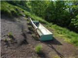 41
41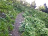 42
42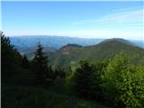 43
43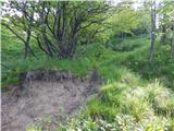 44
44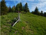 45
45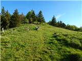 46
46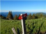 47
47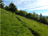 48
48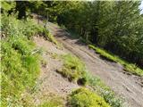 49
49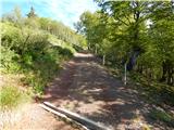 50
50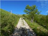 51
51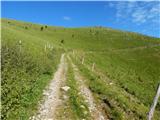 52
52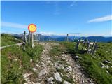 53
53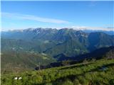 54
54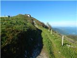 55
55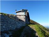 56
56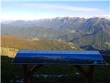 57
57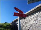 58
58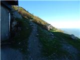 59
59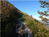 60
60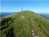 61
61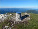 62
62 63
63
Discussion about the trip Poče - Porezen (gentle path)
To post a comment you must log in:
If you do not yet have a username, you must first
register.