Starting point: Počivalnik (575 m)
| Latitude/Longitude: | 46,31860°N 13,57470°E |
| |
Walking time: 1 h 45 min
Difficulty: difficult unmarked way
Elevation gain: 235 m
Elevation difference along the route: 400 m
Map: Julijske Alpe - zahodni del 1:50.000
Recommended equipment (summer): helmet, lamp
Recommended equipment (winter): helmet, ice axe, crampons, lamp
Views: 5.546
 | 1 person like this post |
Access to starting point:
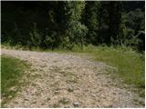
First, we drive to Bovec, and then we continue driving towards Čezsoča. In Čezsoča, at the inn Vančar, we continue left in the direction of Jablenca and Škratov valley and we follow a narrow asphalted road past the pool Slatenik to a somewhat bigger crossroad, where we continue slightly right (straight Jablenca). The road which ahead loses an asphalt covering starts ascending steeper, and at the crossroads we follow it in the direction of the summit Javoršček. This at first nice, then worse forest road we follow to a sharp left turn by which we also park (we can also park earlier on one of the parking lots by the road).
Route description:
In the middle of the turn, at the signpost for Javoršček we will notice an old and quite overgrown cart track which from the road branches off to the right. We head onto the mentioned cart track which after a good 50 m ends. Just a few meters before it ends, we will notice on the left side at first a poorly visible footpath which after a few 10 strides of ascent brings us to a smaller junction.
We continue right on a nicely traceable footpath which crosses relatively steep slopes. The path ahead slightly descends and brings us to the bed of the Hunški potok stream (on maps Humski potok). Ahead we cross the mentioned stream, and the path from the slopes of Javoršček brings us to very steep slopes of Humčič. After a few meters of crossing the path steeply ascends an exposed ledge, then passes to the secured part of the path. With the help of a steel cable we cross a narrow and exposed ledge, which ends at the entrance to a cavern. The still secured path enters the mentioned cavern, where it continues in a gentle ascent. After a few 10 m we step out of the cavern onto occasionally still quite steep slopes of Humčič. After a few minutes of crossing relatively steep slopes we come to a smaller shack, behind which the path starts to ascend more steeply. A little higher we come to a marked junction, where we continue right on the ascending path. Further we ascend on a footpath which leads us past numerous caverns. The path higher flattens and turns somewhat to the left. We continue the ascent on the path which ahead runs on and along the main ridge of Humčič. Higher the path steeply ascends for a short time, then brings us in a few minutes of further walking to the summit.
Due to the overgrowth and numerous unmarked junctions, orientation on the entire path is relatively difficult.

Photos:
 1
1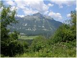 2
2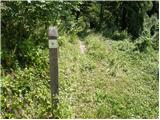 3
3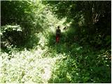 4
4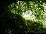 5
5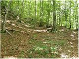 6
6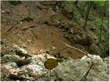 7
7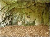 8
8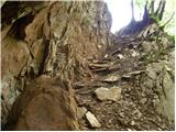 9
9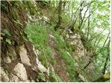 10
10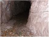 11
11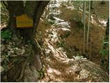 12
12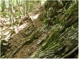 13
13 14
14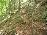 15
15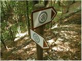 16
16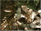 17
17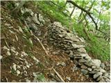 18
18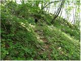 19
19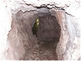 20
20 21
21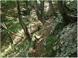 22
22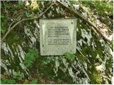 23
23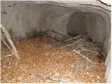 24
24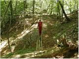 25
25 26
26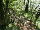 27
27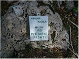 28
28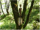 29
29
Discussion about the trip Počivalnik - Humčič
To post a comment you must log in:
If you do not yet have a username, you must first
register.