Starting point: Počivalnik (575 m)
| Latitude/Longitude: | 46,31860°N 13,57470°E |
| |
Walking time: 3 h
Difficulty: difficult unmarked way
Elevation gain: 982 m
Elevation difference along the route: 1025 m
Map: Julijske Alpe - zahodni del 1:50.000
Recommended equipment (summer): helmet
Recommended equipment (winter): helmet, ice axe, crampons
Views: 8.247
 | 1 person like this post |
Access to starting point:
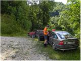
First, we drive to Bovec, and then we continue driving towards Čezsoča. In Čezsoča, at the inn Vančar, we continue left in the direction of Jablenca and Škratov valley and we follow a narrow asphalted road past the pool Slatenik to a somewhat bigger intersection, where we continue slightly right (straight Jablenca). The road, which ahead loses the asphalt covering, starts to ascend steeper, and at the crossroads we follow it in the direction of the summit Javoršček. We follow this at first nice, then worse forest road to a sharp left turn beside which we also park (we can also park earlier on one of the parking spots by the road).
Route description:
We continue on the forest road towards the east and soon come to a junction, where a marked path (Brda - B7a) branches off right upwards. We still walk on the road, which crosses a larger rockfall. The road then soon ends and we continue on the path, which quickly becomes very overgrown and it is almost impossible to follow it. If we cannot follow the path, we continue on pathless terrain, so that in the ascent we cross the slope towards the east. When we come to steeper slopes, the path becomes visible again. The path then begins with the help of fixed safety gear to cross quite steep slopes. Later, the path ascends a few more times along the steel cable and crosses the exposed slope with the help of an iron ladder. On this section considerable caution is needed as the slope we cross is steep, and the path is poorly beaten. The fixed safety gear are also not always in the best condition.
Further on, the path becomes less demanding and is marked with somewhat faded red dots and some cairns. Despite the markings, we must be quite attentive at some points so as not to stray from the path. The path, which all the time runs through the forest, then brings us to an abandoned forestry cottage, where we join the usual marked path.
From the cottage, we then mostly ascend through the forest along a military mule track. The path also leads us past some clearings where a nice view opens up on the surrounding peaks, and a little off the path there is also a military cemetery. The path through the forest then leads us past the mountain pasture Golobar and brings us to the saddle Čez Utro. Here nice views open up on the surrounding peaks, and on the saddle there is also a monument to the fallen partisans.
From the saddle, we continue straight and after a few dozen meters the path brings us to a junction. We continue on the path right upwards, while left leads the path towards Čezsoča and Drežnica.
From the junction onwards, the path is no longer marked, but it is sufficiently beaten that we can follow it without difficulty. Further on, the path runs mostly along the northern side of the mountain and crosses relatively steep slopes a few times. In the final part, the path brings us out of the forest and only a short ascent remains to the panoramic summit.

Along the route: Planina Golobar (1257m), Čez Utro (1305m)
Photos:
 1
1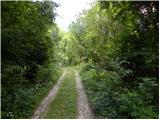 2
2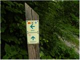 3
3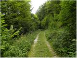 4
4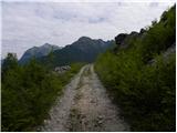 5
5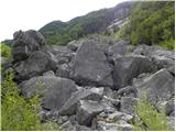 6
6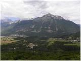 7
7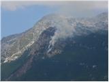 8
8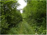 9
9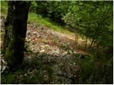 10
10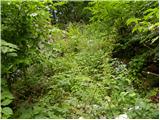 11
11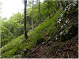 12
12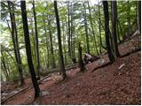 13
13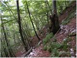 14
14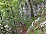 15
15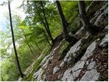 16
16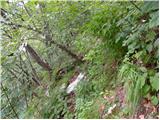 17
17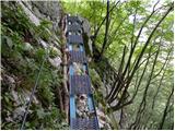 18
18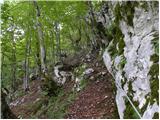 19
19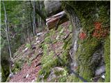 20
20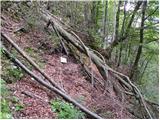 21
21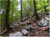 22
22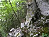 23
23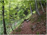 24
24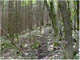 25
25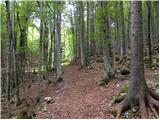 26
26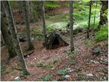 27
27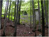 28
28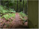 29
29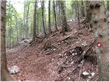 30
30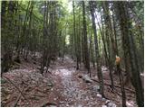 31
31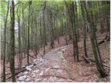 32
32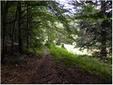 33
33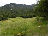 34
34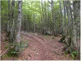 35
35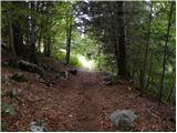 36
36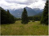 37
37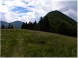 38
38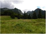 39
39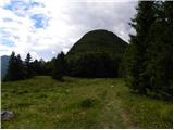 40
40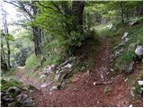 41
41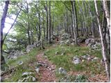 42
42 43
43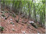 44
44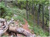 45
45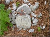 46
46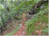 47
47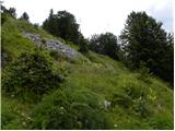 48
48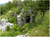 49
49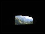 50
50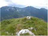 51
51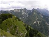 52
52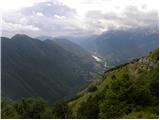 53
53
Discussion about the trip Počivalnik - Javoršček
|
| darinka43. 11. 2022 06:45:13 |
On 2.11. it was finally time for the ascent to Javoršček. Despite navigation, we were searching for passages in the Slatenik valley. Because the path is there and it's not anymore. We admired the Slatenik gorges. They are magnificent. There was just the right amount of water so we could at least go along the stream over rocks somewhere. The last part of the path from the sign onwards dragged on quite a bit. That's because the military path goes all around. We stumbled upon a hand grenade. Unexploded. We descended past planina Golobar along the mule track, which is nicely laid to Čezsoča already in the dark, where rain caught us right at the car. The tour wasn't short at all. For the elevation of Javoršček, which isn't very high.
|
|
|
|
| smatjaz3. 11. 2022 18:03:04 |
darinka4, Marjan and I also discussed this path a while ago, we did it exactly in the opposite direction so we started from Počivalnik along the hunting path in the direction as described in the post above. Descent to the Slatenik gully, but we continued along the old marked path to the landslide. which we couldn't cross and returned back to the cheese dairy, there we should have gone down the stream bed but we missed it and continued along the path of peace under Vršič to pl. Predolina where we turned right along the forest lane. When that ended, transversely back towards the gully. That was pure hell, and night caught us too. More by luck we caught the old mule track and hunting path at the gully, crossed the landslide below and safely descended at the pools, then up to the car at Počivalnik. Every lesson costs something......
|
|
|
|
| darinka44. 11. 2022 15:07:25 |
smatjaz yeah I know, we had you in mind when looking for passages. The path is indeed poorly passable in places. Somewhere we clambered over fallen trees. Missed it a few times, but with navigation got back on the right path. I got instructions the day before to wear something older, because it won't be exactly a nice path. And it really was like that.
|
|
|
To post a comment you must log in:
If you do not yet have a username, you must first
register.