Starting point: Pod Krnico (1250 m)
| Latitude/Longitude: | 46,43460°N 14,40830°E |
| |
Walking time: 1 h 20 min
Difficulty: easy unmarked way
Elevation gain: 551 m
Elevation difference along the route: 551 m
Map: Karavanke - osrednji del 1:50.000
Recommended equipment (summer):
Recommended equipment (winter): ice axe, crampons
Views: 22.045
 | 3 people like this post |
Access to starting point:
From the highway Ljubljana - Jesenice we go to the exit Ljubelj. From this road before the gas station, we turn right into Tržič. The road then quickly brings us to Tržič, and we follow it further in the direction of the villages Jelendol and Medvodje. In the village Medvodje we turn left towards Košuta (direction Dolga njiva and Košutnikov turn) on the forest road which we follow to the crossroads at Košutnik (1082 m). Here we go right and drive on an occasionally bad road to the parking lot at a smaller quarry.
Route description:
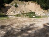
From the parking lot, we go on a cart track which branches off left from the road. The cart track goes into the forest and ascends moderately, first crossing a smaller and then a bigger stream. The cart track, which has some shortcuts, makes some turns and after a good 15 minutes brings us to the pastures of the mountain pasture Spodnja Dolga njiva.
After a short walk on the mountain pasture, the path brings us to a junction, where there are signposts. We go right in the direction of the path Košutnikov turn eastern approach. A gently sloping path after a few dozen steps brings us to the shepherd's hut on the mountain pasture Spodnja Dolga njiva.
Further, we continue upwards on the mountain pasture in the middle of which runs a wide cart track which after a good 15 minutes of walking brings us out of the forest onto the mountain pasture Zgornja Dolga njiva.
The marked path to Košutnikov turn then turns left, and we continue slightly right towards the border ridge. A little higher at a suitable spot we cross the grazing fence and then ascend along an occasionally somewhat poorly visible footpath which runs along the border line (the footpath which leads to Plešivec starts at border stone no. 13). We then follow this path, which is largely surrounded by dwarf pines, to the summit.
During the ascent to Plešivec we must also be careful because of snakes, as there are a lot of them here.
Starting point - Zgornja Dolga njiva 45 minutes, Zgornja Dolga njiva - Plešivec 35 minutes.

Photos:
 1
1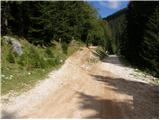 2
2 3
3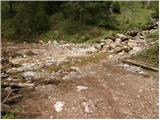 4
4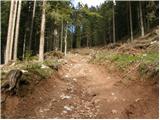 5
5 6
6 7
7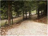 8
8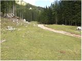 9
9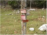 10
10 11
11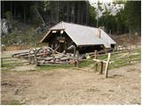 12
12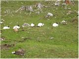 13
13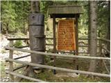 14
14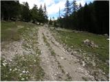 15
15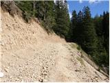 16
16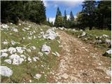 17
17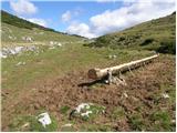 18
18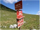 19
19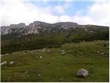 20
20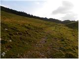 21
21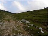 22
22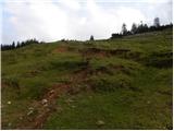 23
23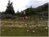 24
24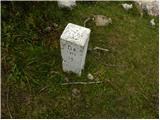 25
25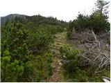 26
26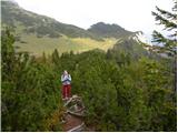 27
27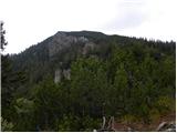 28
28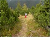 29
29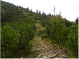 30
30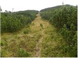 31
31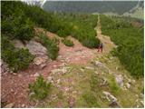 32
32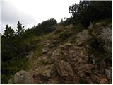 33
33 34
34
Discussion about the trip Pod Krnico - Plešivec
|
| Gost28. 04. 2007 |
Nice trip, we did it today, but we missed from Zgornja Dolga Njiva or from Orlovsko Sedlo above it and went along the path around Plešivec almost to Planina Brsnina, then to the border and from the south side to Plešivec. True, this path is longer, but interesting, as you see much more, and you don't have to return partly on the same path you came.
|
|
|
|
| Gost31. 10. 2007 |
Nice path suitable for these days when there is snow in the high mountains. Here a few cm of snow does not hinder the trip. Recommended, Evgen.
|
|
|
|
| Gost31. 10. 2007 |
How is the road to the parking lot at the quarry, is it normally drivable?
|
|
|
|
| Loni22. 09. 2013 |
Yesterday I crossed the Košuta ridge, today before lunch just a quick hop to Plešivec. Nice short hike to knock out quickly.
|
|
|
|
| Loni23. 09. 2013 |
I forgot to mention that a few steps to the left of border stone no. 13 there are steps that make crossing the fence easier, and at the stone there is a wooden directional sign.
|
|
|
|
| tango21. 11. 2021 14:35:16 |
On the way back from Košutnikov Turn, we also popped over to Plešivec, from where there is a wonderful view of the entire Košuta ridge, and also on the KSA. When you're in that area, a short hop to Plešivec is almost mandatory!
|
|
|
To post a comment you must log in:
If you do not yet have a username, you must first
register.