Pod Krnico - Tolsta Košuta - eastern peak
Starting point: Pod Krnico (1250 m)
| Latitude/Longitude: | 46,43460°N 14,40830°E |
| |
Walking time: 2 h 5 min
Difficulty: partly demanding unmarked way
Elevation gain: 807 m
Elevation difference along the route: 807 m
Map: Karavanke - osrednji del 1:50.000
Recommended equipment (summer):
Recommended equipment (winter): ice axe, crampons
Views: 32.955
 | 3 people like this post |
Access to starting point:
From the Ljubljana - Jesenice highway, take the Ljubelj exit. From this road before the gas station, we turn right towards Tržič. The road then quickly brings us to Tržič, and we follow it further in the direction of the villages Jelendol and Medvodje. In the village Medvodje we turn left towards Košuta (direction Dolga njiva and Košutnikov turn) on the forest road which we follow to the junction at Košutnik (1082 m). Here we go right and drive on an occasionally bad road to the parking lot at a smaller quarry.
Route description:
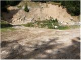
From the parking lot, we go on a cart track which branches off left from the road. Cart track goes into the forest and is moderately ascending, first crossing a smaller and then a bigger stream. The cart track, which has some shortcuts, makes some turns and after a good 15 minutes brings us on the mountain pasture Spodnja Dolga njiva.
After a short walk on the mountain pasture the path brings us to a crossing, where there are signposts. We go right in the direction of the path Košutnikov turn eastern approach. A gently sloping path after a few dozen steps of walking brings us to the shepherd hut on the mountain pasture Spodnja Dolga njiva (shepherd hut of open type).
Further, we continue on the mountain pasture upwards in the middle of which runs a wide cart track which after a good 15 minutes of walking brings us out of the forest on the mountain pasture Zgornja Dolga njiva.
The steepness of the path, which was moderate until now, eases and the path on nice grassy terrain soon brings us to the central part of the mountain pasture, where the blazes end. We continue straight (left Košutnikov turn) on a slightly ascending path which runs by a smaller but very distinct torrent gully. A little further the unmarked path splits into two parts.
We continue left (slightly right Mala Košuta) on the path which starts ascending through a belt of dwarf pines. If here we miss the right path we will have to get through the belt of dwarf pines or look for a better passage lower. Above the dwarf pines the path brings us to a grazing fence, where a nice view opens up on the Austrian side (to here we can also come on an easily passable gully or scree which in the middle of the mountain pasture Zgornja Dolga njiva branches off to the left, over the mentioned passage the path is a little shorter but also steeper). The path ahead, as well as the ridge, turns a little to the left and starts ascending steeply over increasingly steep grassy slopes. The path ascends further along the edge of the eastern ridge of Košuta on the steep southern slopes of Tolsta Košuta. A very steep path, which in wet is dangerous for slipping, a little higher turns left (avoids the cliffs above us) and after further short ascent brings us to the eastern peak of Tolsta Košuta.
On hot days we can on the path or next to it notice a larger number of snakes (carefully).
Starting point - Spodnja Dolga njiva 20 minutes, Spodnja Dolga njiva - Zgornja Dolga njiva 25 minutes, Zgornja Dolga njiva - Tolsta Košuta 1:20.

Photos:
 1
1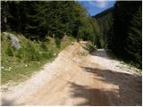 2
2 3
3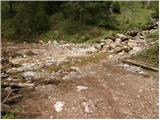 4
4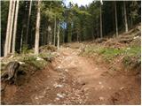 5
5 6
6 7
7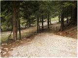 8
8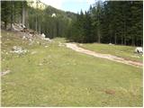 9
9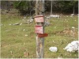 10
10 11
11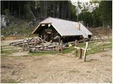 12
12 13
13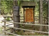 14
14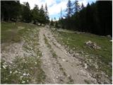 15
15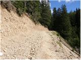 16
16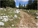 17
17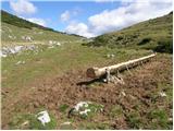 18
18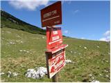 19
19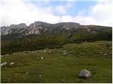 20
20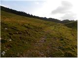 21
21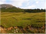 22
22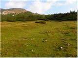 23
23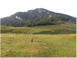 24
24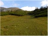 25
25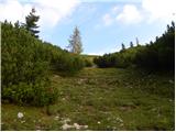 26
26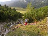 27
27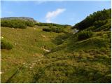 28
28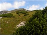 29
29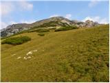 30
30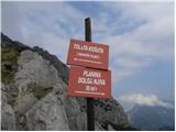 31
31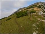 32
32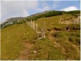 33
33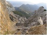 34
34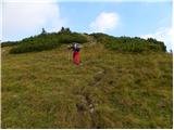 35
35 36
36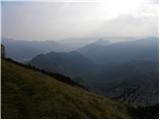 37
37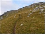 38
38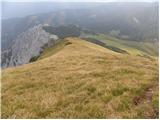 39
39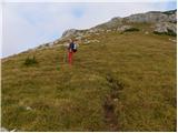 40
40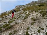 41
41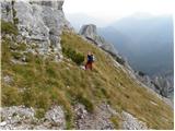 42
42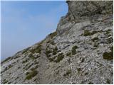 43
43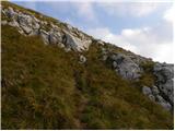 44
44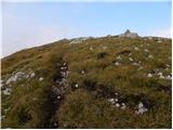 45
45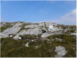 46
46
Discussion about the trip Pod Krnico - Tolsta Košuta - eastern peak
|
| Gost17. 07. 2006 |
On Tolsta Košuta again a box, the Tržič alpinist got involved. Just a new book and a stamp pad, please. Nice tour. No snakes.
|
|
|
|
| Gost17. 07. 2006 |
In the hut in Dolga njiva, real sour milk and žganci. Commendable, considering the previous state!!1
|
|
|
|
| Gost6. 06. 2007 |
Probably the most beautiful peak in Košuta. But you really need to watch out for snakes, I saw as many as four.
|
|
|
|
| Gost3. 10. 2007 |
Is it possible to combine the trip to Tolsta Košuta with the trip to Košutnikov turn?
|
|
|
|
| Gost3. 10. 2007 |
Everything is possible! The path from Tolsta Košuta along the ridge is very demanding pathless terrain with grade 2 climbing. I recommend descent to zg.dolga njiva and then along the marked path to the summit. You can descend directly to the lower njiva.
|
|
|
|
| Edina22. 09. 2009 |
Suitable to connect with the visit to Mala Košuta. The path is fully visible from both summits of T. Košute.
|
|
|
|
| rogoza4. 06. 2011 |
on Wednesday 01.06.11 up there. Super weather and beautiful views, right until I returned to pl. Dolgo Njiva where there was already sour milk and žganci. They also have stamp of Tolsta and Kušutnikov turn.
|
|
|
|
| Lunca28. 06. 2011 |
Lately, the path to TK is marked with a sign on the cart track at the alpine pasture... Then you push a bit through the scree, onwards it's a well-trodden path all the way. And wonderful views from both summits!
|
|
|
|
| zabonka21. 08. 2012 |
Today my husband and I went on this path and about halfway a large black snake crossed our path, which was enough for me to turn back  but nevertheless, this is a nice path with beautiful views, the hut at Dolga Njiva is really fairy-tale like and I recommend it for a trip with children, because they have a real petting zoo of domestic animals but nevertheless, this is a nice path with beautiful views, the hut at Dolga Njiva is really fairy-tale like and I recommend it for a trip with children, because they have a real petting zoo of domestic animals
|
|
|
|
| michael6629. 10. 2017 |
Has anyone driven from Medvodje to the quarry? What's the condition of the road...macadam?
|
|
|
|
| lubadar29. 10. 2017 |
14 days ago it was quite solid.
|
|
|
|
| michael6629. 10. 2017 |
Thanks, there wasn't any heavy rain afterwards anyway
|
|
|
|
| tango19. 05. 2022 14:00:48 |
This morning it was quite pleasantly "fresh", so my wife and I dynamically traversed it first to the eastern, then also to the western peak (snakes still hiding). Without proper equipment the path to KT was too risky, so we returned via the approach path, but with a detour to Mala Košuta and Plešivec. Pleasant breeze on the ridge, among the scrub on Plešivec already real summer. Below Košuta peak avrikelj is blooming, both on Spodnja and Zgornja dolga njiva everything is blue from beautifully blooming gentians.
|
|
|
|
| felix29. 05. 2022 10:39:00 |
I'm wondering if the return is along the same path, or if there is another path for the return from the western summit - to the path leading to Košutnikov turn?
Thank you and best regards.
|
|
|
|
| tango29. 05. 2022 13:51:13 |
Of course you can continue to Košutnikov turn, but the crossing requires caution and quite some experience, as some section is in my opinion grade II. Good luck.
|
|
|
|
| Planinka9910. 07. 2025 15:44:33 |
My friend and I went to Tolsta Košuta today. The route description confused us a bit, so we would describe the route like this: From the parking lot, we first go to Spodnja dolga njiva. From the hut, we continue straight on the wide path to Zgornja dolga njiva. We walk through the 'valley' until we see the livestock pasture fence. From there, we follow the fence, where at the end of this 'valley' it turns left into the bushes. From there on, we just follow the trodden path through the bushes and further along the ridge to the summit. The description above confused us at the part where you need to turn into the bushes. There you can follow the fence.
|
|
|
To post a comment you must log in:
If you do not yet have a username, you must first
register.