Pod Luknjo - Planina Osredki
Starting point: Pod Luknjo (950 m)
| Latitude/Longitude: | 46,24880°N 13,91450°E |
| |
Walking time: 1 h 15 min
Difficulty: easy marked way
Elevation gain: 450 m
Elevation difference along the route: 450 m
Map: TNP 1:50.000
Recommended equipment (summer):
Recommended equipment (winter):
Views: 5.228
 | 1 person like this post |
Access to starting point:
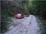
From the motorway Ljubljana - Jesenice we take the Lesce exit and follow the road towards Bled and onwards towards Bohinjska Bistrica. From Bohinjska Bistrica we continue left in the direction of Tolmin and Soriška planina. Soon we will notice signs for Črno prst to the right by the road, but we continue straight. Only a little later we come to a junction, where a signpost directs us right towards the village of Ravne. We turn onto this road, which takes us to the end of the village, where the asphalt ends. We then continue on the macadam road, which leads past the former home of Dr. Janeza Mencingerja (today a private house). We follow this road for approximately 4 km to the spot where a worse forest road joins from the right (nearby is a hunting observatory, numerous cart tracks and a mountain signpost for Črno prst). We park on one of the smaller parking areas by the road, in such a way that we do not hinder forestry work (timber hauling).
Route description:
Due to forestry work and the consequent numerous tractor tracks, the start of the path is relatively hard to find. Between the hunting observatory and the mountain signpost for Črno prst there are three larger cart tracks that head left uphill from the road (direction of our arrival). We choose the "first" one, i.e., the one closest to the hunting observatory (the mountain sign for Črno prst directs us to the "last" cart track, but if we follow the direction of this sign we will quickly go astray).
So if we have decided on the ascent along the "first" cart track we will already after a few minutes of ascent notice the blazes (the path comes transversely from the "last" cart track and is completely overgrown). We then follow the wide tractor tracks somewhat to the left, but only to the spot where the blazes direct us right onto a somewhat narrower cart track. Further on, orientation is much easier, as the labyrinth of cart tracks ends. Along an occasionally somewhat steeper path, a marked path to Orožnova koča soon branches off to the left.
We continue straight along the cart track, which higher up brings us into a small valley, through which we ascend to the forest road (we need approximately 30 minutes to get here). When we step onto the road we continue a few steps to the left, then the mountain sign for Črno prst directs us right into the forest, where it starts to ascend steeply. The path somewhat higher crosses an overgrown clearing (ferns and raspberry bushes) and then returns to the forest, where it continues all the way to the mountain pasture Osredki.

Photos:
 1
1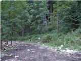 2
2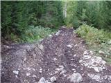 3
3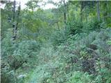 4
4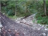 5
5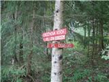 6
6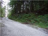 7
7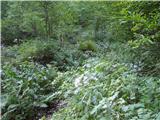 8
8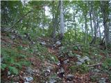 9
9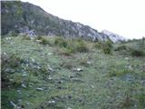 10
10 11
11 12
12
Discussion about the trip Pod Luknjo - Planina Osredki
To post a comment you must log in:
If you do not yet have a username, you must first
register.