Pod Peco / Koprein-Petzen - Čofatijev vrh (via Šoparjev vrh)
Starting point: Pod Peco / Koprein-Petzen (1280 m)
| Latitude/Longitude: | 46,50720°N 14,71230°E |
| |
Route name: via Šoparjev vrh
Walking time: 2 h 10 min
Difficulty: easy unmarked way
Elevation gain: 326 m
Elevation difference along the route: 460 m
Map: Koroška 1:50.000
Recommended equipment (summer):
Recommended equipment (winter):
Views: 416
 | 1 person like this post |
Access to starting point:
A) Via the border crossings Jezerski vrh or Pavličev vrh, we drive to Bela / Bad Vellach, from there we continue driving towards Železna Kapla / Bad Eisenkappel. At the beginning of Železna Kapla, we notice signs for Lepena / Leppen, which direct us to the right. Further on, we drive on a somewhat narrower asphalt road, which first leads us along the bottom of the valley, then near the hamlet Koprivna / Koprein - Sonnseite it starts to ascend more steeply. Higher up, we arrive at the hamlet Pod Peco / Koprein - Petzen, where the starting point of the path to Topica / Topitza and the inn Riepl are located. Here we continue straight on the initially still asphalted road, which further leads past the church of all faiths. A little above the church, the asphalt ends, and the road starts to descend. After a short descent, we arrive at a smaller crossroads, where we continue right in the direction of Peca and St. Ana (straight ahead on the main road to Globasnica / Globasnitz). From the crossroads, we drive only a short time longer, then we arrive at a barrier near which we park in a suitable spot.
B) From Dravograd or Slovenj Gradec, we drive to Ravne na Koroškem, then continue driving towards the border crossing Holmec. Once we enter Austria, we first drive towards Pliberk / Bleiburg, then follow the signs for Globasnica / Globasnitz. After approximately 13 km from the border crossing Holmec, we arrive in Globasnica, from where we continue driving left towards the upper part of the place. From Globasnica, we continue on a narrower and ascending road in the direction of the hamlet Pod Peco / Koprein - Petzen. Further on, we ascend alongside Globaška grapa for quite some time, then the road brings us to an indistinct saddle, where we arrive at a smaller crossroads. Here, where we notice signs for Peca, we continue left onto a side road, along which we quickly descend to the nearby barrier near which we park in a suitable spot.
Route description:
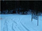
From the parking lot, we continue past the barrier and along the road in a few minutes descend to the crossroads at the edge of the mountain pasture Spodnja Luža.
Here, a marked Austrian path branches off to the left to Peca or to Bistriška špica, while we continue straight in the direction of the mountain hut on the Kumer farm. The path ahead leads us across a vast mountain pasture, then it passes along the edge of the forest and splits into two parts. We choose the lower, worse road, along which we descend along the edge of the forest to the state border and cross it. After a few meters of walking on the Slovenian side, we join a wider macadam road, along which we continue the descent. A little lower, a marked cart track branches off to the right towards St. Ana, while we continue descending. When we have already descended 100 elevation meters, we arrive at a somewhat larger and marked crossroads, where the road to Kumer branches off to the right, straight ahead the road continues towards Koprivna and Črna na Koroškem, and we continue sharply left onto the ascending road (at the crossroads there are also the first Slovenian signs for Peca).
From the crossroads, we continue along the road in the direction of Šopar, Ledrovec, Topla, and the marked path to Peca. The road along which we continue quickly splits, and we choose the slightly left road (right to Šopar and Debelak), from which after approximately 10 minutes a marked footpath to Peca branches off to the left.
We continue along the macadam road, which past the chapel leads us out of the forest, where with nice views we reach the Ledrovec homestead. Above the homestead, the road makes a few hairpin turns, then returns to the forest. When we return to the forest, the road gradually levels out, then for some time in a gentle ascent crosses the slopes to the left.
When the road starts to descend gently, we reach the pass between the Koprivna and Topla valleys, and at the snow gauge we continue right onto the cart track. The cart track quickly enters dense forest, and we then follow the unmarked path to the nearby Šoparjev vrh, from which a nice view opens towards Peca and Topla.
From Šoparjev vrh, where there is a larger clearing to which some wider cart tracks lead, we continue towards the south to southeast, where we first walk along the cart track at the edge of the forest, and the cart track quickly enters the forest. Through the forest, the path continues mostly along a forested ridge, and the direction remains mostly the same. At first the path is fairly level, occasionally even descending slightly, in the second part it starts gently at first, then somewhat more steeply ascending in the last part. At a few junctions, we follow the ridge path, along which we then arrive at the panoramic but still somewhat vegetated Čofatijev vrh.
Starting point - Planina Luža 5 minutes, Planina Luža - Koprivna 20 minutes, Koprivna - Šoparjev vrh 1:10, Šoparjev vrh - Čofatijev vrh 35 minutes.

Photos:
 1
1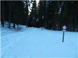 2
2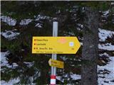 3
3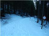 4
4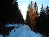 5
5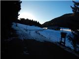 6
6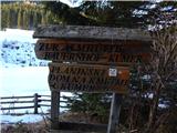 7
7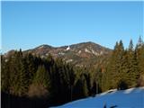 8
8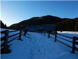 9
9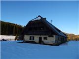 10
10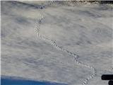 11
11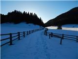 12
12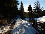 13
13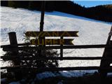 14
14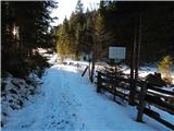 15
15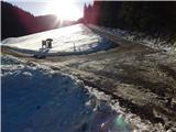 16
16 17
17 18
18 19
19 20
20 21
21 22
22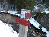 23
23 24
24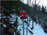 25
25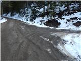 26
26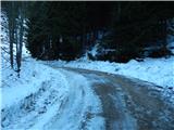 27
27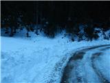 28
28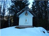 29
29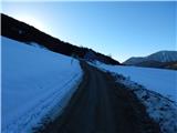 30
30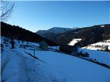 31
31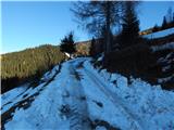 32
32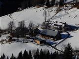 33
33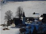 34
34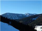 35
35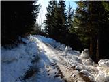 36
36 37
37 38
38 39
39 40
40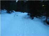 41
41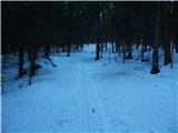 42
42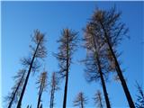 43
43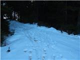 44
44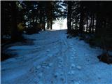 45
45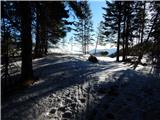 46
46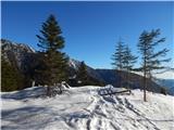 47
47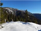 48
48 49
49 50
50 51
51 52
52 53
53 54
54 55
55 56
56 57
57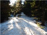 58
58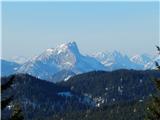 59
59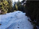 60
60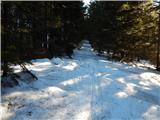 61
61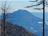 62
62 63
63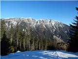 64
64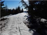 65
65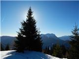 66
66 67
67
Discussion about the trip Pod Peco / Koprein-Petzen - Čofatijev vrh (via Šoparjev vrh)
To post a comment you must log in:
If you do not yet have a username, you must first
register.