Pod Peco / Koprein-Petzen - Planina Rep (Repija)
Starting point: Pod Peco / Koprein-Petzen (1280 m)
| Latitude/Longitude: | 46,50720°N 14,71230°E |
| |
Walking time: 1 h 30 min
Difficulty: easy marked way
Elevation gain: 50 m
Elevation difference along the route: 175 m
Map: Kamniške in Savinjske Alpe 1:50.000
Recommended equipment (summer):
Recommended equipment (winter): ice axe, crampons
Views: 407
 | 1 person like this post |
Access to starting point:
A) Over the border crossing Jezerski vrh or Pavličev vrh we drive to Bela / Bad Vellach, and from there we continue driving towards Železna Kapla / Bad Eisenkappel. At the beginning of Železna Kapla we notice signs for Lepena / Leppen, which point us to the right. Further, we drive on a somewhat narrower asphalt road which leads us first along the bottom of the valley, and then at the hamlet Koprivna / Koprein - Sonnseite it starts to ascend more steeply. Higher, we arrive at the hamlet Pod Peco / Koprein - Petzen, where there is the starting point of the path to Topica / Topitza and inn Riepl. Here we continue straight on the initially still asphalt road, which further leads past the church of all faiths. A little above the church the asphalt ends, and the road starts to descend. After a short descent we arrive at a smaller crossroad, where we continue right in the direction of Peca and St. Anne (ahead on the main road Globasnica / Globasnitz). From the crossroad we drive only a short time, and then we arrive at a gate near which we park on an appropriate place.
B) From Dravograd or Slovenj Gradec we drive to Ravne na Koroškem, and then we continue driving in the direction of the border crossing Holmec. When we drive into Austria we first drive towards Pliberk / Bleiburg, and then we follow the signs for Globasnica / Globasnitz. After approximately 13 km from the border crossing Holmec we arrive at Globasnica, from where we continue driving left towards the upper part of the settlement. From Globasnica we continue on a narrower and ascending road in the direction of the hamlet Pod Peco / Koprein - Petzen. Further, we ascend for quite some time along Globaška grapa, and then the road brings us to an indistinct saddle, where we arrive at a smaller crossroad. Here, where we notice signs for Peca, we continue left onto a side road, along which we quickly descend to the nearby gate near which we park on an appropriate place.
Route description:
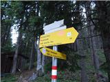
From the parking lot we continue past the gate and along the road in a few minutes descend to the crossroad at the edge of the mountain pasture Spodnja Luža.
Here a marked Austrian path branches off to the left to Peca or to Bistriška špica, and we continue straight in the direction of the mountain hut on the farm Kumer. The path ahead leads us across an extensive mountain pasture, then it passes along the edge of the forest and splits into two parts. We choose the lower worse road, along which along the edge of the forest we descend to the state border and also cross it. After a few meters of walking on the Slovenian side we join a wider macadam road, and we continue the descent along it. A little lower we continue right upwards on a marked cart track towards St. Anne and the mountain hut on the farm Kumer (straight ahead the road continues towards Koprivna and the marked path towards Peca). After a short ascent the cart track along which we continue levels out, then it continues transversely towards the left. At the end of the traverse a short descent follows to the nearby road, along which we walk to the nearby mountain hut.
From the hut we continue in the direction of Olševa, and the path ahead still leads along the road. Behind the hut we first bypass a chapel, a little further a cross, and later also a smaller hunting observation post. When the road, which continues without major changes in elevation, enters the forest, it splits into two parts, and we continue along the upper right road in the direction of Olševa (slightly left the church of St. Anne with the black Mary 2 minutes). Further we ascend slightly to moderately, and then, after a somewhat more pronounced right bend, the road levels out and brings us out of the forest onto the mountain pasture Rep or Repija.
Starting point - Planina Luža 5 minutes, Planina Luža - Kumer 40 minutes, Kumer - Repija 45 minutes.
Description and pictures refer to the condition in 2016 (August).

Photos:
 1
1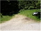 2
2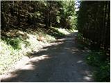 3
3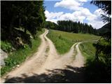 4
4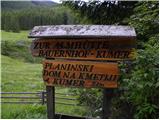 5
5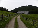 6
6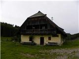 7
7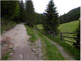 8
8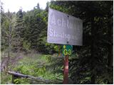 9
9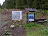 10
10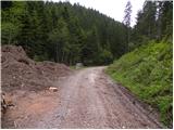 11
11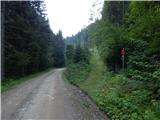 12
12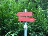 13
13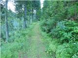 14
14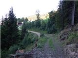 15
15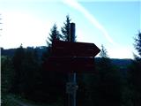 16
16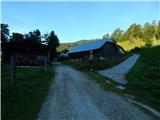 17
17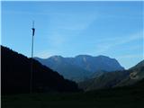 18
18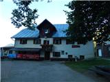 19
19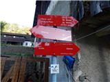 20
20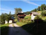 21
21 22
22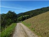 23
23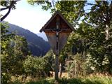 24
24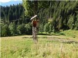 25
25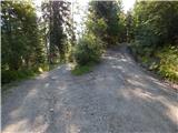 26
26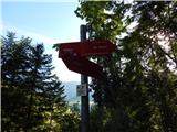 27
27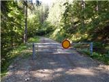 28
28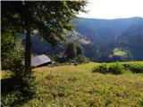 29
29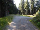 30
30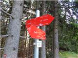 31
31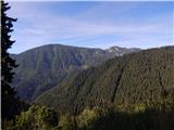 32
32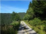 33
33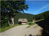 34
34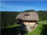 35
35
Discussion about the trip Pod Peco / Koprein-Petzen - Planina Rep (Repija)
To post a comment you must log in:
If you do not yet have a username, you must first
register.