Starting point: Pod Zjabci (745 m)
| Latitude/Longitude: | 46,32610°N 13,69820°E |
| |
Walking time: 5 h 15 min
Difficulty: easy pathless terrain
Elevation gain: 1483 m
Elevation difference along the route: 1550 m
Map: TNP 1:50.000
Recommended equipment (summer):
Recommended equipment (winter): ice axe, crampons
Views: 10.975
 | 2 people like this post |
Access to starting point:
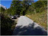
A) First, we drive to Kranjska Gora, then continue driving over Vršič Pass towards Bovec. Soon after the Berebica gallery, we arrive in the village of Soča, where we turn left over the bridge across the Soča River (direction tourist farm Jelinčič and camp Korita). After the bridge, we do not turn left towards the camp, but continue driving straight on the ascending asphalt road. Further, we ascend through expansive meadows, in the middle of which stand some individual huts, then the road enters the forest. Higher, the road turns quite to the left and brings us to Pod Zjabcev, where we notice mountain signposts for pasture Za skalo, Dom na Komni and Triglav Lakes. We park at a suitable place by the road.
B) From the Primorska side, first we drive to Bovec, then continue driving towards Trenta. Towards the end of the village of Soča, we turn right in the direction of tourist farm Jelinčič and camp Korita. After the bridge, we do not turn left towards the camp, but continue driving straight on the ascending asphalt road. Further, we ascend through expansive meadows, in the middle of which stand some individual huts, then the road enters the forest. Higher, the road turns quite to the left and brings us to Pod Zjabcev, where we notice mountain signposts for pasture Za skalo, Dom na Komni and Triglav Lakes. We park at a suitable place by the road.
Route description:
From Pod Zjabcev we follow the marked path, which bypasses the nearby huts on the right side. Behind the huts the path goes into the forest and quickly brings us to a smaller junction, where we continue right over the stream. On the other side of the stream, the path turns left and starts moderately ascending through dense forest. We continue the ascent along an old mule track, which is already quite damaged in several places, and which higher brings us to a short steep rocky section. Through the mentioned section a well-maintained and wide mule track leads us, and the path above the mentioned section brings us to a viewpoint, from which a beautiful view opens onto Bavški Grintavec.
From the viewpoint, the path returns to the forest and quickly ascends to an old trough with water (here by the path is a small spring, which dries up in dry periods). Above the trough, the path turns slightly left, then ascends in numerous zigzags through the forest. Higher, the trail levels somewhat and brings us to a less noticeable junction, where an abandoned path to pasture Za skalo branches off to the left.
From here we continue straight ahead, and a somewhat steeper path after 10 minutes of further walking brings us to the next, this time completely unmarked junction. Here an unmarked trail branches off to the right, leading to the nearby hunting hut and further to pasture za Črnim vrhom; to the left a hunting path to pasture Za skalo branches off; we continue straight to the nearby next junction, which is somewhat better marked.
Here we continue straight or slightly right along the marked path in the direction of Triglav Lakes and Komna. We continue along a gentle path through coniferous forest to a path fork.
From the fork we continue on the left path in the direction of Koča pri Triglavskih jezerih (straight to Komna and Lanževica), which bypasses Dol za Bajarjem on the left side. The path ahead merely crosses slopes for some time, then briefly ascends and brings us to a small valley, where we arrive at a small junction. At the junction we continue left on the marked path (straight unmarked path (mule track) leading towards Mali vrata), which then ascends laterally across moderately steep grassy slopes. Higher the path leads us through a series of smaller indistinct valleys, then ascends somewhat more and brings us below the cliffs, where there is the next less noticeable junction. Here we continue right (left by a small cairn leads a partly pathless path towards Travniška dolina) and cross slopes below the cliffs for some time, then the path continuing along the old mule track turns slightly left and begins to ascend more steeply. After a shorter steeper section the marked path turns right towards the nearby Velika vrata; we continue straight onto pathless terrain (at the place where we leave the marked path there is a cairn). Here we leave the already little-visited path and continue right through pathless terrain. Initially the passages between dwarf pines and scree terrain are relatively easy, as cairns help us find the "path", though they are indeed rare. We continue the ascent roughly northwards, but there are no direct passages due to the karst terrain. Due to fissures we occasionally have to make quite a large detour. When the "path" finally brings us onto the ridge, the orientation loops end. We continue the ascent along an increasingly panoramic ridge, and the "path" then quickly brings us to the indistinct summit of Glava za Bajto.
Further we descend slightly, then ascend the grassy slope of Čelo to the little-known and even less visited summit.

Along the route: Velika vrata (1924m), Glava za Bajto (2131m)
Photos:
 1
1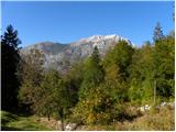 2
2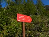 3
3 4
4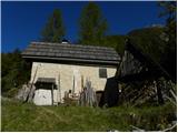 5
5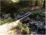 6
6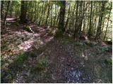 7
7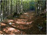 8
8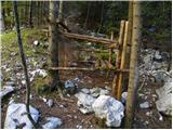 9
9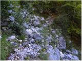 10
10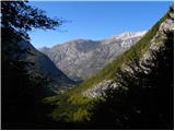 11
11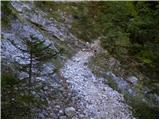 12
12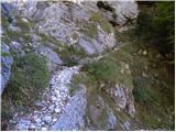 13
13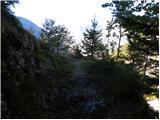 14
14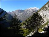 15
15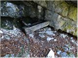 16
16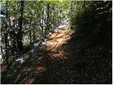 17
17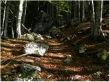 18
18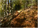 19
19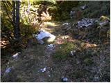 20
20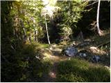 21
21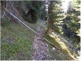 22
22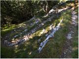 23
23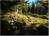 24
24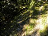 25
25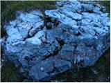 26
26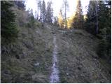 27
27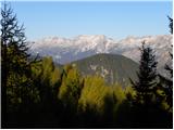 28
28 29
29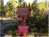 30
30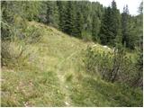 31
31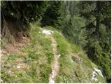 32
32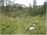 33
33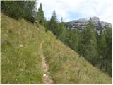 34
34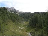 35
35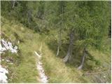 36
36 37
37 38
38 39
39 40
40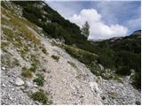 41
41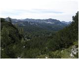 42
42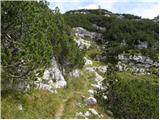 43
43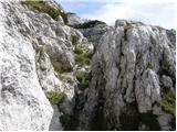 44
44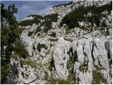 45
45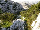 46
46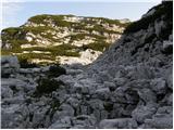 47
47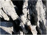 48
48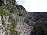 49
49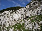 50
50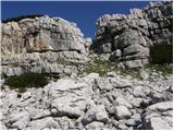 51
51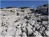 52
52 53
53 54
54 55
55 56
56
Discussion about the trip Pod Zjabci - Čelo
|
| adry15. 06. 2015 |
On Saturday 13.6. along this path to the Velika vrata pass and from there with the help of cairns to the top.
The path through Dol za Bajerjem is overgrown with brush in many sections, and there are a couple of fallen trees on the trail. The weather held, it's a real solitary world, nevertheless we met two young hikers exploring the barracks.
|
|
|
|
| adry3. 08. 2015 |
On Saturday again on this trail only partially in the opposite direction, from Velikih vrat to Pod Zjabci. Thanks to the one who cut the brushwood and obstacles, making the trail more passable. Solitude is the main feature of this trail.
|
|
|
|
| tomislavo3. 07. 2016 |
On Friday with an experienced colleague visited this remote mountain range, namely via Rušje to Čelo then to Glava za bajto further to Gladki vrh and then a bit of searching for the path back again past Glava under Čelom via Rušje back towards Zjabci.. yeah quite a solid tour, weather just right.
|
|
|
|
| king1234. 07. 2016 |
Colleague  Not Gladki vrh but Gladki Lašt. Otherwise a tour worth repeating. Pure untouched natural beauty. Silence everywhere. Just a few chamois bounding across these plateaus. To rest the ears Not Gladki vrh but Gladki Lašt. Otherwise a tour worth repeating. Pure untouched natural beauty. Silence everywhere. Just a few chamois bounding across these plateaus. To rest the ears
|
|
|
|
| zajko26. 08. 2016 |
Yesterday Travniška dolina-Rušje-Vršac-Čelo-Glava za bajto-V.vrata-Pod Zjabci. Walking 9.30 hours. alt. gain 1,660 m. Path from Glava za bajto to Vrata almost untraceable, markers sometimes there, then gone again. Difficult karst and scree terrain. Otherwise a tour for peace-seeking hikers. I managed the tour despite 81 years.
|
|
|
|
| Evjuna3. 09. 2023 11:55:23 |
Right next to the starting sign on pic. 3 there is a fairly deep, uncovered pit, usually overgrown with grass and therefore invisible. Be careful, as it's suitable for some fracture or similar!
|
|
|
|
| B23. 09. 2023 20:23:55 |
Not only the pit, but also angle grinders for twisting car doors are there in constant readiness. In the pockets of the "workers" there are "packages" ready, and on the head of course a hood. It happened, we settled the "job" on the spot and I hope it worked well...
|
|
|
|
| turbo3. 09. 2023 21:04:10 |
Ugh, this reads like a crime novel 
|
|
|
|
| Hammond4. 09. 2023 08:31:23 |
B2, I'm interested what type of people these workers are. Because it's hard for me to get into my head that something like that could even occur to someone plus it's good to know who to be careful of.
|
|
|
|
| B24. 09. 2023 11:44:37 |
Yes, these "workers" are very active at remote parking lots in the Trenta valley. Only a fraction of the results of their "work" can we read in the daily newspaper posts. The police can't be everywhere either.
But to calmly watch someone breaking into my car doesn't work either. It was at the right time and educational...
|
|
|
|
| Hammond4. 09. 2023 12:38:36 |
Well, are they young/old, from nearby/farther away, Slovenians/foreigners, individual/group, do they stand out (except hoods) by anything else?
Correct. There was too little of a lesson for such people.
|
|
|
|
| turbo4. 09. 2023 14:02:42 |
In summer I spotted a news item online, sadly can't find it anymore. Bovec police ascertained that a gang walks from Italy to Posočje daily over Predel, breaking into cars at our mountain trailheads. They confirmed it's the same thieves via Predel webcam by license plates. They could act only if catching them red-handed during break-in. It also said Italian police showed no desire to cooperate, like "why should we care what ours do at your place". What happened next with this gang, if the issue got resolved or not, I wouldn't know.
|
|
|
|
| Hammond4. 09. 2023 14:53:40 |
Interesting situation. Good to know who to watch out for especially.
Thanks a lot for the explanation, turbo. Hope it helps others too.
|
|
|
|
| bongo4. 09. 2023 16:42:16 |
Break-ins also faced those who parked at various remote parking lots just over the border (Viš etc.)
|
|
|
|
| B24. 09. 2023 22:29:09 |
And I caught them red-handed. There were traces of a screwdriver on my car doors and on the seals too. Two of the "bold trio" quickly made off down the road, but I caught one and gave him a good lesson on the paragraphs of the penal code. They were probably on a car-breaking spree, but I didn't see that and they weren't Italians. Maybe they were even "tourists" from Dolenjska... This kind of "action" also happens in Kluzah, at the ramp in Moznica, and by the Veliki koriti along the Soča in Lepena and in Zadnja Trenta. I believe it's not Italians at work but our own "thieves", who in my opinion aren't that hard to recognize even on the road. Admittedly, I didn't manage to find out anything myself and in all the rush didn't register anyone, but I did manage to "teach" one well, and I hope he passed on the "lesson" to his "colleagues"...
|
|
|
|
| Kafetarca5. 09. 2023 14:11:26 |
Did you just lecture him verbally, or did you back up what you said with other means?
|
|
|
|
| Resevna26. 11. 2023 20:03:16 |
Question for those familiar with this area.
Is it possible to branch left upwards from the wall in photo 38 to Travniška dolina (and the cairn in photo 39)?
Once I descended down here from T. dolina and I don't know if we joined the marked path towards the valley at this spot.
Thanks.
|
|
|
|
| stanes27. 11. 2023 15:39:00 |
Of course there is a branch here of a poorly visible path that leads through some friendly passages to Travniška dolina. I have used this passage several times descending to Planina za skalo and then along the lower path to the ramp above Vasja na skali.
|
|
|
|
| mirank27. 11. 2023 16:12:52 |
From Čelo to Travniška dolina the easiest is directly from the top down the grassy gully a bit left of the ridge connecting Čelo and Vršac. From the saddle between these two peaks it looked quite scary, but up close it was perfectly fine
|
|
|
|
| Jernej96811. 11. 2024 10:41:41 |
Yesterday I descended from Čelo via the mentioned gully or rather to the right of it. It's quite comfortable to descend. Otherwise I reached Čelo from Kal (2001m). I crossed the marked path to 7 Jezer slightly below V. Vrati (on the Primorska side) and ascended to Čelo through the cirque on the western side of Glava za Bajto. The upper description, if I understand it correctly, leads along the eastern side of Glava za Bajto and left onto the ridge. Also on this western variant cairns are quite frequently placed at the beginning.
|
|
|
|
| cjendaw13. 11. 2024 19:57:26 |
Does anyone have a picture of this gully, even better if they draw a line. Namely, this part interests me, but I don't know when there will be time yet.
|
|
|
To post a comment you must log in:
If you do not yet have a username, you must first
register.