Pod Zjabci - Planina Lopučnica
Starting point: Pod Zjabci (745 m)
| Latitude/Longitude: | 46,32610°N 13,69820°E |
| |
Walking time: 5 h
Difficulty: easy marked way
Elevation gain: 813 m
Elevation difference along the route: 1215 m
Map: TNP 1:50.000
Recommended equipment (summer):
Recommended equipment (winter): ice axe, crampons
Views: 2.393
 | 1 person like this post |
Access to starting point:
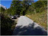
A) First, we drive to Kranjska Gora, and then we continue driving through the Vršič pass towards Bovec. Soon after the Berebica gallery, we arrive in the village of Soča, where we turn left over the bridge across the Soča River (direction tourist farm Jelinčič and camp Korita). After the bridge, we do not turn left towards the camp, but continue driving straight on the ascending asphalt road. Further on, we ascend over extensive meadows amid which stand a few individual huts, and then the road enters the forest. Higher up, the road turns quite to the left and brings us to Pod Zjabcev, where we notice mountain signposts for Planina Za skalo, Dom na Komni, and Triglav Lakes. We park in a suitable spot by the road.
B) From the Primorska side, first we drive to Bovec, and then continue towards Trenta. Towards the end of the village of Soča, we turn right in the direction of the tourist farm Jelinčič and camp Korita. After the bridge, we do not turn left towards the camp, but continue driving straight on the ascending asphalt road. Further on, we ascend over extensive meadows amid which stand a few individual huts, and then the road enters the forest. Higher up, the road turns quite to the left and brings us to Pod Zjabcev, where we notice mountain signposts for Planina Za skalo, Dom na Komni, and Triglav Lakes. We park in a suitable spot by the road.
Route description:
From Pod Zjabcev we head onto the marked path, which bypasses the nearby huts on the right side. Behind the huts, the path goes into the forest and quickly brings us to a smaller junction, where we continue right across the stream. On the other side of the stream, the path turns left and begins to ascend moderately through dense forest. We continue the ascent along an old mule track, which is badly eroded in several places, and which higher up brings us to a short steep rocky section. Across this section, a well-maintained and wide mule track leads us, and the path above this section brings us to a vantage point from which a beautiful view opens onto Bavški Grintavec.
From the vantage point, the path returns to the forest and quickly ascends to an old trough with water (here by the path is a small spring, which dries up in dry periods). Above the trough, the path turns slightly left, then ascends in numerous zigzags through the forest. Higher up, the trail levels out somewhat and brings us to a less noticeable junction, where an abandoned path to Planina Za skalo branches off to the left.
From here we continue straight ahead, and a somewhat steeper path, after 10 minutes of further walking, brings us to the next junction, which this time is completely unmarked. Here a unmarked trail branches off to the right, leading to the nearby hunting hut and further to Planina za Črnim vrhom, to the left a hunting path branches off to Planina Za skalo, while we continue straight to the nearby next junction, which is somewhat better marked.
Here we continue straight or slightly right along the marked path in the direction of Triglav Lakes and Komna. We continue along a gentle path that brings us through coniferous forest to a path fork.
From the fork we continue along the left path in the direction of Koča pri Triglavskih jezerih (straight to Komna and Lanževica), which bypasses Dol za Bajarjem on the left side. The path ahead merely crosses the slopes for a while, then ascends briefly and brings us to a small valley, where we arrive at a smaller junction. At the junction we continue left along the marked path (straight unmarked path (mule track) leading towards Mala vrata), which then ascends diagonally across moderately steep grassy slopes. Higher up the path leads us through a series of smaller indistinct valleys, then ascends a bit more and brings us below the cliffs, where there is the next less noticeable junction. Here we continue right (left by a small cairn leads a partly pathless trail towards Travniška dolina) and cross the slopes below the cliffs for a while, then the path, continuing along the old mule track, turns slightly left and begins to ascend more steeply. After a shorter steeper section the marked path turns right (here straight ahead continues the pathless approach to Čelo - marked with cairns) and brings us to Velik vrat, where we notice the old border stone of the Rapallo border.
Here a pathless approach to Kal branches off to the right, while we continue along the marked path, which descends to the nearby limestone pavements. We continue across the limestone pavement terrain, where orientation in fog is very difficult despite the blazes. Looking at the ridge of mountains above Dolina triglavskih jezer we soon reach the eastern edge of the extensive limestone pavements, where the blazes lead left into a short gully, through which we descend steeply for a few meters. The path soon levels out and gradually transitions into a belt of dwarf pines, bushes, and low sparse forest. Less trodden but always marked, the path lower leads us across tall grass, through which we descend to Planina Lopučnica.

Along the route: Velika vrata (1924m)
Photos:
 1
1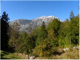 2
2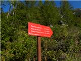 3
3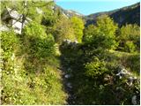 4
4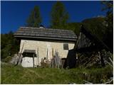 5
5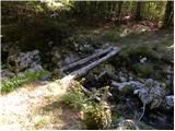 6
6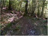 7
7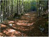 8
8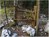 9
9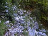 10
10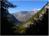 11
11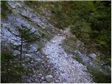 12
12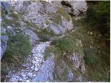 13
13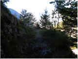 14
14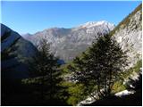 15
15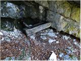 16
16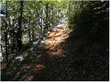 17
17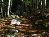 18
18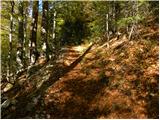 19
19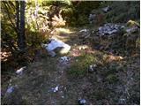 20
20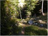 21
21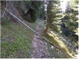 22
22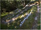 23
23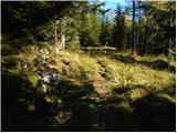 24
24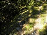 25
25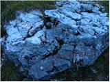 26
26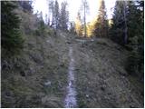 27
27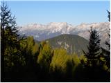 28
28 29
29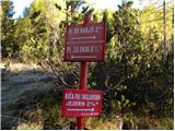 30
30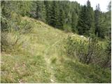 31
31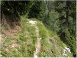 32
32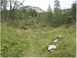 33
33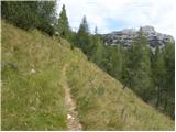 34
34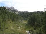 35
35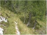 36
36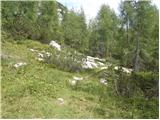 37
37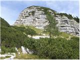 38
38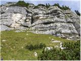 39
39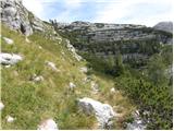 40
40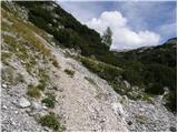 41
41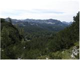 42
42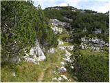 43
43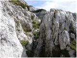 44
44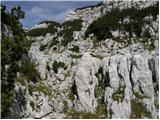 45
45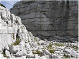 46
46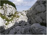 47
47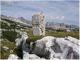 48
48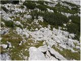 49
49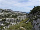 50
50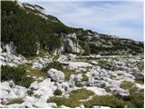 51
51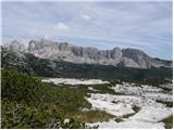 52
52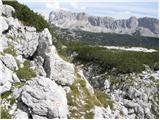 53
53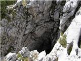 54
54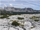 55
55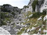 56
56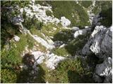 57
57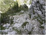 58
58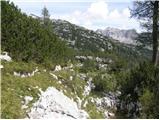 59
59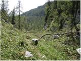 60
60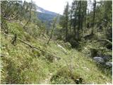 61
61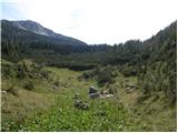 62
62 63
63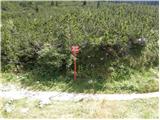 64
64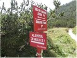 65
65
Discussion about the trip Pod Zjabci - Planina Lopučnica
To post a comment you must log in:
If you do not yet have a username, you must first
register.