Podbrdo - Slatnik (northwestern peak)
Starting point: Podbrdo (515 m)
| Latitude/Longitude: | 46,21510°N 13,97390°E |
| |
Walking time: 3 h 15 min
Difficulty: easy marked way
Elevation gain: 1094 m
Elevation difference along the route: 1105 m
Map: Škofjeloško in Cerkljansko hribovje 1:50.000
Recommended equipment (summer):
Recommended equipment (winter): ice axe, crampons
Views: 8.584
 | 1 person like this post |
Access to starting point:
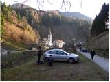
A) First, we drive to Škofja Loka, and then we continue driving towards Železniki and Tolmin. When we get to Podbrdo, we need to pay attention, because right behind the church we will turn right onto a narrower local road which starts ascending along the river Bača. We park at an appropriate place by the road, or on a smaller parking lot by the local cemetery.
B) From the road Idrija - Most na Soči, at the settlement Bača pri Modreju we turn right, or left, if we come from the direction of Posočje, and we continue driving towards Podbrdo. At the end of the settlement Podbrdo, we need to pay attention, because just before the church of St. Miklavž we will turn left onto a narrower local road which starts ascending along the river Bača. We park at an appropriate place by the road, or on a smaller parking lot by the local cemetery.
Route description:
From the starting point, we continue on the initially still asphalted road, from which soon a marked footpath towards Vrh Bače branches off sharply to the left. Further, we continue past an old residential house, behind which we gradually enter the forest. Through the forest, we ascend on a relatively well-marked and partly also quite steep mountain path, which higher up levels out and brings us out of the forest onto a short panoramic slope, across which we walk to the nearby small church of St. Lenart.
At the church, we step onto a narrow road, along which we quickly walk into the village Bača pri Podbrdu. Through the small and panoramic village, we follow the blazes, which lead us onto a cart track that starts ascending through the forest. The narrower and initially somewhat overgrown cart track joins an old mule track already after a few minutes. We follow the wide mule track to the right, and it brings us after a few minutes to a smaller junction, where we continue on the upper left path in the direction of Vrh Bače (slightly right Petrovo Brdo).
Further, we ascend for quite some time on the well-preserved and quite wide mule track, which higher up we leave briefly, as the path leads us along a marked shortcut. Higher up, the mule track is a few times blocked by some fallen trees, and then we approach the cliffs of the peak Šance, where we leave the mule track. Next, we ascend a quite steep path, along which in 5 minutes of further walking we arrive at the hunting cottage on Vrh Bače.
From the hunting cottage, we continue in the direction of Črna prst, then just a few steps below the indistinct saddle Vrh Bače, we continue right in the direction of Šavnik and Možica. The path ahead steeply ascends through the forest for a short time, then brings us to a grassy clearing, where the path temporarily levels out. The path ahead returns to the forest, where after a short ascent it brings us to an old military bunker that has been converted into a kind of weekend cottage; the path bypasses it on the right side. A moderately steep path then brings us to the edge of the ridge (here we can climb in a few steps to a nice vantage point - view of Baška grapa and Kobla) along which we then ascend through more or less dense forest. Higher up, the path turns left and completely levels out. There follows a good 5 minutes of walking, after which the path brings us to a larger grassy slope between Šavnik and Slatnik. Here we continue on an easy path that turns right and after a few steps brings us to a marked junction.
We continue straight ahead (left Šavnik) and continue the path across the meadow named Na poljani. After a few steps, we bypass an emergency bivouac and a little further we reach a less noticeable junction, where we continue slightly right (slightly left planina za Šavnikom). The marked path then enters the forest, where it starts to ascend relatively steeply. Higher up, the forest thins out, and the path brings us to a small saddle between Možic on the left and Slatnik on the right. Here we continue right (sharply left Možic) on the path that ascends to the ridge of Slatnik. When after a short ascent we reach the mentioned ridge, we continue right (straight Soriška planina) and ascend along the increasingly panoramic ridge in a few minutes to the unvegetated peak.

Photos:
 1
1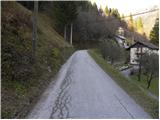 2
2 3
3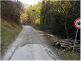 4
4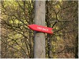 5
5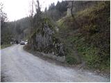 6
6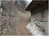 7
7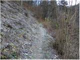 8
8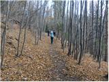 9
9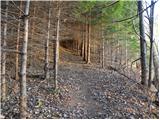 10
10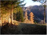 11
11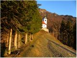 12
12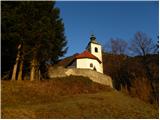 13
13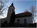 14
14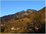 15
15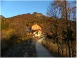 16
16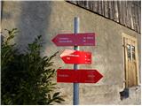 17
17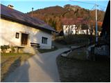 18
18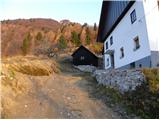 19
19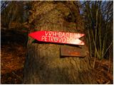 20
20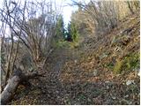 21
21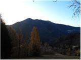 22
22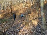 23
23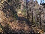 24
24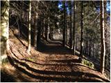 25
25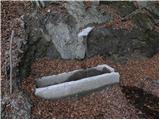 26
26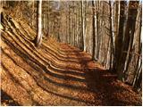 27
27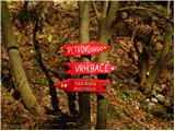 28
28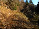 29
29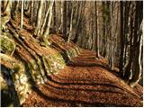 30
30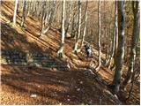 31
31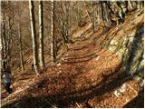 32
32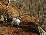 33
33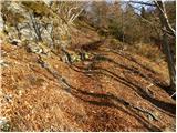 34
34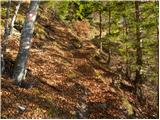 35
35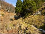 36
36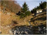 37
37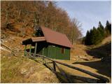 38
38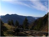 39
39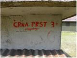 40
40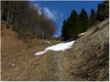 41
41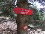 42
42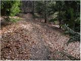 43
43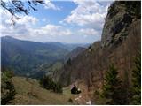 44
44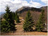 45
45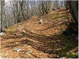 46
46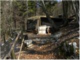 47
47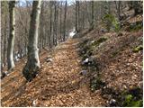 48
48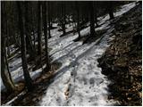 49
49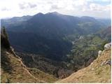 50
50 51
51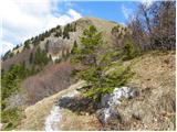 52
52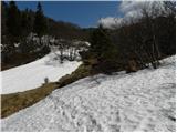 53
53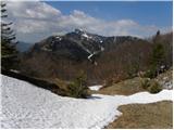 54
54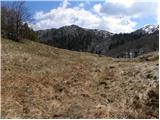 55
55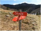 56
56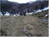 57
57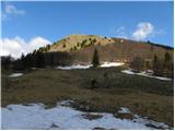 58
58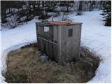 59
59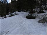 60
60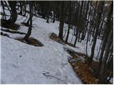 61
61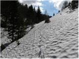 62
62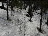 63
63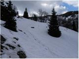 64
64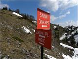 65
65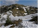 66
66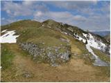 67
67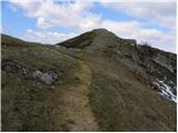 68
68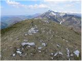 69
69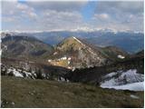 70
70
Discussion about the trip Podbrdo - Slatnik (northwestern peak)
|
| GregorC13. 12. 2011 |
I'm not entirely sure that this peak is Slatnik. On picture 67 you go to Slatnik left and not right. I also thought it was Slatnik, but it was strange that there was no stamp up there, because it's only in the Ratitovec Circuit. To Slatnik you go left ahead along the path to the next peak. On it is the stamp attached to a red pole.
|
|
|
|
| bats13. 12. 2011 |
I would also say that the left variant to Slatnik is the right one, the right leads towards Možic. But it's true that I haven't been exactly on this path for a long time.
|
|
|
|
| Skovik22. 12. 2012 |
With colleague today on mentioned path. Found start without issues. Path to hunting hut on Bača normally passable (except couple avalanches on path). Further crampons and ice axe perfect to top. Two ahead without or with poles probably struggled on slope. Nice path, not too strenuous. Fantastic view!
|
|
|
|
| Skovik29. 12. 2012 |
Today we went to Lajnar from Pretrovo Brdo and also to the summit left of the cable car or Lajnar. To our surprise, the summit was Slatnik! There's a stamp for Slatnik at the top. We also checked the map.
The description of this path leading to the summit where there's some hollow, rusted pipe with a lid is really not Slatnik, as GregorC and bats mentioned.
|
|
|
To post a comment you must log in:
If you do not yet have a username, you must first
register.