Starting point: Podbreg (720 m)
| Latitude/Longitude: | 46,41980°N 14,64550°E |
| |
Walking time: 3 h
Difficulty: easy unmarked way, easy marked way
Elevation gain: 1043 m
Elevation difference along the route: 1050 m
Map: Kamniške in Savinjske Alpe 1:50.000
Recommended equipment (summer):
Recommended equipment (winter): ice axe, crampons
Views: 4.380
 | 2 people like this post |
Access to starting point:
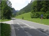
A) We drive to Luče, and then we continue driving towards Logarska dolina. After Solčava and 300 meters before the landscape park Logarska dolina, we will notice signs for the parking lot, which direct us left to the larger parking lot Podbreg, where we park. The turn-off from the main road is near the road sign 13.5 km.
B) From Črna na Koroškem over the mountain pass Spodnje Sleme we drive to Solčava, and from there we continue right in the direction of Logarska dolina. After Solčava and 300 meters before the landscape park Logarska dolina, we will notice signs for the parking lot, which direct us left to the larger parking lot Podbreg, where we park. The turn-off from the main road is near the road sign 13.5 km.
C) Over the mountain pass Pavličev Vrh we drive to Slovenia, and then we continue driving towards Logarska dolina. When we get to the crossroad, where the road branches off to the right into the landscape park Logarska dolina, we continue straight, and after 300 meters to the right onto the larger parking lot for motorhomes, where we park.
Route description:
From the parking lot, we continue on the main road towards Logarska dolina, and a few meters after we cross the stream Jezera over the bridge we continue left onto a macadam road. The macadam road quickly brings us to a second bridge, where after the stream Črna (stream Črna is the second source of Savinja) we continue right, at first still on the macadam road which quickly changes into a wide cart track. The path ahead leads us on a steep cart track, which at the crossings we follow in the direction where the "main" cart track continues. Higher, at the crossing at an altitude of approximately 1200 meters we continue on the right cart track which then crosses the slopes between Icmanikova and Logarska peč towards the right. The cart track soon ends, and from the end of the cart track we continue on a worse footpath or deer path which still in the same direction crosses the slopes. After less than 5 minutes of diagonal ascent we reach another cart track (to here also possible on the mentioned cart track), which in the last part steeply ascends some sort of ridge, and we reach it near its end. From the end of the cart track (end of the cart track is at an altitude of approximately 1350 to 1400 m) we continue on a visible footpath which crosses the slopes towards the right, and soon the footpath joins an old marked path, on which we ascend to the gully, where the abandoned marked path steeply ascends beside the gully. For a few minutes we steeply ascend, then, when we exit the gully we continue slightly right, where we notice one more faded blaze, and the path ends here. We continue through the clearing to the nearby Icmanikov stan, where we reach the marked path Plesnikova planina - Strelovec.
Behind the stan we step onto a newer cart track, from which soon slightly to the right a marked path branches off, but we continue on the cart track, because the path in the upper part is impassable due to branches which they left when building the nearby forest road. On the cart track in a few minutes we ascend to Icmanikova planina, where there is a marked crossing and from where a beautiful view opens up.
From the crossing on the mountain pasture we continue right (left Logarska peč 5 minutes, straight on the forest road we arrive at the farm Knez) on an indistinct ridge, on which we continue a gentle ascent. At first we ascend parallel with a newer road which is right below us, then the path becomes increasingly steep and gradually distances itself from the road. The steep path higher brings us to a poorly visible crossing, which is situated in a belt of lush vegetation, and we continue to the left on a noticeably less trodden footpath which ascends to the ridge of Strelovec northeast of the summit (right path crosses the slopes towards the right and reaches the ridge of Strelovec southwest of the summit, the latter path is also about 15 minutes longer). When we reach the ridge we continue right and in a few steps ascend to the panoramic summit.
Podbreg - Icmanikova planina 2:15, Icmanikova planina - Strelovec 45 minutes.

Photos:
 1
1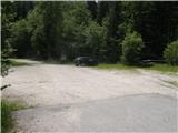 2
2 3
3 4
4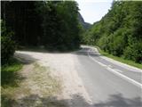 5
5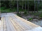 6
6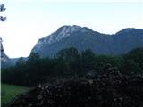 7
7 8
8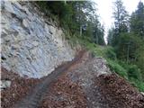 9
9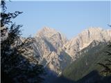 10
10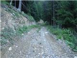 11
11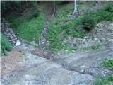 12
12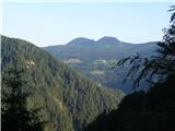 13
13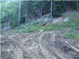 14
14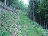 15
15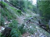 16
16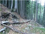 17
17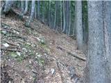 18
18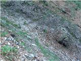 19
19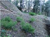 20
20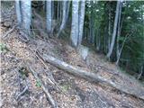 21
21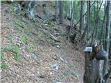 22
22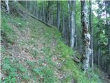 23
23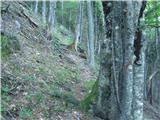 24
24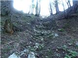 25
25 26
26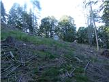 27
27 28
28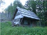 29
29 30
30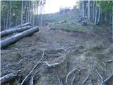 31
31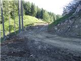 32
32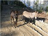 33
33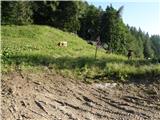 34
34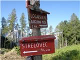 35
35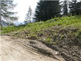 36
36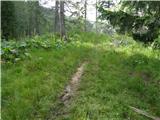 37
37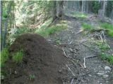 38
38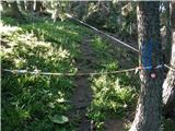 39
39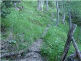 40
40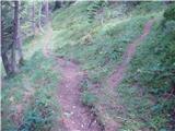 41
41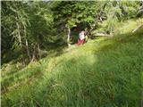 42
42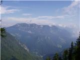 43
43 44
44 45
45 46
46 47
47 48
48
Discussion about the trip Podbreg - Strelovec
|
| pohodnik3820. 06. 2021 21:22:19 |
The description of this trail needs to be supplemented as there are many new forest roads in this area that branch off in all directions and in the end, if you're not prepared, you can get lost. The roads are now laid out all the way to Icmankova planina. Hiked the trail on 17.6., otherwise I also visited Podbrežnikova planina....
PICTURES and personal impressions from the trail
Best regards! Tone
|
|
|
To post a comment you must log in:
If you do not yet have a username, you must first
register.