Podgora - Gora Oljka (Martin way)
Starting point: Podgora (312 m)
| Latitude/Longitude: | 46,32300°N 15,04410°E |
| |
Route name: Martin way
Walking time: 1 h 20 min
Difficulty: easy marked way
Elevation gain: 421 m
Elevation difference along the route: 421 m
Map: Zgornja Savinjska dolina 1:50.000
Recommended equipment (summer):
Recommended equipment (winter):
Views: 46.644
 | 4 people like this post |
Access to starting point:
From the highway Ljubljana - Celje we go to the exit Šempeter and follow the road ahead in the direction of Polzela. In Polzela signs for Gora Oljka point us to the right. The road then brings us to the village Podvin pri Polzeli, where we notice the next sign for Gora Oljka. Here we continue straight (even though it says Gora Oljka right) and follow the road to the railway crossing at the end of the village Podgora. Only a few meters before the railway crossing we turn right onto a macadam road alongside which we park (there are no large parking lots).
Route description:
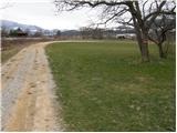
The road alongside which we park brings us after a few minutes of walking to the chapel near which there is a junction. We continue left uphill along Martinova pot, which after a short ascent brings us to a small hamlet, where we continue right. We continue along the cart track, which quickly brings us to the water catchment. The marked path turns right away from the water catchment, slightly downhill, and then ascends diagonally towards the southeast. After some time, the path leaves the forest for grassy slopes over which we ascend to the inn Jug. Further we continue along the road, from which soon a marked path to Gora Oljka branches off left uphill. Here we continue straight along the road to the next junction. Here the signs for Martinova pot direct us left uphill onto a trail that ascends diagonally above the road. A little higher we step onto the road again, which we soon leave again. Only a few minutes of moderate ascent to Gora Oljka follow.

Along the route: Gostišče Jug (530m)
Photos:
 1
1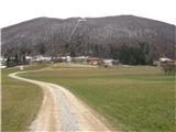 2
2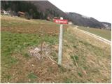 3
3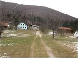 4
4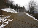 5
5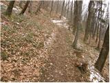 6
6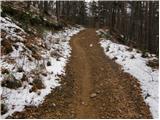 7
7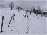 8
8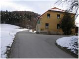 9
9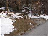 10
10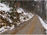 11
11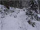 12
12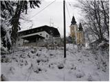 13
13 14
14
Discussion about the trip Podgora - Gora Oljka (Martin way)
|
| KARAMELICA10. 04. 2016 |
Every time my husband and I drove from Ljubljana towards Celje, I looked at the church with two towers on the left side and wondered what that hill is called. This winter I found out it's Gora Oljka. So today we decided to climb it too. Martinova pot seemed the most suitable to us. The path is very well described above, so we had no problems with the ascent. The weather was quite suitable today, so the view into the valley was nice. Recommended.   
|
|
|
|
| zlatica11. 12. 2016 |
The author wrote here (probably some time ago) that there are no larger parking spots along the road. Yesterday I was on this path and just before the turn-off to Martinova pot there is an arranged parking for quite a few cars on the left side. Just for info for new hikers to Gora Oljka. regards
|
|
|
|
| potpodnoge15. 06. 2017 |
I can't find anywhere how much time we need if we go on foot from Polzela and where the path runs. Thanks for the answer.
|
|
|
|
| Jany16. 06. 2017 |
From Polzela you first climb to Vimperk to the beautiful church on the top. From there a marked path leads past Juga to Gora. It takes about 2 hours of moderate walking.
The top of Gora Oljka is not very panoramic, so it's worth asking the caretaker for the church keys, where you can climb the tower, which is something completely different. But watch out for cables, antennas, computers, ... because everyone crowds into those two bell towers.
|
|
|
To post a comment you must log in:
If you do not yet have a username, you must first
register.