Starting point: Podgorje (518 m)
| Latitude/Longitude: | 45,53530°N 13,94350°E |
| |
Walking time: 1 h
Difficulty: easy unmarked way
Elevation gain: 131 m
Elevation difference along the route: 131 m
Map: Primorje in Kras 1:50.000
Recommended equipment (summer):
Recommended equipment (winter):
Views: 5.539
 | 1 person like this post |
Access to starting point:
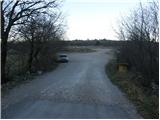
From the highway Ljubljana - Koper, we take the exit Kozina. We follow the road ahead towards Koper to the village Petrinje, where we turn left in the direction of Podgorje. The road, which at first steeply ascends, soon brings us to the next crossroad, where we continue left. Further we drive to the village Podgorje, where we park on a large parking lot near the sports field.
Access from Koper: On the old road we drive towards Postojna and just a little after the village Črni Kal, the road branches off sharply to the right towards Vasi Podgorje. We follow this road to the large parking lot near the sports field, which is situated in the village Podgorje.
Route description:
From the parking lot, we return to the main road which we follow ahead in the direction of travel. After a few dozen meters we get to a crossroad, where wooden hiking signposts point us towards Kojnik. At the crossroad, we continue on the road in the direction of Kojnik. The road which runs without changes in altitude has at the beginning some crossroads but everywhere we continue on the one that is "the main". Here and there we can notice some faded marking, which marks the path towards Kojnik. After some time the road gradually starts ascending and a little higher brings us to a crossroad, where we continue left. We follow this road only a few minutes to the spot, where on a smaller clearing a cart track branches off right upwards. We go on this cart track which after a short ascent brings us to a smaller saddle on the ridge. Here, where the cart track ends we continue right on a worse and quite overgrown path, which barely ascends by the edge of the cliffs. After approximately 15 minutes of walking on and by the ridge we step on an indistinct peak from which a nice view opens up towards the sea.

Photos:
 1
1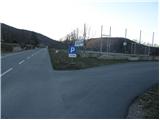 2
2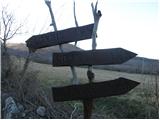 3
3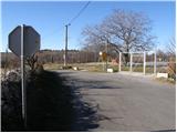 4
4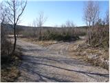 5
5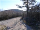 6
6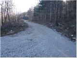 7
7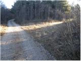 8
8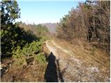 9
9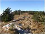 10
10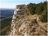 11
11 12
12
Discussion about the trip Podgorje - Jampršnik
|
| grega_p14. 02. 2010 |
I also recommend to Jampršnik from Podpeči, past the tower and along the karst edge to the top - the path is described in January PV, but it's poorly marked in places though orientation is not difficult. Today on the path sunny and almost spring-like, on the summit slightly breezy for a calm snack. Definitely a trip for a clear view day without bora!
Good luck
|
|
|
To post a comment you must log in:
If you do not yet have a username, you must first
register.