Podgorje - Slavnik (gentle path)
Starting point: Podgorje (518 m)
| Latitude/Longitude: | 45,53132°N 13,94719°E |
| |
Route name: gentle path
Walking time: 1 h 40 min
Difficulty: easy marked way
Elevation gain: 510 m
Elevation difference along the route: 510 m
Map: Slovenska Istra - Čičarija, Brkini in Kras 1:50.000
Recommended equipment (summer):
Recommended equipment (winter):
Views: 220.943
 | 3 people like this post |
Access to starting point:
A) From the highway Ljubljana - Koper we go to the exit Kozina, and then on the old road towards Koper we drive to the settlement Petrinje (smaller settlement on the right side of the main road), where we go left in the direction of Podgorje. The road, which at first steeply ascends, soon brings us to the next crossroad, where we continue left, again in the direction of Podgorje. Further we drive to the village Podgorje, where we park on a large parking lot near the sports field.
B) From the highway Koper - Ljubljana we go to the exit Kastelec, and then we continue right in the direction of Ljubljana, Kozina and Podgorje. There follow two more crossroads, in both we go left or straight in the direction of Podgorje (at the first crossroad we stick to the signs for Kozina). We follow this road to a large parking lot near the sports field, which is situated in the village Podgorje.
Route description:
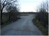
From the parking lot, we return to the main road, which we follow ahead in the direction of travel. After a few tens of meters we come to a crossroad, where wooden mountain signposts direct us left past the chapel upwards. We then follow the asphalt road to the next crossroad where there are a few benches. Here we continue straight but only a few meters to the spot, where the sign for the easy path directs us left. The road then takes us past the last houses in the village and changes from asphalt into macadam, which is closed to traffic. The road, which gently ascends, mostly runs through the forest so that in the first hour of walking there are no beautiful views. A little higher, the marked path leaves the road for a short time but rejoins it after the first bend. The path then brings us to a sign by the path, which informs us that we have entered the area of the natural monument Slavnik. After a few more steps, we step out of the forest onto the gentle summit unvegetated slopes of Slavnik. Here in front of us we already see the transmitters, which we slowly begin to approach. We follow the road ahead for a few more minutes and then leave it at the spot where the marked path ascends across the meadow towards the hut. From the hut to the summit of Slavnik we have only a few steps left.

Photos:
 1
1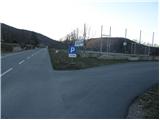 2
2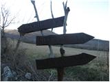 3
3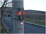 4
4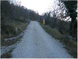 5
5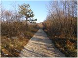 6
6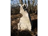 7
7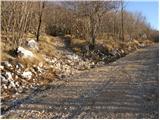 8
8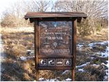 9
9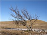 10
10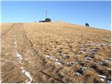 11
11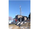 12
12 13
13
Discussion about the trip Podgorje - Slavnik (gentle path)
|
| Enka24. 03. 2009 |
Is there snow on Slavnik?
|
|
|
|
| teabag25. 03. 2009 |
I saw its summit white today..
|
|
|
|
| Tadej25. 03. 2009 |
On Sunday it was clear, but possibly yesterday or today a little snow fell.
|
|
|
|
| Enka26. 03. 2009 |
Thank you very much, we will postpone it for a week just in case  . .
|
|
|
|
| Balky7923. 09. 2011 |
And we were here too third Slovenian peak conquered! I Feel Slovenia ) (Nanos, Slavnik, Snežnik...) come on, where next?
|
|
|
|
| ales5023. 09. 2011 |
there is something historical to see on this hill
|
|
|
|
| tristic24. 09. 2011 |
Hello ales50,
on this hill there's nothing historical to see.. just nice views, variously nice paths and good service at the top.
To make the visit more interesting, I suggest visiting Slavnik on Sunday, October 2nd, when the local PD organizes the 33rd memorial hike to.
Nice day and good luck!
|
|
|
|
| Balky7927. 09. 2011 |
It has views in all directions
|
|
|
|
| thalea27. 02. 2013 |
How is it now on Slavnik? Is there any snow? Is the hut open?
|
|
|
|
| tristic28. 02. 2013 |
@ thalea
At Slavnik it's a winter idyll! Everything is under snow, all paths are trodden. Nearby villages are also snowy, roads are dry. The hut is open all holidays, Saturdays, and Sundays.. so, also open this weekend.
Views open up in all directions, because we've had sun and spring temperatures all week.
|
|
|
|
| bojann28. 02. 2013 |
Hi, I'm wondering if the path from Prešnica is icy? I'll go up on Saturday.
Thanks and best regards!
|
|
|
|
| jax28. 02. 2013 |
Quite possible. These are anyway paths where even if they are icy, a certain dose of caution suffices, without special equipment.
|
|
|
|
| smatjaz16. 04. 2013 |
At the fourth photo: on the candelabrum there is no longer a signpost for the easier path, only the marking and line.
|
|
|
|
| Petra8811. 05. 2013 |
Hey, I have one question. Are there daffodils on Slavnik already? Thanks
|
|
|
To post a comment you must log in:
If you do not yet have a username, you must first
register.