Starting point: Podgrad (283 m)
| Latitude/Longitude: | 46,06642°N 14,63698°E |
| |
Walking time: 40 min
Difficulty: easy unmarked way
Elevation gain: 160 m
Elevation difference along the route: 180 m
Map: Ljubljana - okolica 1:50.000
Recommended equipment (summer):
Recommended equipment (winter):
Views: 504
 | 3 people like this post |
Access to starting point:
From the eastern Ljubljana bypass, we head to the exit Ljubljana - east and continue driving along Zaloška cesta in the direction of Zalog. Further, we drive on the main road towards Podgrad. In the settlement Podgrad, we turn right through the underpass under the railway track and then continue on a relatively narrow road in the direction of Besnica and Janče. Only a little before the end of the settlement Podgrad, we park on the parking lot on the left side of the road. If the parking lot is occupied, we can turn right here onto a cart track by the information board and cross the stream over a small wooden bridge. There is also some space for parking.
Route description:
From the parking lot, we first cross the main road and, past the information board which describes the Ostrovrharjeva pot, head onto the cart track and over a small wooden bridge cross the stream Besnica. The cart track turns left and brings us to a junction.
Sharply right on the cart track or macadam road leads the Ostrovrharjeva pot, beside which there is also a signpost; slightly to the right a shortcut branches off, which higher up joins the Ostrovrharjeva pot; we continue straight on the flat cart track. The flat cart track then brings us to a grassy clearing, on which we will also notice a hunting observatory. We continue on the cart track, which at this spot, due to frequent mud, we can also bypass on a path running along the edge of the clearing. After the clearing, the path brings us to a junction.
Straight on the cart track leads the path towards the old castle Osterberg; we continue left on a narrower path, where a signpost for the Ostrovrharjeva pot directs us. From the junction, the path first slightly descends and then, over a small wooden bridge, crosses the stream Besnica. Here we are again at a junction. Right along the stream leads the path through the valley of the stream Besnica and further towards the millstone quarry; we follow the signs for the Ostrovrharjeva pot and cross the asphalt road.
Here we begin to ascend somewhat more steeply and the path soon brings us to a junction. We continue right, and then ascend transversely towards the southeast. The path here runs through the forest, occasionally opening up some views through the trees on the surrounding hills above the valley of the stream Besnica. Such a path then brings us to a junction where we first head left onto the ridge along which the cart track runs.
On the ridge, we then continue left on the cart track, where the marking for the Ostrovrharjeva pot also directs us. Right leads the path towards Grmadnik and further towards Janče. The path here begins to descend slightly and through the trees some views also open up on the eastern side of the ridge. We continue further along the wide path on the ridge and soon reach a bench and an information board that describes the interesting features on the Ostrovrharjeva pot.
Just a little after the information board, we reach a junction where we must be somewhat more attentive to choose the right path. At the junction, we leave the Ostrovrharjeva pot and head left, but not onto the cart track but onto a narrow path that continues along the ridge. The cart track otherwise leads to the power line where there is also a nice viewpoint with a bench. We thus continue on the narrow path, which ascends through the forest and continues along the forested ridge. We follow this path all the way to the top, which due to the forest does not offer much of a view.

Photos:
 1
1 2
2 3
3 4
4 5
5 6
6 7
7 8
8 9
9 10
10 11
11 12
12 13
13 14
14 15
15 16
16 17
17 18
18 19
19 20
20 21
21 22
22 23
23 24
24 25
25 26
26 27
27 28
28 29
29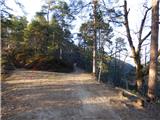 30
30 31
31 32
32 33
33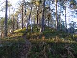 34
34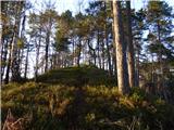 35
35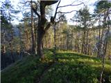 36
36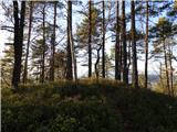 37
37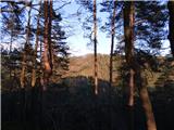 38
38 39
39
Discussion about the trip Podgrad - Murjevka
To post a comment you must log in:
If you do not yet have a username, you must first
register.