Starting point: Podhom (590 m)
| Latitude/Longitude: | 46,39030°N 14,08500°E |
| |
Walking time: 40 min
Difficulty: easy unmarked way
Elevation gain: 244 m
Elevation difference along the route: 244 m
Map: TNP 1 : 50.000
Recommended equipment (summer):
Recommended equipment (winter): ice axe, crampons
Views: 6.384
 | 2 people like this post |
Access to starting point:
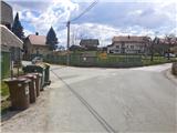
A) From the Ljubljana - Jesenice highway, take the Lipce exit (Jesenice east), where we turn left (direction Blejska Dobrava and Spodnje Gorje). After 100 m of driving, immediately after we have driven through the railway underpass, we find ourselves at the next crossroad, where we go right in the direction of Gorje, Bled (left Blejska Dobrava). After a steeper ascent, we drive through the settlement Kočna and continue towards Spodnje Gorje, where soon after we cross the river Radovna on a bridge and the road ascends a little, we come upon the left turn-off of the road with signs "Zasip, Vintgar, Podhom". Here we turn left and already after a few 10 m at the crossroad again left, in the direction of "Vintgar". Soon we are again at the crossroad, where we do not continue downwards towards Vintgar, but only slightly right or straight up the slope to the parking lot (sign by the road at the crossroad). The right road leads to the village. We park on the arranged parking lot by the playground.
B) From Bled we head towards Pokljuka and Spodnje Gorje. In Spodnje Gorje we follow the signs Jesenice, Vintgar. At the crossroad which is located a few meters ahead from the inn Fortuna we turn right, in the direction of "Zasip, Vintgar, Podhom". Already after a few 10 m at the crossroad we turn left, in the direction of "Vintgar". Soon we are again at the crossroad, where we do not continue downwards towards Vintgar, but only slightly right or straight up the slope to the parking lot (sign by the road at the crossroad). The right road leads to the village. We park on the arranged parking lot by the playground.
Route description:
From the parking lot, we continue forward across the pasture, towards the hill Hom, which we see in front of us. The path in the middle of the pasture turns slightly to the right and soon starts to ascend. Shortly, when the path turns more sharply right, we leave it and continue along the cart track straight up the slope towards the forest (right Sveta Katarina na Homu). The cart track up the slope turns left and starts to ascend quite steeply through the forest, after a few zigzags the greater steepness eventually eases. Soon after, the path turns left and continues directing more and more towards the western slope of the hill. Here we walk on a trodden and driven cart track, and miss the junction on the right. When the path with moderate ascending brings us a little higher below the summit of the hill, it narrows into a footpath, and on this section we again miss the right junction of the cart track. The path along the slope, which through mostly deciduous forest turns slightly to the right, soon brings us to a wooden cross and boxes with the logbook and stamp on the top of the 834 m high Hom.

Photos:
 1
1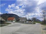 2
2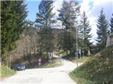 3
3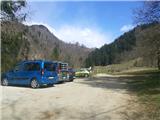 4
4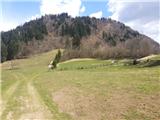 5
5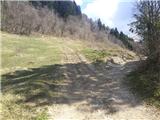 6
6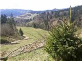 7
7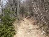 8
8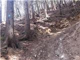 9
9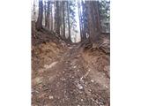 10
10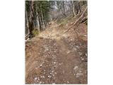 11
11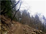 12
12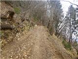 13
13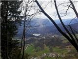 14
14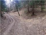 15
15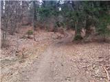 16
16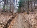 17
17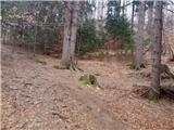 18
18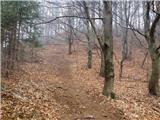 19
19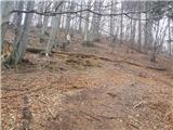 20
20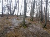 21
21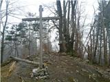 22
22
Discussion about the trip Podhom - Hom at Bled
|
| Jusk13. 08. 2020 |
Nice path, start from Bl. Dobrava to Katarina, around Hom, then up this path. It is really quite steep at the beginning, especially these days in the heat.. the path around Hom full of tourists, this path completely secluded.. back towards Katarina on the marked path and to Bl. Dobrava. a quick hike after work given the weather, thunderstorms were brewing, luckily nothing happened given the weather, thunderstorms were brewing, luckily nothing happened
|
|
|
|
| Majdag14. 08. 2020 |
Picture 4 - there is no more parking there..
|
|
|
|
| Jusk15. 08. 2020 |
I don't know if it is or not, but there were quite a few cars parked at this location, on picture 4 at the bend definitely not, on 5 yes.
|
|
|
|
| Jusk15. 09. 2020 |
Again on this path from Bl. Dobrava, past Katarina around Hom, then to this path... everything fine on the path, I went to the top and back the same way, then back to Dobrava via Strma. Via Strma path it's nicely quiet, not so many tourists as in summer.
|
|
|
To post a comment you must log in:
If you do not yet have a username, you must first
register.