Starting point: Podhom (590 m)
Starting point Lat/Lon: 46.3903°N 14.085°E 
Time of walking: 40 min
Difficulty: easy unmarked way
Difficulty of skiing: no data
Altitude difference: 244 m
Altitude difference (by path): 244 m
Map: TNP 1 : 50.000
Access to starting point:
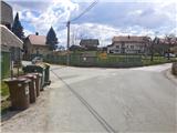
A) From highway Ljubljana - Jesenice we go to the exit Lipce (Jesenice east), where we turn left (direction Blejska Dobrava and Spodnje Gorje). After 100 meters of driving, immediately after we drove through the railway underpass, we find ourselves at the next crossroad, where we go right in the direction of Gorje, Bled (left Blejska Dobrava). After a steeper ascent, we drive through the settlement Kočna and we continue towards Spodnje Gorje, where soon after we on a bridge cross river Radovna and the road ascends a little, we run into the left turn-off of the road with signs "Zasip, Vintgar, Podhom". Here we turn left and already after few 10 meters at the crossroad again left, in the direction of "Vintgar". We are soon again at the crossroad, where we don't continue downwards towards Vintgar, but only slightly right or straight uphill on a parking lot (a sign by the road at the crossroad). The right road runs into a village. We park on a settled parking lot by the playground.
B) From Bled we go towards Pokljuka and Spodnje Gorje. In Spodnje Gorje we follow the signs Jesenice, Vintgar. At the crossroad which is situated few meters ahead from inn Fortuna we turn right, in the direction of "Zasip, Vintgar, Podhom". Already after few 10 meters, at the crossroad we turn left, in the direction of "Vintgar". We are soon again at the crossroad, where we don't continue downwards towards Vintgar, but only slightly right or straight uphill on a parking lot (a sign by the road at the crossroad). The right road runs into a village. We park on a settled parking lot by the playground.
Path description:
From the parking lot, we continue forward through the pasture, towards the hill Hom, which we see in front of us. The path in the middle of the pasture is turning slightly to the right and soon starts ascending. Soon, when the path turns sharply right, we leave it and we continue on a cart track straight uphill towards the forest (right Sveta Katarina on Hom). Cart track in uphill turns left and starts quite steeply ascending through the forest, and after few hairpin turns, the steepness eventually decreases. And then the path soon turns left and is further turning more and more on the western slope of the hill. Here we walk on a beaten cart track, and we ignore the turn-off on the right. When the path in a moderate ascending a little higher brings us below the top of the hill, it narrows into a footpath, and on this part, we again ignore the right turn-off of the cart track. The path on a slope, which is through mostly deciduous forest turning slightly to the right, quickly brings us to a wooden cross and boxes with an inscription book and a stamp on the summit of 834 meters high Hom.
Pictures:
 1
1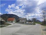 2
2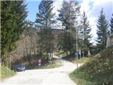 3
3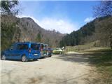 4
4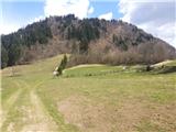 5
5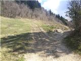 6
6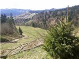 7
7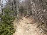 8
8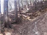 9
9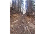 10
10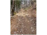 11
11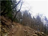 12
12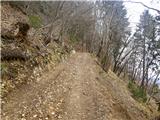 13
13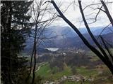 14
14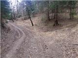 15
15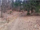 16
16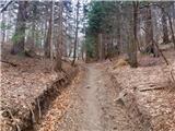 17
17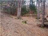 18
18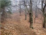 19
19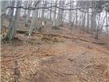 20
20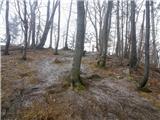 21
21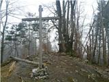 22
22