Podkilavac - Obruč (via Kolci, eastern slopes of Obruč)
Starting point: Podkilavac (320 m)
Route name: via Kolci, eastern slopes of Obruč
Walking time: 4 h 15 min
Difficulty: partly demanding marked way
Elevation gain: 1056 m
Elevation difference along the route: 1056 m
Map: SMAND: 14 Gorski kotar IV, 1:30.000, 2007.g.
Recommended equipment (summer):
Recommended equipment (winter): crampons
Views: 2.139
 | 2 people like this post |
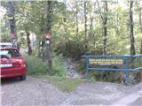
Access to starting point:
From the Rijeka – Zagreb highway, exit at Čavle (3 km from Rijeka). At the traffic light, turn left towards Čavle. Drive about 600 meters to the second traffic light and turn right (towards Zagreb, Grobnik). Drive 650 meters and turn left towards Dražice.
After that, drive 3.9 km to the roundabout on the right side (access via the connecting road, 250 meters from the petrol station). Exit at the second exit. Here begins the marked path (on a tree on the right side of the road is a sign with times to Hahlić and Platak).
Continue along the road for about 550 meters and turn slightly left. After that, continue for 1.8 km to the small bridge.
The car can be left here, or you can continue over the small bridge and take the left road to shorten the route. Along the road, there are occasional marked signs from the pedestrian path that crosses the road. The road leads 5 km to the turnaround.
Route description:
We leave the small bridge on the right side and proceed along the road over the pipeline. The path leads us partly along the road, but at several points, it diverges from the road, shortening our walk. Before the end of the road, we reach a crossroad (left is an easier path, right along the road is harder). We continue along the road, and at the end of the road, there is a turnaround where the path through the forest begins.
The path steeply leads us through a pine forest. Occasionally, through the forest, a beautiful view opens toward Učka, the sea, and Kvarner Bay. After some time, we emerge from the pine forest, and here the view opens in all its beauty. The path further leads through an area with low vegetation, over a small scree, and soon we emerge from the shade onto meadows. We ascend through the meadows for about 20 minutes to a small saddle. After crossing the saddle, a few minutes of walking bring us to several small lakes, their size depending on the amount of rain. A few more minutes of easy walking, and we reach a crossroad (left to Ćunina glava, straight to Obruč, Pakleno, etc., right to Hahlić cottage).
We move forward directly towards Pakleno, Obruč. After a few minutes, we arrive at the first crossroads. We continue straight towards Obruč, the peaks of Pakleno. Soon we reach another crossroad where we again continue straight (Obruč). After a few minutes, we reach the third crossroad. Here, an easier path from Podkilavac joins. We continue right toward Obruč, Pakleno, Previjak. Soon we reach a crossroads where a steep left path begins along the ridge to Obruč. We continue straight, and after a few minutes at a crossroad, we turn left toward Pakleno H6/H7.
The path leads us at a gentle pace through a beautiful forest. The forest provides pleasant shade, and occasionally the view opens slightly to the surrounding terrain. After about 40 minutes, we emerge onto a forest road and turn left. A few steps further, in a left turn, the path branches off towards Obruč, Pakleno north. peak (right Pakleno).
The path continues along an old, overgrown forest trail and leads to a forest road. We continue left, and after about 20 minutes, we reach a faintly marked crossroads (right, Pakleno northern peak). We continue along the road, and after about ten minutes, we reach a crossroads where we turn left off the road towards Obruč. The path leads through the forest and ascends along an interesting trail. Along the entire path, beautiful views open up. After half an hour, we reach the crossroads for Studena (right). We continue straight, and after about ten minutes of easy walking, we reach the summit.

Along the route: Planinarski dom Hahlić (1097m),
Pakleno (1340m), Pakleno sjeverni vrh (1330m)
Photos:
 1
1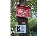 2
2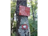 3
3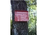 4
4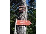 5
5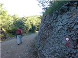 6
6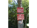 7
7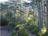 8
8 9
9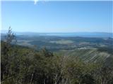 10
10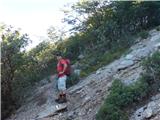 11
11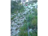 12
12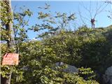 13
13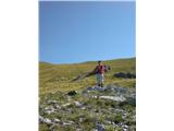 14
14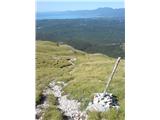 15
15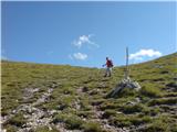 16
16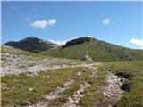 17
17 18
18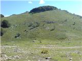 19
19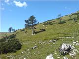 20
20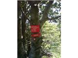 21
21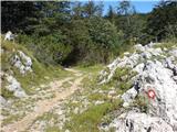 22
22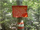 23
23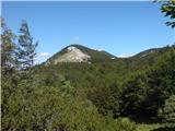 24
24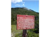 25
25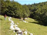 26
26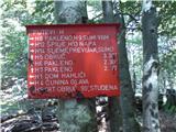 27
27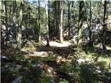 28
28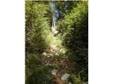 29
29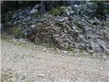 30
30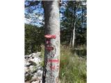 31
31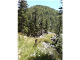 32
32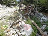 33
33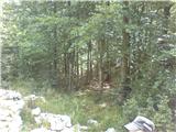 34
34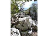 35
35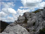 36
36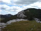 37
37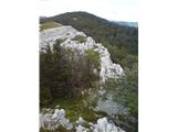 38
38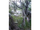 39
39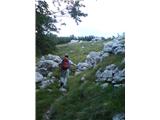 40
40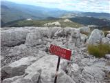 41
41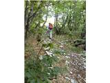 42
42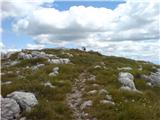 43
43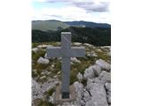 44
44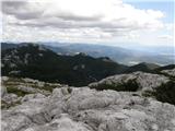 45
45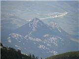 46
46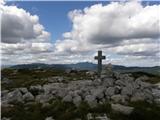 47
47
Discussion about the trip Podkilavac - Obruč (via Kolci, eastern slopes of Obruč)
To post a comment you must log in:
If you do not yet have a username, you must first
register.