Podkraj - Križna gora (Hrušica) (steep way)
Starting point: Podkraj (798 m)
| Latitude/Longitude: | 45,86390°N 14,06300°E |
| |
Route name: steep way
Walking time: 1 h
Difficulty: easy marked way
Elevation gain: 364 m
Elevation difference along the route: 364 m
Map: Nanos 1:50.000
Recommended equipment (summer):
Recommended equipment (winter): ice axe, crampons
Views: 6.783
 | 1 person like this post |
Access to starting point:
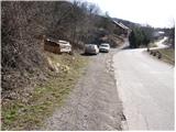
From Logatec we drive towards Idrija. Only a little after the village Kalce we will notice a road which goes left in the direction of the village Podkraj and Col. We go on this quite winding road and follow it to the village Podkraj. We park on a smaller parking lot by the road right next to the sign for the end of the village Podkraj (by the parking lot there are also hiking signposts).
From Primorska we first drive to Col, and then we continue driving in the direction of the village Podkraj. When the road brings us to the beginning of the village we do not continue right into the village, but we continue on the left upper road which bypasses the center of the village. Near the sign for the beginning of Podkraj we park on a smaller parking lot by the road.
Route description:
From the starting point, we go on an ascending cart track in the direction of Sveti Duh and Javornik. The cart track already after a few steps turns to the right and then ascends diagonally through a grassy slope. Higher, we pass into a short stretch of forest, after which the path brings us to a marked junction.
We continue left (right Javornik) on a gently sloping path, which crosses slopes towards Križna gora, which we can clearly see in front of us. The well-marked path continues on a cart track, from which soon to the right a rather steep path branches off for a short time. Higher, the path passes into the forest, where it ascends diagonally towards the northwest. When we step out of the forest, the path turns a little more to the right and with the help of a steel cable (undemanding) brings us to the next junction.
We continue left in the direction of Križna gora (straight Sveti Duh and Križna gora on a gentle path). The path ahead quickly passes into the forest, where it then moderately ascends on a cart track. At the spot where the cart track turns to the right, the blazes direct us slightly to the left onto a footpath which quickly passes out of the forest onto panoramic grassy slopes. The panoramic path from which a wonderful view opens up onto the Nanoška plateau and part of the Gulf of Trieste then ascends ever more steeply on an occasionally very steep slope, which is dangerous for slipping when wet and in snow. We follow this path all the way to the top of Križna gora, on which a lookout tower stands.
I recommend descending on a somewhat longer gentle path.

Photos:
 1
1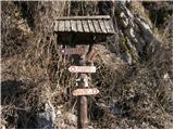 2
2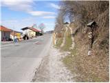 3
3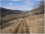 4
4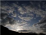 5
5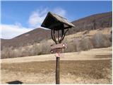 6
6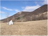 7
7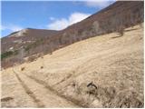 8
8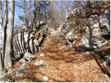 9
9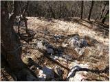 10
10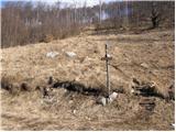 11
11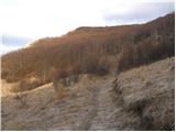 12
12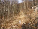 13
13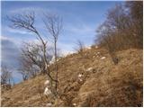 14
14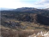 15
15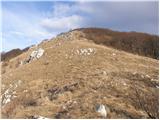 16
16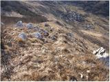 17
17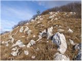 18
18 19
19
Discussion about the trip Podkraj - Križna gora (Hrušica) (steep way)
|
| akvarij22. 07. 2018 |
Nice trip, attaching link to the "track" of the circular path Podkraj-Križna gora-Sveti Duh-Podkraj
Circular path
|
|
|
To post a comment you must log in:
If you do not yet have a username, you must first
register.