Podkraj - Streliški vrh (Hrušica) (east path)
Starting point: Podkraj (798 m)
| Latitude/Longitude: | 45,86390°N 14,06300°E |
| |
Route name: east path
Walking time: 1 h 30 min
Difficulty: easy marked way
Elevation gain: 468 m
Elevation difference along the route: 500 m
Map: Nanos 1:50.000
Recommended equipment (summer):
Recommended equipment (winter): ice axe, crampons
Views: 10.498
 | 1 person like this post |
Access to starting point:
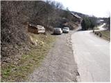
From Logatec we drive towards Idrija. Only a little after the village of Kalce we will notice a road which turns left in the direction of the villages Podkraj and Col. We turn onto this quite winding road and follow it to the village Podkraj. We park on a smaller parking lot by the road right next to the sign for the end of the village Podkraj (there are also hiking signposts by the parking lot).
From Primorska we first drive to Col, and then we continue driving in the direction of the village Podkraj. When the road brings us to the beginning of the village we don't continue right into the village, but we continue on the left upper road which bypasses the center of the village. Near the sign for the beginning of Podkraj we park on a smaller parking lot by the road.
Route description:
From the starting point, we head onto an ascending cart track in the direction of Sveti Duh and Javornik. The cart track already after a few steps turns to the right and then transversely ascends across a grassy slope. Higher, we pass through a short stretch of forest, after which the path brings us to a marked junction, where we continue right in the direction of Javornik (left Sveti Duh and Križna gora). The path ahead gently ascends along the edge of the forest and then brings us to Izakova koča (smaller emergency bivouac), which is located somewhat to the left of the path.
Somewhat above the bivouac we come to a junction of several cart tracks. We continue straight ahead (direction Javornik) on a partly rocky cart track and follow it for a few minutes, then at a smaller junction (marked) we continue slightly right on a grassy cart track, which leads us past an old military bunker. We bypass the bunker on the left side, then the path brings us to the edge of a pasture fence. For some time we continue along the pasture fence, then the path makes an orientation loop. The path turns right downward, essentially in the direction from which we came, then after a short descent left into the forest. Further we pass into dense forest and for some time moderately ascend on a quite overgrown cart track. A short descent follows and the path brings us to a macadam road, which we follow to the left. The road soon brings us out of the forest onto expansive grassy slopes, in the midst of which we arrive at a marked junction.
We continue right in the direction of Javornik, on a footpath which first gently ascends past a smaller sign on a tree, then begins to ascend more steeply across relatively panoramic grassy slopes. Higher, the path levels out and brings us to a larger plain south of Streliški vrh. We continue slightly left on the marked footpath, which descends to a smaller torrent, after which we come upon a pleasant bench. This is followed by traversing the eastern slopes of the aforementioned summit, then the path brings us to a smaller saddle.
On the right side of the saddle we notice a smaller lookout tower or belfry, while we continue left (straight down to Javornik) on a less trodden but well-marked footpath which begins to ascend ever more steeply. The path through a belt of scrub quickly enters the forest and ascends even more steeply. After a short ascent we reach a nice and somewhat exposed vantage point (view of Javornik and Vodice), then the path returns to the forest, where it continues all the way to Streliški vrh.

Photos:
 1
1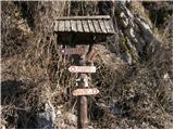 2
2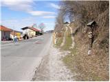 3
3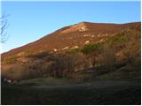 4
4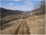 5
5 6
6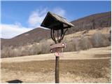 7
7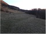 8
8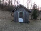 9
9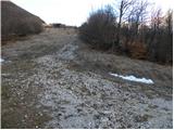 10
10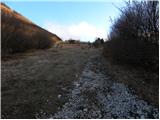 11
11 12
12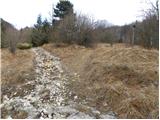 13
13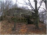 14
14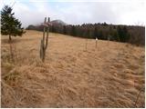 15
15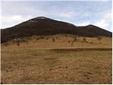 16
16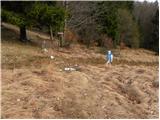 17
17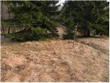 18
18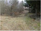 19
19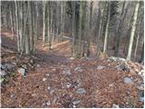 20
20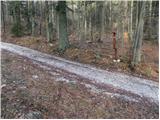 21
21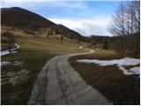 22
22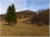 23
23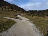 24
24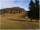 25
25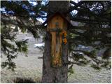 26
26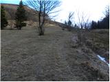 27
27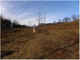 28
28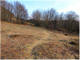 29
29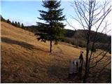 30
30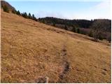 31
31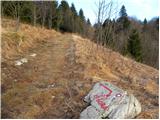 32
32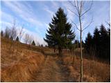 33
33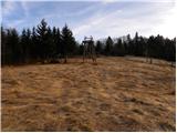 34
34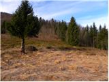 35
35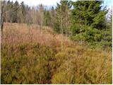 36
36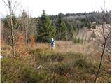 37
37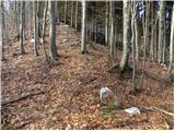 38
38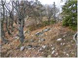 39
39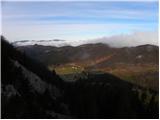 40
40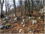 41
41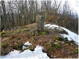 42
42 43
43
Discussion about the trip Podkraj - Streliški vrh (Hrušica) (east path)
|
| Am Shagar29. 06. 2015 |
Yesterday on a rarely visited summit. The path to Javornik is in good condition. To the junction on the gravel road without problems and also further to the start of the "eastern path". The ascent at the beginning is steep. Need to push through fallen trees (probably consequence of the last ice storm; not the big one last year). When the slope flattens, lush undergrowth. The path is recognizable only in some places. We used faded markings for approximate direction. Descent back not recommended. On the summit now a tower for wireless wi-fi communication is erected. They also felled some trees, so the view towards the Julians with Triglav is better. I didn't find the "western path" except for two markings on a pole and nearby tree. Luckily the descent didn't pose special orientation challenges, as subsequent hills are visible. Descent more or less straight down to the object in the forest. Then along the forest road that leads from the object to the crossroads. There left onto the forest road by which we reach the junction where we left it right uphill. From there along the marked path to the start. From the summit there is also a track where they laid the cable for the tower, but where it leads I didn't even explore. So now it's more an unmarked trail or pathless than a marked path, if someone decides to ascend. Be careful and good luck.
|
|
|
To post a comment you must log in:
If you do not yet have a username, you must first
register.