Podljubelj (Lajb) - Begunjščica
Starting point: Podljubelj (Lajb) (770 m)
| Latitude/Longitude: | 46,41510°N 14,27010°E |
| |
Walking time: 3 h 30 min
Difficulty: partly demanding marked way
Elevation gain: 1290 m
Elevation difference along the route: 1290 m
Map: Karavanke - osrednji del 1:50.000
Recommended equipment (summer):
Recommended equipment (winter): ice axe, crampons
Views: 20.648
 | 3 people like this post |
Access to starting point:
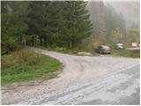
We leave the Gorenjska motorway at the Podtabor junction, and then continue driving towards the Ljubelj border crossing. Further, we drive past the turn-off for Bistrica pri Tržiču, and higher also past the turn-off for Podljubelj. A little after the 4.5 km road sign, after the underpass we turn right and then once again right into Podljubelj. We park at a suitable spot by the sign that marks the beginning of Podljubelj.
Route description:
From the parking lot, we continue on the road which crosses a narrower bridge (overpass) and on the other side turns left. After a few dozen steps along the road, we notice signs for Preval, Begunjščica and Dobrča. Further, we continue on the road which climbs above the village and at the end of the village we notice a sign prohibiting further driving. The road, which further moderately ascends, soon crosses the stream over a bridge and continues along a mostly vegetated slope. Somewhere halfway up to Preval, the road crosses some panoramic slopes, then goes back into the forest, where we have two options for continuing. On the right side of the road, we notice a steep cart track which soon brings us to Preval, or we can continue on the slightly gentler road which brings us to Preval just a minute later. At Preval both paths join and only a short ascent follows to the hut, which we notice on the left side.
From the cross at Preval we continue north on the marked footpath in the direction of Begunjščica over Kalvarija (left Roblekov dom over Roža, right Ljubelj and Podljubelj). The path ahead first ascends over a panoramic grassy slope, then transitions into the forest through which it begins to ascend more steeply. Higher up, the forest starts to thin out, and the path becomes a bit steeper. A fairly steep ascent follows, which first runs through some bands of dwarf pines, higher over steep grassy slopes which are especially dangerous for slipping when wet. Further, we cross a slightly exposed gully, where a small memorial marker is placed, and the path then ascends for a few more minutes along the steep grassy slope. When the slope a little higher flattens somewhat, the marked path turns left and crosses the slopes to the left. Just a few minutes further we arrive at a small basin, where the slope flattens even more. We only cross the mentioned basin (slightly to the right of the basin we can climb to Begunjska Vrtača on easier pathless terrain in 15 minutes), then in a few minutes we ascend to the main ridge of Begunjščica. When we step onto the ridge, a nice view also opens towards the north, and we continue along the gentle path which proceeds along a somewhat narrower ridge. A short descent follows to a small saddle, where the "path" over Šentanski plaz joins from the right. Here the Begunjščica ridge widens, and we follow the increasingly panoramic path to the forepeak of Veliki vrh. One more very short descent follows, then without major difficulties in a few minutes we ascend to the highest summit of Begunjščica.
Starting point - Preval 1:30, Preval - Begunjščica 2:00.

Photos:
 1
1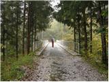 2
2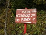 3
3 4
4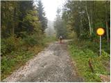 5
5 6
6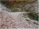 7
7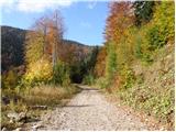 8
8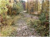 9
9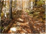 10
10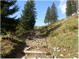 11
11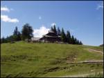 12
12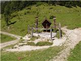 13
13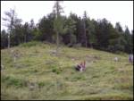 14
14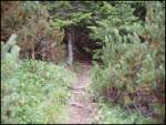 15
15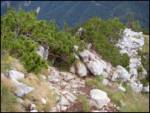 16
16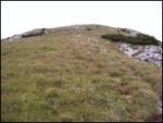 17
17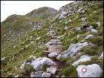 18
18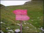 19
19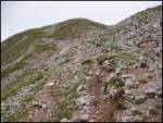 20
20 21
21 22
22 23
23
Discussion about the trip Podljubelj (Lajb) - Begunjščica
|
| mabone23. 01. 2010 |
Today I went on this trail.
No markings up to Preval. Best along the road and not the described path, which has been washed away by a landslide in a few places (at least that's what it seems to me).
From the alpine pasture onwards there are markings, but the path is not trodden or there are many footsteps each going their own way. The upper part is by no means easy. Without an ice axe it wouldn't be possible.
Nice view and warm sun more than compensate for the entire effort.
LP
Martin
|
|
|
To post a comment you must log in:
If you do not yet have a username, you must first
register.