Podljubelj (Lajb) - Roblekov dom na Begunjščici
Starting point: Podljubelj (Lajb) (770 m)
| Latitude/Longitude: | 46,41510°N 14,27010°E |
| |
Walking time: 3 h
Difficulty: easy marked way
Elevation gain: 887 m
Elevation difference along the route: 887 m
Map: Karavanke - osrednji del 1:50.000
Recommended equipment (summer):
Recommended equipment (winter): ice axe, crampons
Views: 22.062
 | 2 people like this post |
Access to starting point:
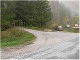
We leave the Gorenjska motorway at the Podtabor junction, and then we continue driving towards the Ljubelj border crossing. Further on, we drive past the turn-off for Bistrica pri Tržiču, and higher up also past the turn-off for Podljubelj. A little after the 4.5 km road sign, after the underpass we turn right and then once again right into Podljubelj. We park at a suitable spot by the sign, which marks the beginning of Podljubelj.
Route description:
From the parking lot, we continue on the road which crosses a narrow bridge (overpass) and on the other side turns left. After a few dozen steps of walking along the road we notice signs for Preval, Begunjščica and Dobrča. Further, we continue on the road which ascends above the village and at the end of the village we notice a sign that prohibits further driving. The road, which further moderately ascends, soon over a bridge crosses the stream and continues on a mostly vegetated slope. Somewhere on the halfway ascent to Preval the road crosses some panoramic slopes, then goes again into the forest, where we have two options to continue. On the right side of the road we notice a steep cart track which soon brings us to Preval, or we can continue on a slightly more gentle road which brings us to Preval just a minute later. On Preval both paths join and only a short ascent follows to the cottage, which we notice on the left side.
From Preval we continue on a slightly ascending road in the direction of Roblekov dom and Poljska planina. After approximately 15 minutes of easy walking on the macadam road on the right side thereof we will notice a trough with water and above it signposts for Roblekov dom (over Roža). We head onto this path, which ascends through a belt of forest and after a few minutes brings us to the unvegetated southern slopes of Begunjščica. The path ahead ascends transversely towards the west, meanwhile crossing a few steep gullies. The path is even secured with pegs at some places, so that in dry conditions it presents no major difficulties. After approximately half an hour of walking from the place where we left the road, we come to a pleasant bench, which is located directly beside the spring named Roža. The moderately steep path crosses a few more gullies, then levels out and brings us into a short belt of forest, where we join the usual path to Roblekov dom. Here we continue right and follow the path, which moderately ascends, to Roblekov dom on Begunjščica, which we reach after 10 minutes of further walking.
Starting point - Preval 1:30, Preval - Roblekov dom 1:30.

The trip can be extended to the following destinations: Begunjščica
Photos:
 1
1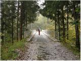 2
2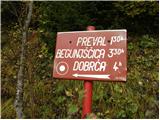 3
3 4
4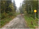 5
5 6
6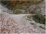 7
7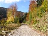 8
8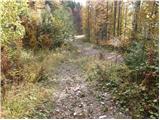 9
9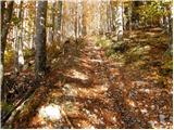 10
10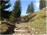 11
11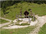 12
12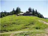 13
13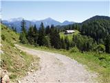 14
14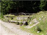 15
15 16
16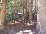 17
17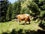 18
18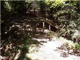 19
19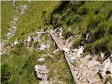 20
20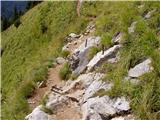 21
21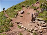 22
22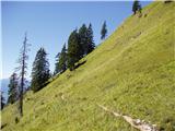 23
23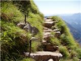 24
24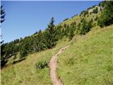 25
25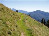 26
26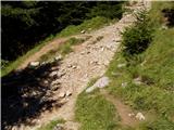 27
27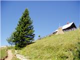 28
28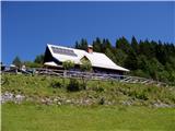 29
29
Discussion about the trip Podljubelj (Lajb) - Roblekov dom na Begunjščici
To post a comment you must log in:
If you do not yet have a username, you must first
register.