Podljubelj (Pod Košuto) - Robič (via lake Jezero pri Čežov)
Starting point: Podljubelj (Pod Košuto) (820 m)
| Latitude/Longitude: | 46,40950°N 14,29450°E |
| |
Route name: via lake Jezero pri Čežov
Walking time: 2 h 15 min
Difficulty: easy unmarked way
Elevation gain: 564 m
Elevation difference along the route: 610 m
Map: Karavanke - osrednji del 1:50.000
Recommended equipment (summer):
Recommended equipment (winter): ice axe, crampons
Views: 1.130
 | 2 people like this post |
Access to starting point:
We leave the Gorenjska motorway at the Podtabor junction and continue driving on the fast road towards Tržič and the Ljubelj border crossing. After the turn-off for Tržič we follow the main road towards Austria to the turn-off for Podljubelj, and when we leave the main road from the nearby crossroad we continue left; further we follow the signs for Dom na Kofcah and Karami. Further, we drive on an ascending asphalt road, which we follow to a crossroad where the roads for Dom na Kofcah and Karami separate. At the mentioned crossroad the described path begins, and we park somewhere nearby at a suitable place.
Route description:
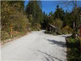
From the starting point, we head onto the right road in the direction of the holiday cottage Karami Mountainhouse (straight to Matizovec and Dom na Kofcah), where we first pass a few more houses, then the road enters the forest and temporarily ascends more steeply. When we leave the forest we arrive at the farm Čižovnik, where we leave the road that continues towards the aforementioned holiday cottage and continue slightly left onto a cart track that ascends above the farm. A little further ahead the cart track temporarily passes into a strip of forest, then ascends across a panoramic meadow and higher again enters the forest. When in the forest the cart track levels out, or even descends slightly, at the fork we choose the right cart track (straight the cart track that bypasses the lake), which gently descends to the lake at Čežov.
From the lake we return a little back, then continue on the ascending cart track, which quickly rejoins the cart track that we left before descending to the lake. There follows an ascent on a wide cart track or poorer road, at junctions we follow the wider path. Further on we make a few hairpins, during the ascent beautiful views occasionally open up for us, which higher reach all the way to Triglav. The road higher levels out and takes us past a green ramp to the place where we reach the marked path Kal - mountain pasture Kofce.
We merely cross the mentioned path and continue straight along the road leading towards Jelendol. We walk a few more minutes without major change in elevation, then we gradually begin to descend. After a few minutes of descent we first cross another marked path leading to mountain pasture Kofce, a little further the road from Zavetišče na Kalu joins from the right, we continue straight and follow the road to the place where it forks in the forest.
We continue straight onto the poorer cart track that continues between both roads, which soon becomes quite steep. During the ascent on the cart track a nice view opens up on the western peaks of Košuta when looking back, higher the path turns left and brings us in a few minutes to the ridge, where it turns right and turns into a poorer footpath. Just a little further we step out of the forest onto a smaller clearing, where we reach the forepeak, and from the forepeak we continue another approximately 2 minutes on the poorer footpath, which brings us to the panoramic summit.
Starting point - lake at Čežov 0:45, lake at Čežov - Robič 1:30.
The description and photos refer to the situation in October 2019.

Along the route: Jezero pri Čežov (1010m)
Photos:
 1
1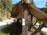 2
2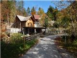 3
3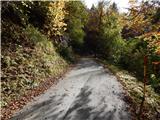 4
4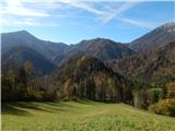 5
5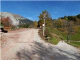 6
6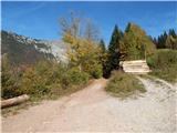 7
7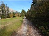 8
8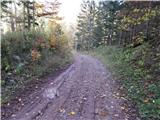 9
9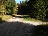 10
10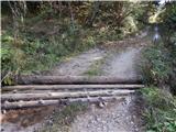 11
11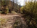 12
12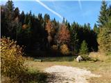 13
13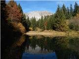 14
14 15
15 16
16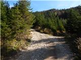 17
17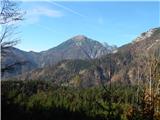 18
18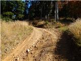 19
19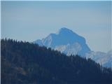 20
20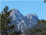 21
21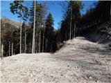 22
22 23
23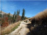 24
24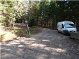 25
25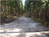 26
26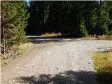 27
27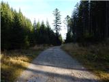 28
28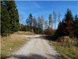 29
29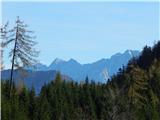 30
30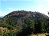 31
31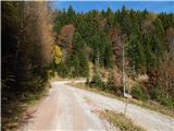 32
32 33
33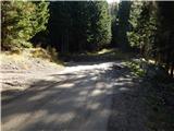 34
34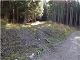 35
35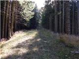 36
36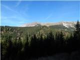 37
37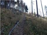 38
38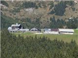 39
39 40
40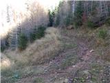 41
41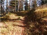 42
42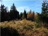 43
43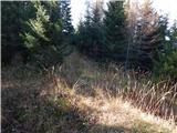 44
44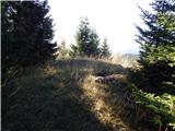 45
45 46
46
Discussion about the trip Podljubelj (Pod Košuto) - Robič (via lake Jezero pri Čežov)
|
| sebanakis11. 07. 2020 |
Unfortunately, the lake has been drained recently.
|
|
|
To post a comment you must log in:
If you do not yet have a username, you must first
register.