Podmeja - Reška planina (on ridge)
Starting point: Podmeja (724 m)
| Latitude/Longitude: | 46,18610°N 15,06180°E |
| |
Route name: on ridge
Walking time: 2 h 5 min
Difficulty: easy marked way
Elevation gain: 201 m
Elevation difference along the route: 350 m
Map: Posavsko hribovje - zahodni del 1:50.000
Recommended equipment (summer):
Recommended equipment (winter): ice axe, crampons
Views: 390
 | 1 person like this post |
Access to starting point:
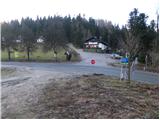
A) From the Ljubljana - Celje highway we take the Šempeter exit and continue driving towards Prebold and later Trbovlje. We then follow the serpentine road to the Podmeja pass, where we park on the parking lot near the hunting lodge.
B) From Zasavje we first drive to Trbovlje, then continue driving towards Prebold. When we come to the Podmeja pass, we park on the parking lot near the hunting lodge.
Route description:
From the Podmeja pass we head west on a poor macadam road towards Sveta planina, or Partizanski vrh. After a few dozen steps we leave the road and continue on a cart track which gently ascends through the forest. Higher up, the cart track flattens entirely and from an indistinct ridge gradually passes to the shady side. Here the marked cart track turns sharply right (poorly marked) and begins to descend noticeably. At the end of the descent we step on a wide cart track, on which we walk a few steps to an asphalt road which we follow to the right. Next, with a view of Kum and ascending past a few houses, we reach a marked junction, where we continue right towards Sveta Planina - on the road (straight Sveta Planina - on a footpath).
A diagonal ascent across a panoramic slope follows, then the road passes into the forest. A little further a view opens to the right towards Golava, Kamnik and Mrzlica, and the road brings us to a marked junction.
We continue right in the direction of Reška planina, Dom pod Reško planino, Gradišče and Šmiglova zidanica (slightly left Vrhe, Sveta Planina, Čemšeniška planina and Krvavica), where soon after the crossroad we notice a notification that we are in the area of brown bear habitat. The path ahead continues on the asphalt road and first bypasses Nacetov vrh (828 m) on the left side, then on the right side Jamškov vrh (811 m).
When we reach the saddle between Jamškov vrh and Reška planina, from a marked junction we continue left towards Reška planina along the ridge and Šmiglova zidanica and Grajska vas (slightly right Dom pod Reško planino).
A few minutes of diagonal ascent on an asphalt road follow, where we first bypass a nearby homestead on the right side; in approximately 15 minutes we reach a junction at the Čeren saddle, where we continue sharply right on a ridge path towards Reška planina (slightly right Strnik, Tolsti vrh, Šmiglova zidanica and Grajska vas, straight on a drivable road towards Tabor and Grajska vas).
The path ahead leads us along the western ridge of Reška planina, ascending moderately at first, then more steeply. Soon we reach the indistinct peak Popelova skala, followed by a short descent along and beside the ridge, where additional caution is needed in some spots due to the considerable steepness of the slopes. Further along the ridge becomes less steep, and in a gentle ascent we reach the indistinct peak of Reška planina, recognizable by the inscription on a tree.
Description refers to conditions in September 2020 and January 2025, and pictures are from various periods.

Along the route: Preval Čeren (781m), Popelova skala (Kukel) (875m)
Photos:
 1
1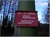 2
2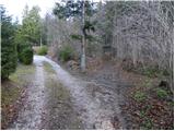 3
3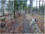 4
4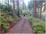 5
5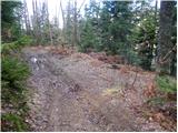 6
6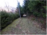 7
7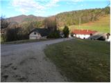 8
8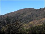 9
9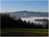 10
10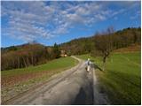 11
11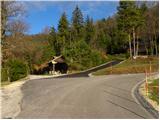 12
12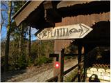 13
13 14
14 15
15 16
16 17
17 18
18 19
19 20
20 21
21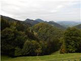 22
22 23
23 24
24 25
25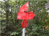 26
26 27
27 28
28 29
29 30
30 31
31 32
32 33
33 34
34 35
35 36
36 37
37
Discussion about the trip Podmeja - Reška planina (on ridge)
To post a comment you must log in:
If you do not yet have a username, you must first
register.