Podmežakla (Jesenice) - Partisan hospital on Mežakla (via Zakop)
Starting point: Podmežakla (Jesenice) (580 m)
Route name: via Zakop
Walking time: 1 h 40 min
Difficulty: easy marked way
Elevation gain: 470 m
Elevation difference along the route: 470 m
Map: TNP 1:50.000
Recommended equipment (summer):
Recommended equipment (winter): ice axe, crampons
Views: 8.448
 | 3 people like this post |
Access to starting point:
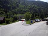
From the Ljubljana–Jesenice highway, take the Lipce exit and drive right towards Jesenice (left at the traffic light). Here in the town centre, follow the signposts for Podmežakla. When we drive through the underpass, we turn right, and nearby we can notice the hockey hall. We drive a further 350 m, when before the highway underpass we notice a parking lot. Here is our starting point.
Route description:
From the parking lot, we head into the underpass, on whose right side we find the first blaze. When we step through it, we notice on the left side a path that leads from the road uphill (blaze on the asphalt). We take it, ascend a few metres and turn right (west) towards the power line. The path, which initially ascends only moderately and later more steeply, brings us after some time to a junction. Here we go left, even steeper uphill towards the south. Soon we reach a forest road, which through a right and left bend brings us to the junction of a cart track that steeply ascends to the right in the SE direction. We head onto it and follow it for quite some time, ignoring the right turn-offs of smaller shortcuts.
The winding path occasionally rises in serpentine fashion somewhat towards the east. When we have passed a larger right bend, the blazes direct us to a narrower path on the right. Now we are facing SW. From here onwards, the path gradually ascends in larger or smaller zigzags even more steeply towards the top on the left. When we arrive below the rocks on the left, we are already near the top of the plateau, where we soon encounter a junction of marked trails, meaning two variants are available.
First is straight ahead (SW direction); there soon, when the gradient eases, we reach Zakop, where we encounter a forest road, turn left and notice a monument and benches (smaller event space). The second option is left (SE direction), steeply uphill to the top of the plateau, where we encounter the same road that leads us left towards the goal. When the forest road ends on flat sandy terrain (some kind of turning area), on the left edge of this open space we spot a small wooden signpost with the inscription "bolnica", where we head. After a few metres of path, it somehow disappears, but if we look north uphill, on a tree we notice again a small sign that directs us slightly to the right. If we now continue the path either in that direction or straight ahead, we reach the northern edge of the plateau, where the "panoramic" path runs. Here we go left and after a short time on the tree (or two) we again encounter the inscription "bolnica", which points downhill. Here we notice a wooden fence along which we descend some 10 m lower to the destination - the Partisan hospital. (Careful - slippery when wet!)

Photos:
 1
1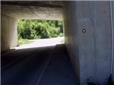 2
2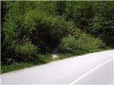 3
3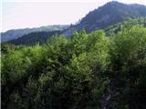 4
4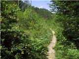 5
5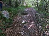 6
6 7
7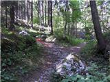 8
8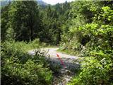 9
9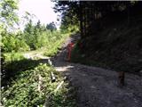 10
10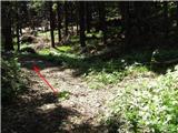 11
11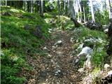 12
12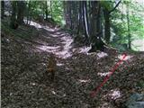 13
13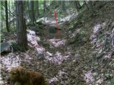 14
14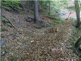 15
15 16
16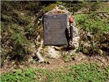 17
17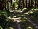 18
18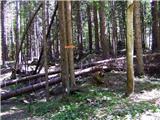 19
19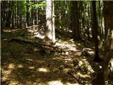 20
20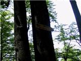 21
21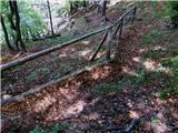 22
22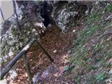 23
23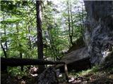 24
24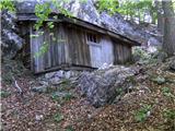 25
25
Discussion about the trip Podmežakla (Jesenice) - Partisan hospital on Mežakla (via Zakop)
|
| birch19. 05. 2009 |
best regards and thanks for the detailed descriptions 
|
|
|
To post a comment you must log in:
If you do not yet have a username, you must first
register.