Podmežakla (Jesenice) - Škrbina (Mežakla) (via Zakop)
Starting point: Podmežakla (Jesenice) (580 m)
Route name: via Zakop
Walking time: 1 h 40 min
Difficulty: easy marked way
Elevation gain: 630 m
Elevation difference along the route: 630 m
Map: TNP 1:50.000
Recommended equipment (summer):
Recommended equipment (winter): ice axe, crampons
Views: 26.474
 | 4 people like this post |
Access to starting point:
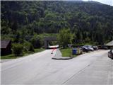
From the highway Ljubljana - Jesenice, we take the exit Lipce and drive right towards Jesenice (at the traffic light, left). Here in the center of the town we follow the signposts for Podmežakla. When we drive through the underpass, we turn right, and nearby we can notice the hockey hall. We drive another 350 m until before the highway underpass we notice the parking lot. Here is our starting point.
Route description:
From the parking lot, we head into the underpass, on whose right side we find the first blaze. When we step through it, we notice on the left side a path which leads from the road uphill (blaze on the asphalt). We step onto it, ascend a few meters and turn right (west) towards the power line. The path, which initially ascends only moderately but later more steeply, brings us after some time to a junction. Here we go left, even steeper uphill towards the south. Soon we reach a forest road, which through a right and left bend brings us to the branch-off of a cart track that steeply ascends to the right in the southeast direction. We head onto it and follow it for quite some time, meanwhile ignoring the right turn-offs of smaller shortcuts.
The winding path occasionally zigzags slightly towards the east. When we have passed the larger right bend, the blazes direct us onto a narrower path on the right. Now we are facing southwest. From here on, the path gradually ascends even more steeply towards the top on the left in larger or smaller zigzags. When we come below the rocks on the left, we are already near the top of the plateau; here we soon encounter a junction of marked trails, which means two variants are available.
The first is straight ahead (southwest direction); there soon, when the steepness eases, we reach Zakop, where we encounter a forest road, turn left and notice a monument and benches (smaller event space). The second option is left (southeast direction), steeply uphill towards the top of the plateau, where we encounter the same road, which leads us left towards the goal. Soon the road ends, and we continue on the path in the same direction, ignoring the left turn-offs of cart tracks. When the path finally ascends again, we reach the forest road a second time, which we cross (just before Škrbina). After a few meters we reach the edge of the plateau; here the path, which turns left near the precipitous edge, quickly brings us to the transmitter next to which stands a brown tin shed.

Along the route: Zakop (1150m)
Photos:
 1
1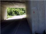 2
2 3
3 4
4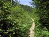 5
5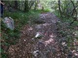 6
6 7
7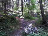 8
8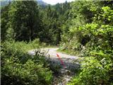 9
9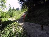 10
10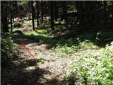 11
11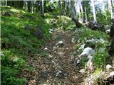 12
12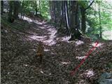 13
13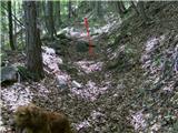 14
14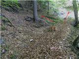 15
15 16
16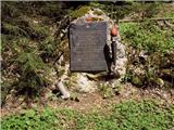 17
17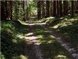 18
18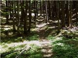 19
19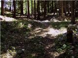 20
20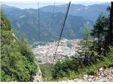 21
21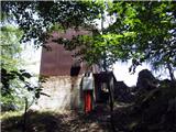 22
22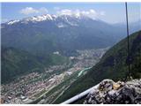 23
23
Discussion about the trip Podmežakla (Jesenice) - Škrbina (Mežakla) (via Zakop)
|
| heinz18. 05. 2009 |
To all Jesenice residents and those nearby! Anyone who hasn't yet been to the Mežakla transmitter on Škrbina should go there as soon as possible to see what beauty they're missing right nearby! The partisan hospital located not far away is also worth a visit.
|
|
|
|
| jprim19. 05. 2009 |
But isn't the trail marked, yet you've equipped it so well with rappels too.
Best regards!
|
|
|
|
| birch19. 05. 2009 |
I've already seen everything, the hospital, natural bridge and snow cave (approach from the other side.). Thanks to heinza I easily found the waterfalls on Dobršnik. Thanks heinza and LP
|
|
|
|
| FLEKSARCA21. 05. 2009 |
If anyone wants to treat themselves to a nice ramble around Mežakla, I recommend they get the POTEP PO MEŽAKLI map at TIC Jesenice (it's free by the way). The trail is really nicely described and I think suitable also for a family trip, even if the kids are a bit younger, provided they're used to hiking.
|
|
|
|
| heinz22. 05. 2009 |
If you happen to mean the so-called "Pohodniške poti po občini Jesenice" by Ragor, I wouldn't quite 100% agree on the "beautiful descriptions", apart from the map itself of course, an identical copy of which you can find earlier on Geopedia.si, where it was copied from. Otherwise we can check the TIC Jesenice main page and easily convince ourselves of the "wealth" of the descriptions found. Anyway, if it's something else, please let me know where to get those "beautiful" trail descriptions. Thanks!
|
|
|
|
| FLEKSARCA22. 05. 2009 |
Yes, I really mean that thing and I have to say that the map and description came in handy during my ramble. Of course, you shouldn't expect heaven knows what for zero euros. Maybe you should make such a map and offer it to us in printed form, I would take it right away, for free. And don't tell me now to copy your descriptions and pictures. Or go to the TIC and say "see how it's done, because that's how Heinz does it."
|
|
|
|
| heinz22. 05. 2009 |
Thanks! I'll get it, or - I already have it. But still, I wouldn't quite join such advertising.
(For myself, I don't do it either. We are on the Hribi.net portal, where anyone can post a trip that isn't listed here at the moment).
Just one more example to mention:
The TIC-mentioned ATTRACTION of the Jesenice municipality - the archaeological find Jamnikov spodmol, which is the "oldest evidence of human presence in our area" is, according to the description, "located on Kočni".
You or the TIC (if you two aren't one and the same (I hope I'm not flattering you)) can beat me with a more detailed description of the path to this famous find. Anyway, I'll be glad!
|
|
|
|
| FLEKSARCA22. 05. 2009 |
I'm not the TIC, but let me quickly end our little argument. Since you mention Jamnikov spodmol, I assume you've already made the effort and prepared a detailed path description for us, which I'm already looking forward to, because you know what they say "only Heinz knows how it's done." No hard feelings LP.
|
|
|
|
| heinz22. 05. 2009 |
I assume you're a local from Jesenice, keyholder from the steelworks - flex girl.
I apologize for the mistake regarding the ti-tic relation. 
(internet is really cool; we're no longer bored at all, right?)
|
|
|
|
| Parkeljc16. 09. 2009 |
Today my colleague and I conquered the summit via Zakop. It took us one hour to the top. Heinz, since you described the other path as very demanding pathless terrain, we preferred the Zakop path, although I admit I don't know what that means or where it is. To the top we crossed a well-maintained forest road three times(!!!!). Two were definitely not the same. For all those looking for the hospital, it's located to the left of the transmitter, facing the Karavanke. We went from the transmitter to the hospital along the ridge, there are markers, but until you reach the nicely made wooden fence you don't know where the path leads. For all Jesenice folks who haven't conquered Škrbina yet, don't be scared, the view is really phenomenal. This time I wasn't lucky to see the neighboring peaks due to low cloud cover (a few dozen meters above the transmitter), but in good weather I'll try again.
|
|
|
|
| heinz17. 09. 2009 |
Let me correct you a bit; the other path ("along the power line") is marked only as difficult and not very difficult pathless terrain.
Zakop (picture 17) is located near the junction of marked trails, where you go straight or right to reach it in 5 min. It is a small forest event space with a partisan monument. Next to it is a hardened forest road, which you also join if you choose the left direction at the junction.
The path leading to the partisan hospital is described on this portal.
The marked (I think slightly worse) path from the transmitter - along the ridge, or northern edge of the plateau, which also leads to the p. hospital, is the so-called path over Mežakla, which comes from planina Obranica, past Snežna jama, Planski vrh and the natural bridge to the transmitter and of course further to the mentioned hospital.
Yes, you cross the forest road 3x. Once at the bottom and twice near the goal.
1 hour = fast walking.
LP and good luck!
|
|
|
|
| Parkeljc3. 03. 2011 |
This afternoon I treated myself to this hike and from AC to the top it took 1 hour and 4 min, back exactly half! The path was somewhat muddy and frozen, now mainly fresh snow has fallen and covered the tracks a bit. Only the track of one or two people is somewhat more pronounced. In the lower part walking is more or less normal, in the steep section tracks go via shortcut and it's quite slippery. But it's so much nicer on the way back.
|
|
|
|
| Bojan_A5. 03. 2011 |
Today I ran this trail. To the top of the plateau 34 min, then I turned left and ran east for another 15 min or so, then the path ended in the middle of the forest. So I don't even know where I was.
Never mind, snow conditions were excellent for running. Especially downhill, as you could go full speed without worrying about twisting an ankle.
Otherwise, (too) short a trip.
|
|
|
|
| heinz5. 03. 2011 |
For running to the transmitter it's probably really too short, but there is the option to run or walk all the way to Jerebikovec near Mojstrana.. Take a map and find the path. To there it's still quite some elevation and kilometers. I myself went to Kisovec and Petelin. Otherwise, mountain bikers quite like Mežakla.
Best regards! H
|
|
|
|
| Bojan_A5. 03. 2011 |
Well, judging by the map and description, I think I was on Planski vrh. Well, there wasn't time for much more anyway, since I was tied to transport.
|
|
|
|
| ploha22. 05. 2011 |
Was at the top today, view of Jesenice and Karavanke phenomenal, otherwise a great morning or afternoon hike for building fitness, especially if you don't have far to the starting point
|
|
|
|
| vpekla17. 08. 2012 |
At the beginning of the path to Škrbina I found glasses with prescription on a cord.
|
|
|
|
| Darxta13. 07. 2013 |
Heinz, great description!
Today I went up, the markers might be a bit faded, but still no problem finding them. In places the path is a bit overgrown with low vegetation, obviously not much traffic on this path
The view is  (in a positive sense) (in a positive sense)
|
|
|
|
| heinz27. 04. 2018 |
The trail in the middle section has been significantly altered due to timber hauling and consequently poorly marked. Attention is needed at numerous logging road junctions. The situation at the top is (for now) still the same.
Best regards! heinz
|
|
|
|
| marjanb21. 10. 2018 |
The path is now exemplarily marked, especially to Zakop, and also further to Škrbina.
|
|
|
|
| Jusk21. 10. 2019 |
Today I also went along this trail to the transmitter on Škrbina, 5 days ago I was up here from Spodnje Gorice past Obranca. Didn't meet anyone on the trail, obviously few visitors, only three new entries in the book in these 5 days. But some caution is needed, the upper part of the trail was damp and slippery.. view from the top super
|
|
|
|
| Jusk27. 11. 2019 |
Today the path was wet and slippery, weather foggy, no views, just fog in all directions.. along the path here and there some snowdrops are blooming at the top there is no logbook in the box..
|
|
|
|
| Jusk31. 12. 2019 |
For the last day of this year I choose Mežakla, path without peculiarities, at the top there is a new logbook in the box, snowdrops are still blooming along the path as I wrote a month ago nice last day of the year
|
|
|
|
| Jusk7. 03. 2020 |
At the beginning the trail is fine, here and there a patch of snow, with altitude it gets more, from Zakop to the transmitter at Škrbina there's about 25cm.. and it was quite wet and heavy snow, nice for warming up further towards Planski vrh no track yet. And no logbook again still nice at the top, as always still nice at the top, as always
|
|
|
|
| Jusk31. 03. 2020 |
Today on this trail.. in the valley the poor 3cm of snow melted already during the day, in the afternoon I head towards Škrbina.. trail okay, muddy in the middle section, then more and more snow. From Zakop to Škrbina 20-25cm snow, nice for trudging otherwise winter idyllnice views, nonstop snow showers over Karavanke, one caught me on the way back.. didn't meet anyone on the whole trail Regards
|
|
|
|
| Jusk6. 04. 2020 |
Today completely different picture than last Tuesday, trail dry, only at Zakop around 3-4cm snow.. further along the ridge dry again all the way to Škrbina. Further towards Planski vrh some cm snow, trail trodden.. went to the natural bridge and to the junction of the trail to Snežna jama and Obranci, then back down.. further from that junction is "no go" zone for us Jesenice people Regards and stay healthy
|
|
|
|
| Jusk11. 04. 2020 |
Since we still can't leave the municipalities for now, I went to Mežakla again today, almost no snow left, here and there a small patch of snow on Planski vrh.. path mostly dry.. the difference that is really noticeable these last days is that many more people are visiting the otherwise more solitary Mežakla but everyone is respecting the meeting rules and distance lp
|
|
|
|
| Jusk2. 06. 2020 |
After a long time back on Mežakla, the view is as always super but again lots of logging, the logging track we ascend in the middle part of the trail has been considerably extended, approximately to the point in picture 15
|
|
|
|
| Jusk5. 08. 2020 |
Mežakla was on the schedule again, the weather finally improved today because the lower path is very overgrown I go along the path past the landfill through Mala Mežakla and further up the marked path, a bit further along the new logging trail which avoids another overgrown section of the path.. Mežakla is full of ticks, so it's really smart to avoid the overgrown parts of the path.. at the top pleasantly cool, a rather cold wind was blowing, the view as always superb
|
|
|
|
| Jusk10. 11. 2020 |
since today was such a foggy day and I craved to see a bit of sun I headed up here, but at Škrbina it was still foggy, though a bit of sun was already peeking through the fog, so I continued to Planski vrh, there crazy view, blue sky and sea of fog below through the forest very foggy, from mala Mežakla almost to the top visibility about 20 meters, fog like in some horror movie
|
|
|
|
| orchigu5. 07. 2022 21:16:43 |
Nice variant with really good views, partisan hospital (which you won't miss on this path, as it's separately marked), and past the monument, nice little forest at the top... but there's quite a lot of leaves on the ground even now, so caution (and maybe poles) are still not superfluous. And you can pick up ticks nicely along the path, so check yourselves down there
|
|
|
|
| babica 511. 10. 2024 07:07:20 |
How do I get to the starting point - the parking lot in the 1st photo, if I arrive in Jesenice by train?
|
|
|
|
| heinz11. 10. 2024 07:26:04 |
babica 5: simply go towards the Podmežakla ice hockey hall (through the underpass which is about 250 m from the railway station in the direction of Kr.Gora). From the hall onwards according to the access description to the starting point..
|
|
|
To post a comment you must log in:
If you do not yet have a username, you must first
register.