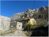
Starting point: Podpeč (312 m)
| Latitude/Longitude: | 45,52130°N 13,90840°E |
| |
Walking time: 25 min
Difficulty: partly demanding marked way
Elevation gain: 137 m
Elevation difference along the route: 137 m
Map: Slovenska Istra - Čičarija, Brkini in Kras 1:50.000
Recommended equipment (summer): helmet
Recommended equipment (winter): helmet
Views: 9.478
 | 1 person like this post |
Access to starting point:
From the Ljubljana - Koper highway, take the Črni Kal exit. From Črni Kal, continue driving on the old road towards the coast, but drive on it only to the next somewhat larger intersection, where we turn left in the direction of the Sočerga border crossing. We drive for a short time on the mentioned road, then signs for Predloka, Loka, Bezovica, Podpeč, Zanigrad, Zazid and Rakitovec direct us left onto a somewhat narrower local road. Further we drive to Bezovica, where at the smaller intersection in the middle of the village we continue left in the direction of Podpeč. Because there are no appropriate parking spots in Podpeč, we can park at an appropriate place by the road before or after the village (this extends the path for 5 to 15 minutes).
Route description:
We will find the beginning of the path just before the sign that marks the end of Podpeč. Here the blazes direct us left into the forest, through which we begin to ascend steeply. The steep path soon flattens temporarily and turns to the left, where it crosses fairly steep and slippery-dangerous slopes. At the end of the crossing, the path turns to the right and with the help of a chain barrier steeply ascends towards the defensive tower from the 11th century. The tower, which is usually closed, we bypass on the right side and continue ascending on a somewhat less steep slope. After a few minutes of walking from the tower, the path flattens and brings us to expansive karst meadows above the steep step of Kraški rob. Here we continue left and ascend along the edge of the cliffs to the indistinct but very panoramic Zjat.
Along the route: Obrambni stolp nad Podpečjo (385m)
Photos:
 1
1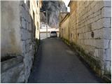 2
2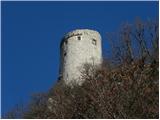 3
3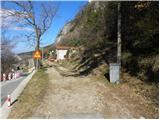 4
4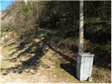 5
5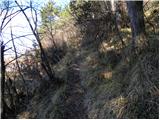 6
6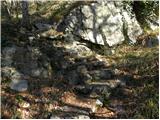 7
7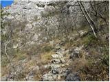 8
8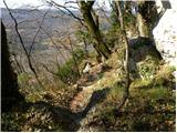 9
9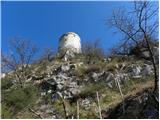 10
10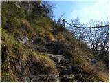 11
11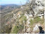 12
12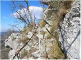 13
13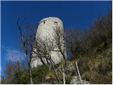 14
14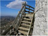 15
15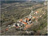 16
16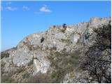 17
17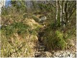 18
18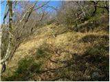 19
19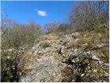 20
20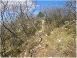 21
21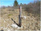 22
22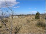 23
23 24
24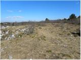 25
25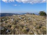 26
26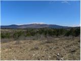 27
27
Discussion about the trip Podpeč - Zjat
|
| Kigeot18. 11. 2014 |
The path is not demanding, the steps are secured with a chain. Shame, because the wooden steps at the tower are broken and you can't climb closer/higher.
When you reach the top at the cliff edge, there are marks, but the junction is not marked. Left is the marked path along the edge, right is the less marked P2 footpath with yellow marks towards Brežec and further to Zazid.
|
|
|
|
| di19. 02. 2023 11:13:31 |
Above the neighboring village of Zazid is also located the peak Zjat.
|
|
|
To post a comment you must log in:
If you do not yet have a username, you must first
register.