Podrožca / Rosenbach - Kamnica (Komnica) / Ferlacher Spitze
Starting point: Podrožca / Rosenbach (630 m)
| Latitude/Longitude: | 46,52200°N 14,02900°E |
| |
Walking time: 3 h 55 min
Difficulty: easy marked way
Elevation gain: 1112 m
Elevation difference along the route: 1130 m
Map:
Recommended equipment (summer): helmet
Recommended equipment (winter): helmet, ice axe, crampons
Views: 525
 | 1 person like this post |
Access to starting point:
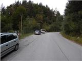
Through the Karawanks Tunnel, we drive to Austria, and then we drive on the highway towards Beljak, which we leave on the first exit. From the point where we left the highway, we follow the signs for Šentjakob v Rožu / Sankt Jakob im Rosental. When we get to the mentioned settlement, we leave the main road and continue driving right in the direction of the settlement Podrožca / Rosenbach. After a few kilometers of additional driving, we get near the railway station in Podrožca, where we continue left downwards, and then at the next crossroad right in the direction of the valley Medji Dol / Bärental. Further, we drive on a somewhat narrower asphalt road, which we follow to the first crossroad, by which we notice hiking signposts. We park at an appropriate place by the road.
From the toll station at Hrušica to the starting point, it is approximately 23 km.
Route description:
From the starting point, we continue on the right road in the direction of Koča Berta / Bertahütte and Kepa / Mittagskogel (straight Koča na Golici, Dovška Baba...), where we go through a few underpasses. After the railway and highway underpass, where at the crossroads we follow the blazes, the road brings us into the torrent valley Gračenica / Gratschenichengraben, where because of quite crumbly slopes, mainly during and after rain, there is a considerably increased possibility of falling stones (high risk of falling stones also exists during the time when snow is melting, and even in nice weather the path is not without danger). We walk for approximately one hour through the mentioned gorge, and then the valley widens, and the path brings us to a marked junction, where temporarily we leave the macadam road.
We continue straight in the direction of Kepa (right Bleščeča planina / Rossalm) and for some time we walk by the torrent, where a few times we also cross the stream Gračenica / Gratschenitzengraben (during high waters it is safer to continue on the road, as the marked path can be impassable). After approximately 20 minutes we return to the road, along which then in numerous serpentines we mostly moderately ascend. With occasional views, mainly towards Kepa, after approximately three hours of walking we arrive at the mountain pasture Borovščica / Ferlacher Alm.
This is followed by a few minutes of gentle ascent and we arrive at the marked junction on the saddle Borovščica / Ferlacher Sattel, which is located between Kepa on the left and Kamnica / Ferlacher Spitze on the right.
Here we go right in the direction of Koča Berta (left Kepa), to which we arrive after 5 minutes of further walking.
From the hut we go slightly right in the direction of Kamnica and quite quickly we start to ascend quite steeply, mostly through the forest. Higher the path temporarily flattens, then becomes steep again, and occasionally some views open up on Kepa and the Julian Alps. A little below the summit the path flattens once more, or even descends for a few steps, and then we quickly arrive at the panoramic summit.
Starting point - Koča Berta 3:15, Koča Berta - Kamnica 0:40.
Description and pictures refer to the condition in 2018 (August).

Photos:
 1
1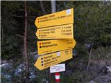 2
2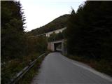 3
3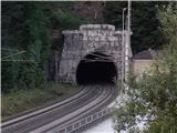 4
4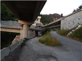 5
5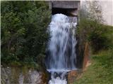 6
6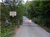 7
7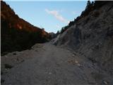 8
8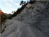 9
9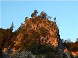 10
10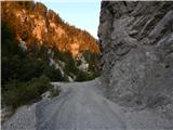 11
11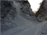 12
12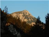 13
13 14
14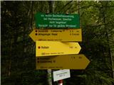 15
15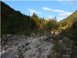 16
16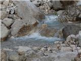 17
17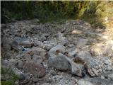 18
18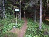 19
19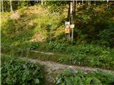 20
20 21
21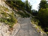 22
22 23
23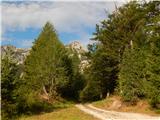 24
24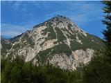 25
25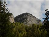 26
26 27
27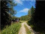 28
28 29
29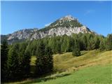 30
30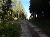 31
31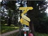 32
32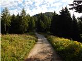 33
33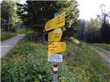 34
34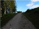 35
35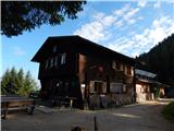 36
36 37
37 38
38 39
39 40
40 41
41 42
42 43
43 44
44 45
45 46
46 47
47 48
48 49
49
Discussion about the trip Podrožca / Rosenbach - Kamnica (Komnica) / Ferlacher Spitze
To post a comment you must log in:
If you do not yet have a username, you must first
register.