Podsreda - Veliki Špiček (through Osredek pri Podsredi)
Starting point: Podsreda (246 m)
| Latitude/Longitude: | 46,03999°N 15,58968°E |
| |
Route name: through Osredek pri Podsredi
Walking time: 2 h 45 min
Difficulty: easy marked way
Elevation gain: 440 m
Elevation difference along the route: 595 m
Map:
Recommended equipment (summer):
Recommended equipment (winter): ice axe, crampons
Views: 16
 | 0 people like this post |
Access to starting point:
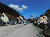
We drive to the center of the Podsreda settlement, where we park at one of the parking lots in the town center. We can also park on the outskirts of the settlement near the cemetery, sports field, or fire station.
Route description:
From the center of Podsreda, we follow the markings for Grad Podsreda, where after the NOB monument we carefully cross the main road, then continue along the side road that leads south. A gentle descent follows past a few houses, then the road forks, and we choose the slightly right road along which there are markings for Grad Podsreda (left Levstikov mlin).
A little further ahead, before the nearby house, we leave the road slightly to the right onto a cart track that climbs parallel to the road and transversely above the aforementioned house. On this section, a nice view opens towards Stara sveti gora from the path, and the path then enters the forest, where we follow the well-maintained Grajska pot. In the lower part of the path, it leads us over a few wooden bridges, followed by fairly frequent ascents on stairs. Higher up, the path, along which there are numerous information boards, levels out temporarily, then mostly continues on a cart track that ascends transversely through the forest to the left. When we are already quite close to the castle, we reach a small valley where the castle pond is located, a little further the path forks.
We continue straight (sharply right the path leads to Florjanova kapelica and from there further to Grad Podsreda or to Zavetišče v Pečicah) and then ascend along the fence to Grad Podsreda.
We bypass the castle on the right side, above the castle we reach an asphalt road and follow it left towards Veliki vrh and Svete gore.
We continue the ascent on the asphalt road, which takes us past two parking lots, then we ascend through the forest to a marked junction, where we continue right in the direction of Pišec, Bizeljski and Veliki vrh (left Svete gore).
A little further from the junction, we leave the forest, where on a larger meadow the road turns left and forks once more.
This time we choose the left road, along which Knafelčeve markings continue (straight Slovenska turno kolesarska pot) and which a little further returns to the forest. A transverse ascent through the forest follows; when the forest ends on the left, a view opens to the nearby Rigelj, the peak with antennas, and we quickly ascend to a marked junction, where the path from Zavetišče v Pečicah joins from the right, namely the path past the Švajger farmstead.
The path ahead leads with nice views along the pastures of the Pusti Vrh hamlet, then temporarily returns to the forest. When we leave the forest, with views of Veliki vrh, the highest peak of the Orlice range, we walk to a junction in the middle of the Preska hamlet, where we continue straight (left another path to Svete gore) to the one-minute distant turn-off to Veliki vrh.
We continue straight along the road (also possible right over Veliki vrh, but the path is somewhat longer and poorly marked in parts), which bypasses the Šulc farm on the left side, where the PPKB stamp (Planinska pot Krško - Brežice) is located.
We continue for a few minutes along the meadows, then the road enters the forest and gradually turns south, where we quickly reach the pass below Šulčev breg, where there is also a marked junction.
From the marked junction, we continue left onto the marked footpath in the direction of Velika bukva, Pišec and Bizeljski (sharply left forest road by which continuation to Svete gore is possible, slightly left forest road that continues parallel to our marked path, straight Kerinov spomenik, 1 minute). The path ahead leads through the forest with some shorter ascents and descents; it initially runs right of the road, later crosses it and continues for some time left of the road, then for a while on it. When we reach a sort of pass, we leave the road and continue left onto the marked path, which ascends gently, a little further moderately, through the forest. Higher up, the path brings us near the highest point of the Intermedija peak, where we go left and reach the summit of Intermedija in a few steps.
We continue along the marked path, which begins to descend through the forest; a few minutes lower, we return to the road, along which we continue in a gentle ascent to Bivak Lovske družine Pišece.
Behind the bivouac, we go slightly left from the forest road onto the path marked for Veliki Špiček. The path ahead begins to ascend transversely along the northwestern slopes of the nearby Veliki vrh; when higher we reach the ridge, we go left in the direction of Veliki Špiček, to whose summit we arrive after two minutes of further walking.
Podsreda - Grad Podsreda 0:40, Grad Podsreda - razpotje za Gradom Podsreda 0:10, razpotje za Gradom Podsreda - razpotje na Marofu 0:05, razpotje na Marofu - Pusti Vrh 0:20, Pusti Vrh - Preska 0:15, Preska - Kerinov spomenik 0:20, Kerinov spomenik - Intermedija 0:30, Intermedija - Bivak Lovske družine Pišece 0:10, Bivak Lovske družine Pišece - Veliki Špiček 0:15.
Description and photos refer to the condition in March 2026.

Photos:
 1
1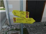 2
2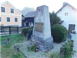 3
3 4
4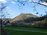 5
5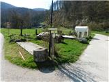 6
6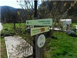 7
7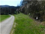 8
8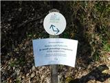 9
9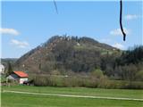 10
10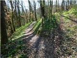 11
11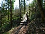 12
12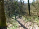 13
13 14
14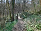 15
15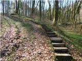 16
16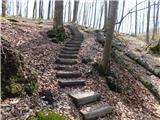 17
17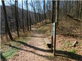 18
18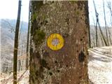 19
19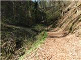 20
20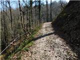 21
21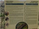 22
22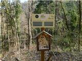 23
23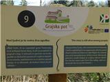 24
24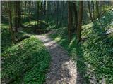 25
25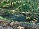 26
26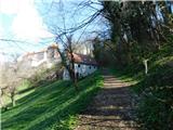 27
27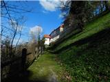 28
28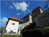 29
29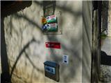 30
30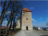 31
31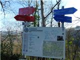 32
32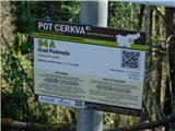 33
33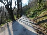 34
34 35
35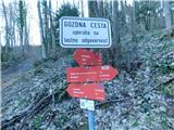 36
36 37
37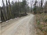 38
38 39
39 40
40 41
41 42
42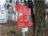 43
43 44
44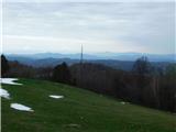 45
45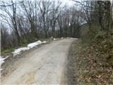 46
46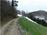 47
47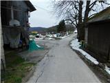 48
48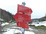 49
49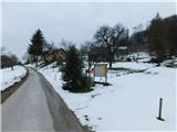 50
50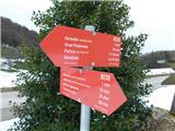 51
51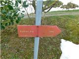 52
52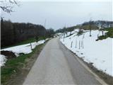 53
53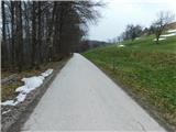 54
54 55
55 56
56 57
57 58
58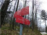 59
59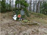 60
60 61
61 62
62 63
63 64
64 65
65 66
66 67
67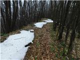 68
68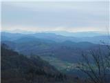 69
69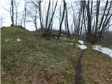 70
70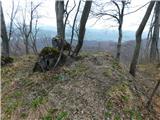 71
71 72
72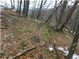 73
73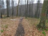 74
74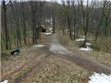 75
75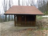 76
76 77
77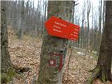 78
78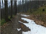 79
79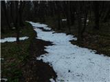 80
80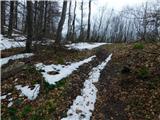 81
81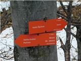 82
82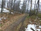 83
83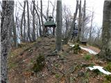 84
84 85
85
Discussion about the trip Podsreda - Veliki Špiček (through Osredek pri Podsredi)
To post a comment you must log in:
If you do not yet have a username, you must first
register.