Podtabor - Sveti Martin (Šilentabor)
Starting point: Podtabor (554 m)
| Latitude/Longitude: | 45,60230°N 14,22940°E |
| |
Walking time: 1 h 45 min
Difficulty: easy unmarked way
Elevation gain: 169 m
Elevation difference along the route: 230 m
Map: Snežnik 1:50.000
Recommended equipment (summer): helmet
Recommended equipment (winter): helmet
Views: 2.639
 | 1 person like this post |
Access to starting point:
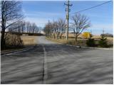
A) From the highway Ljubljana - Koper, we take the exit Postojna and follow the road ahead in the direction of Pivka, Reka and Ilirska Bistrica. In the settlement Pivka, we leave the main road which leads towards Ilirska Bistrica and continue driving towards Knežak. Just a little after Knežak, we arrive at the village Šembije, behind which we turn sharply right towards Podstenje and Podtabor. After a few 100 m of further driving, we arrive at the crossroads in Podtabor, which is the starting point for our tour. Since there are no suitable parking spots at the starting point, we must park somewhere nearby, in a suitable place by the road.
B) We drive to Ilirska Bistrica, then continue driving towards Knežak. Before we arrive at Šembije, we leave the main road and continue driving left towards the village Podtabor. At the beginning of Podtabor, we arrive at a crossroads of several roads, where we start our tour. Since there are no suitable parking spots at the starting point, we must park somewhere nearby, in a suitable place by the road.
Route description:
From the crossroad at the beginning of Podtabor, we follow the signs for Podtabor, and the road immediately brings us to the next crossroad. Here we continue on the left lower road (straight uphill Šembije), which leads us past a few houses. A little further ahead, the asphalt road turns left, but we leave it immediately after the sign indicating the elevation and continue right on the parallel macadam road, which quickly brings us below the steep cliffs of the nearby Brkinški rob. Initially a quite scenic path brings us to a tunnel, through which we continue on the macadam road. On the other side of the tunnel, the cliffs gradually turn into less steep slopes, and the path leads us further on a slightly ascending macadam road, which after 10 minutes of further walking brings us to a smaller crossroad. We continue slightly right and proceed through the forest, mostly gently ascending. After a while, the road brings us to another rocky section, after which it gradually begins to descend.
We continue on the road, which with occasional views towards the west brings us to a smaller crossroad, where a road towards Ratečevo Brdo branches off to the left, and a footpath towards the nearby cross at the saddle Klanec branches off to the right. We continue straight again, and the road brings us to another branch-off to the right towards the nearby cross and saddle Klanec. This time too we continue straight, and the path quickly brings us to the place where a marked path from Narina joins us from the left.
The path ahead leads us past a smaller spring, after which we arrive at a branch-off of a poorer cart track to the left (if we continue on the mentioned cart track, we will reach the former Roman road, which ends a few 100 m further on).
We continue straight and past yet another spring, within a few minutes of further walking we reach the church of St. Martin.

Photos:
 1
1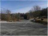 2
2 3
3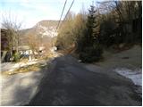 4
4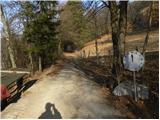 5
5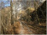 6
6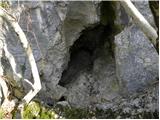 7
7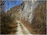 8
8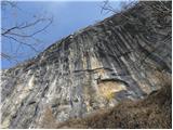 9
9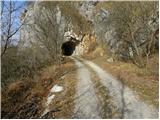 10
10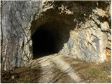 11
11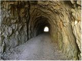 12
12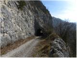 13
13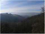 14
14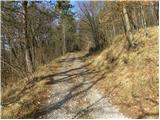 15
15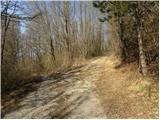 16
16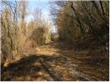 17
17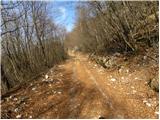 18
18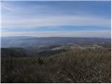 19
19 20
20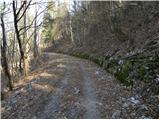 21
21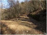 22
22 23
23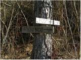 24
24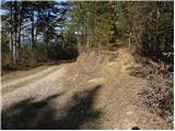 25
25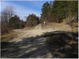 26
26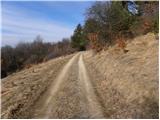 27
27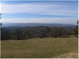 28
28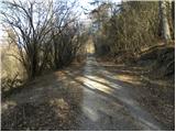 29
29 30
30 31
31 32
32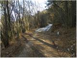 33
33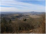 34
34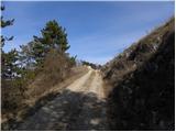 35
35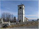 36
36
Discussion about the trip Podtabor - Sveti Martin (Šilentabor)
To post a comment you must log in:
If you do not yet have a username, you must first
register.