Poldov rovt (Vrata) - Šplevta (via Brinje)
Starting point: Poldov rovt (Vrata) (941 m)
| Latitude/Longitude: | 46,42160°N 13,86289°E |
| |
Route name: via Brinje
Walking time: 4 h 45 min
Difficulty: difficult unmarked way
Elevation gain: 1331 m
Elevation difference along the route: 1331 m
Map: Triglav 1 : 25.000
Recommended equipment (summer):
Recommended equipment (winter): ice axe, crampons
Views: 16.490
 | 2 people like this post |
Access to starting point:
We drive to Mojstrana, then follow the signs for the Vrata valley. We continue driving through the Vrata valley, about 100 meters before the 10 km road sign, and we will notice a cart track that branches off to the right perpendicular to the main road. This is the start of the described path. The marked parking lot where parking is allowed is located about 500 meters further along the main road.
Route description:
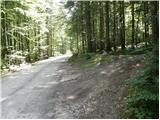
We head onto the cart track that leads into the forest and then past a smaller house, where we continue slightly to the left on a footpath. Through the forest, we ascend slightly to the left towards the Rdeči potok stream. A little before the stream we come to a junction, where we turn right onto the path over Brinje. At the junction there is a cairn, and on the tree there is carved some kind of face and the letter L. The path then begins to ascend steeply through the forest and then turns slightly to the right and slowly brings us to steep grassy slopes. In zigzags we then ascend for some time over steep slopes towards Brinova glava. At Brinova Glava (1571m) the path turns slightly to the left and the slopes become less steep again. Here a small path also branches off to the right leading to the summit of Brinova Glava. The path continues through increasingly sparse forest and occasionally we ascend a grassy slope. Such a path then brings us to the scree under the slopes of Kopic. Here we first ascend the scree, but when the path turns left onto a wide scree, it is better to continue on the grass on the right side of the scree. Soon our path will also turn left and cross the scree. Then we ascend for some time on grassy slopes on the left side of the scree. Towards the end the path turns somewhat towards Šplevta to the left side of the valley and then ascends the scree all the way to the saddle between Dovški Križ and Šplevta.
On the saddle we turn left and continue the ascent on pathless terrain, initially relatively steeply upwards. After a few minutes the steepness eases and the increasingly panoramic "path" brings us after a few more 10 steps to the summit of Šplevta.

Photos:
 1
1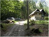 2
2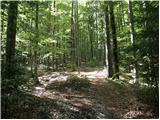 3
3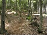 4
4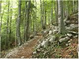 5
5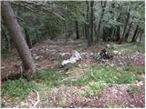 6
6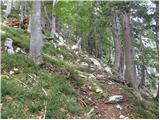 7
7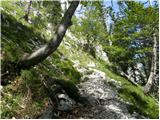 8
8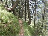 9
9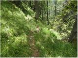 10
10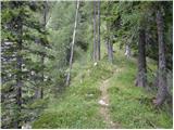 11
11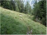 12
12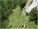 13
13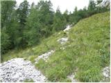 14
14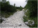 15
15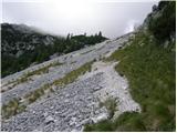 16
16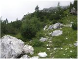 17
17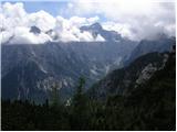 18
18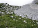 19
19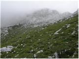 20
20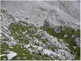 21
21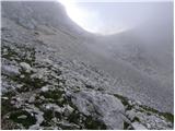 22
22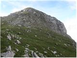 23
23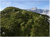 24
24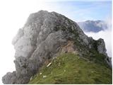 25
25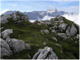 26
26
Discussion about the trip Poldov rovt (Vrata) - Šplevta (via Brinje)
|
| cassiopeia729. 06. 2010 |
Great trip. To the top it's nice to go via Brinje, because there are no scree slopes. For the return I recommend the path past the bivouac, because for the same reason the walking time can be shortened 
|
|
|
|
| katty13. 07. 2011 |
Today I'm looking a bit where I could go next week, if the weather is suitable for visiting the mountains.
Since I'm looking at more unknown peaks, I'm interested if the paths are sufficiently and properly marked. In our high mountains I've been negatively surprised several times, as the markings sometimes disappear.
Thanks for all the info.
And nice mountaineering greetings.
Katarina
|
|
|
|
| turbo13. 07. 2011 |
On this path except for cairns and more or less nicely traceable trail you definitely won't find markings. But it's really nice 
|
|
|
|
| JusAvgustin14. 07. 2011 |
that's why it's called an unmarked path...
yeah, it's really nice yeah, but there's still not much difference between Rdeči potok and čez Brinje, even Brinje isn't flat!
|
|
|
|
| turbo14. 07. 2011 |
Katty wrote: ....negatively surprised, as the markings got lost in places . . . . Katty, the best marking is the nose. The more you follow your nose, the better time you have. Well, not just the nose, some experience and a map don't hurt either 
|
|
|
|
| ločanka11. 11. 2015 |
Description is fine, walking time is exaggerated, I'd say by one hour, so actual time approx 3.45.
Otherwise interesting path and unique summit. You have Rokave, Oltarje, Kopice in front of you, admire them and no need to climb them. Visiting Šplevta is enough for admiration!
|
|
|
|
| katty12. 09. 2016 |
Yesterday finally the stamina-demanding Šplevta. The summit is a super viewpoint in the heart of the Julian Alps, one could write "the lowest among the most beautiful". Despite the strenuous, "straight up" 1300 meters of elevation gain, I would have continued the tour... still, I'm not fit enough stamina-wise to manage Dovški križ as well. Of course, that one will come too .
|
|
|
|
| damijanp17. 10. 2017 |
Sunday offered everything the mountains can offer in autumn. In short, wonderful nature and to top it off very pleasant company @majdag and her relatives.
Photos of the trip (up via Brinje, back past the bivouac) are at the link:
Šplevta
|
|
|
|
| gorska_kozica18. 10. 2017 |
I'd go to Šplevta, up via Brinje and down past the bivouac. I'm wondering how demanding it is to follow the trail, given that I don't know those ends of the Julijci and rarely move on pathless terrain?
Would orientation be easier if I also went to the summit past the bivouac?
|
|
|
|
| malimiha19. 10. 2017 |
We'll go on Saturday and let you know
|
|
|
|
| Majdag19. 10. 2017 |
gorska kozica.. Through Rdeči potok it's harder for me to follow. The scree is collapsing as described in the route descriptions and there are no proper tracks. Through Brinje the path is quite well traceable, except where it goes through grass it sometimes disappears. But you spot it a bit higher. In the upper part, where scree and rocky terrain alternate, you just have to reach the saddle. Then you're almost at Šplevta, safe steps.
|
|
|
|
| gorska_kozica20. 10. 2017 |
Majdag and damijanp, thanks!
malimiha, at your service. Keeping fingers crossed that the weather holds for you.
|
|
|
|
| bbugari14. 11. 2017 |
Today I was first on Šplevta. I drove alone by car from Pula and arrived at Poldov rovt at six. At the beginning I had trouble because there's an error in the introductory text that the cart track branches right "a bit further from the 10km road sign". In fact, the cart track branches a bit before that sign, so I started at seven. Five minutes after leaving the house there's also a branch to the left, marked with a cairn.
The path under Brinova glava and the summit of Brinova glava itself are gorgeous!!! Further the path through the grass becomes hard to follow, but in the sun it can be tracked with a lot of care. At the first smaller scree (intro picture 15) go up about 20 meters then left.
To me it seems better on the big scree (intro picture 16) to continue across it to the left because then the next cairn is easier to find which also directs from the scree to the left. Then keep to the left side of the big boulders to the well visible path that leads along the slopes of Šplevta. There were a few snow patches here, but nothing serious. Before the pass the path disappears, but on it a large cairn is clearly visible.
From the pass to the summit there's snow, but winter gear not needed. Views magnificent... I was at the summit in 2.50h.
Followed descent to Bivak II and continuation of descent to Vrata, which I describe under another topic. Sorry for the bad Slovenian...
|
|
|
To post a comment you must log in:
If you do not yet have a username, you must first
register.