Polharski dom Krim - Krim
Starting point: Polharski dom Krim (742 m)
| Latitude/Longitude: | 45,91220°N 14,43430°E |
| |
Walking time: 1 h 35 min
Difficulty: easy marked way
Elevation gain: 365 m
Elevation difference along the route: 375 m
Map: Ljubljana - okolica 1:50.000
Recommended equipment (summer):
Recommended equipment (winter):
Views: 39.884
 | 3 people like this post |
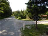
Access to starting point:
A) From the highway Ljubljana - Koper, we take the Brezovica exit, then continue driving in the direction of Podpeči (we can also reach Podpeči from Črna vas or Ig). In Podpeči, we continue in the direction of Borovnica, Krim and Rakitna, and continue driving for a short time along the edge of the Ljubljana Moor, then the signs for Rakitna direct us left onto a steep ascending road. The road then leads us through Preserje, where it also starts to descend. After a short descent, we continue left in the direction of Krim and Rakitna, and we follow the mostly ascending road to the spot where a road branches off to the right to the Polharski dom Krim, a few tens of meters distant (Polharski dom is located between the hunting cottage Plehanov laz and the turn-off to the road to Krim). We park in a suitable place near the hut.
B) First, we drive to Cerknica, then continue driving in the direction of Begunje; when we arrive in Begunje, we follow the signs for Rakitna. From Rakitna, we continue on the main road towards the settlement Preserje. Initially, the road ascends to a smaller saddle, then brings us to the spot where a road towards Krim branches off to the right. Here we continue straight, then soon reach a left bend where a second macadam road branches off to the right. About 100 m further on the right, we notice a smaller parking lot with a bench and table, where we can already park or drive a few tens of meters further, where we turn left towards Polharski dom Krim.
Route description:
From Polharski dom Krim we return to the main road and start ascending along it. The path soon brings us to a smaller parking lot with a bench and table; the road quickly ascends to a right bend, where a forest road branches off to the left, along which we continue. Some 10 m ahead, the forest temporarily ends and the path brings us to a larger meadow, where on the right we notice an apiary. On the other side of the meadow, the road splits into two parts, and we continue on the left road (the right road ends after a few meters at some sort of park). We continue on the road, which barely noticeably ascends through the forest; it gradually passes from the plateau terrain to the slopes of Srednji hrib (836 m), where only temporarily some views open up. When the road completely flattens, we arrive at a somewhat larger crossroads, where we continue straight (the right ascending road leads towards Brancljeva senožet) along the lower road, which even slightly descends further on. A few minutes further, we arrive at the spot where the road crosses the marked path or cart track that leads from the hunting cottage Plehanov laz towards Krim.
At the mentioned spot, we leave the road and continue the ascent to the right along the marked cart track. The cart track further mostly moderately ascends, and during the ascent it leads us past some spots where it crosses some of the numerous tracks. All the time we follow the blazes, then the forest path further brings us to the road that leads towards the summit of Krim. We only cross the mentioned road and continue the ascent on the cart track, which starts to ascend transversely towards the indistinct saddle between Krim on the left and the secondary peak Malinovec on the right. Here the marked path turns left and after further moderate ascent brings us to the fence of the military area, along which we walk to the road. When we step onto the road, only a minute of ascent separates us from the summit.

Photos:
 1
1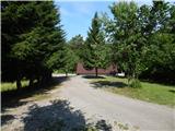 2
2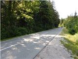 3
3 4
4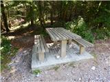 5
5 6
6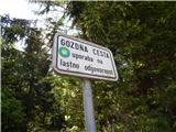 7
7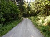 8
8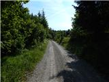 9
9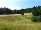 10
10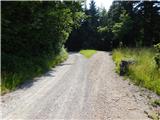 11
11 12
12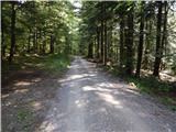 13
13 14
14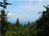 15
15 16
16 17
17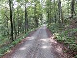 18
18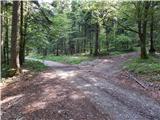 19
19 20
20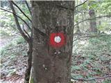 21
21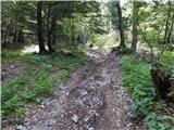 22
22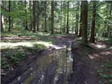 23
23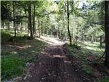 24
24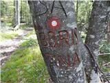 25
25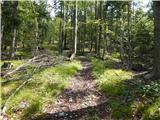 26
26 27
27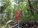 28
28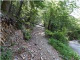 29
29 30
30 31
31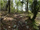 32
32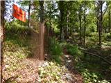 33
33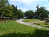 34
34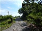 35
35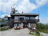 36
36 37
37
Discussion about the trip Polharski dom Krim - Krim
|
| jani bele16. 08. 2018 |
The gate on the fifth picture is already broken. At the start of the gravel road there are no markers, so carefully read the above description.
|
|
|
|
| Mikens23. 06. 2019 |
IMPORTANT!
I ask all hikers to keep their dogs on a leash! (bear area.)
Best hunting regards.
Klement Mal, LD Tomišelj
|
|
|
To post a comment you must log in:
If you do not yet have a username, you must first
register.