Polhov Gradec (Blagajev grad) - Sveti Jurij (Praproče)
Starting point: Polhov Gradec (Blagajev grad) (377 m)
| Latitude/Longitude: | 46,06790°N 14,31370°E |
| |
Walking time: 45 min
Difficulty: easy marked way
Elevation gain: 175 m
Elevation difference along the route: 200 m
Map: Ljubljana - okolica 1:50.000
Recommended equipment (summer):
Recommended equipment (winter):
Views: 1.350
 | 2 people like this post |
Access to starting point:
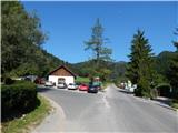
A) From Dobrova, Horjul or Gorenja vas we drive to Polhov Gradec; there from the main crossroad we continue in the direction of Črni Vrh. After a short ascent we arrive at the Polhov Gradec manor, where the road leads us through the enclosure; then behind the enclosure we turn left and park at a suitable place by the road, where there are also hiking signposts (a smaller parking lot is also before the enclosure of the Polhov Gradec manor).
B) From Črni Vrh we descend to Polhov Gradec; there before the enclosure we turn right and park at a suitable place by the road.
Route description:
From the starting point, we continue on a narrower asphalt road in the direction of the ski jumps (right Beekeepers' Home and Sveti Lovrenc), which leads us along the edge of the nicely arranged castle park. After a few minutes we arrive at a marked junction, where the path to Sveti Lovrenc (Polhograjska gora) branches off to the right - the path past the castle water intake - and we continue straight ahead, still on the asphalt road. Some 10 steps further, at the smaller crossroad we continue right, then we walk past a few more houses, behind which the asphalt slowly ends. The macadam road then ascends across panoramic slopes, from which a nice view opens up onto Polhov Gradec and the surrounding hills; a little further we arrive at a smaller crossroad, where we continue along the lower road (right Sveti Lovrenc).
After the crossroad, the road enters the forest and then crosses the stream Ilov graben. After the stream the road ascends more steeply, then brings us out of the forest, where it leads us past a religious symbol (cross), next to which there are a bench and a table. A shorter descent follows, then we arrive at the first houses in Praproče, where we step onto asphalt again. After a few houses, at the stop sign we continue right, then a few steps further, at the crossing of the torrent we go left on the asphalt road (straight ahead marked path to Sveti Lovrenc). On the asphalt road we ascend past a chapel located on a panoramic knoll; behind the chapel we gradually begin to ascend to the central part of Praproče, where yet another path to Sveti Lovrenc branches off to the right.
We continue straight, then past another small chapel we arrive at a smaller crossroad located just a few steps before the marked junction. At the mentioned crossroad we continue left downhill and walk through the yard of the nearby house to the church of St. Jurij.
Description and pictures refer to the condition in 2015 (September).

Photos:
 1
1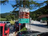 2
2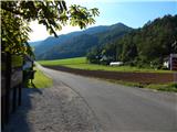 3
3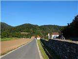 4
4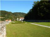 5
5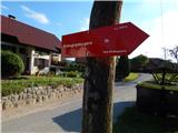 6
6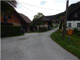 7
7 8
8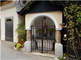 9
9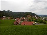 10
10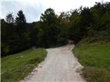 11
11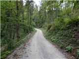 12
12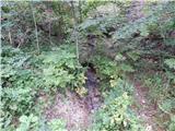 13
13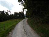 14
14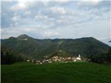 15
15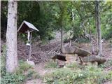 16
16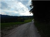 17
17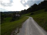 18
18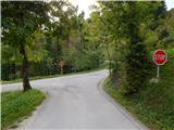 19
19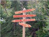 20
20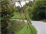 21
21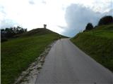 22
22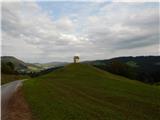 23
23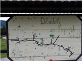 24
24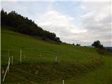 25
25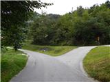 26
26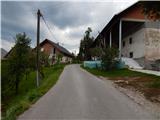 27
27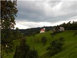 28
28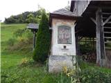 29
29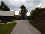 30
30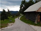 31
31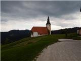 32
32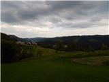 33
33
Discussion about the trip Polhov Gradec (Blagajev grad) - Sveti Jurij (Praproče)
To post a comment you must log in:
If you do not yet have a username, you must first
register.