Polhov Gradec - Tošč (via Grmada)
Starting point: Polhov Gradec (400 m)
| Latitude/Longitude: | 46,07590°N 14,31300°E |
| |
Route name: via Grmada
Walking time: 2 h 30 min
Difficulty: easy marked way
Elevation gain: 621 m
Elevation difference along the route: 750 m
Map: Ljubljana - okolica 1:50.000
Recommended equipment (summer):
Recommended equipment (winter): ice axe, crampons
Views: 38.992
 | 5 people like this post |
Access to starting point:
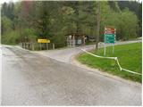
From Horjul or Dobrova we drive to Polhov Gradec, and then we continue driving towards Črni vrh. Right at the spot where we notice the sign for the end of Polhov Gradec, we continue right in the direction of Mačkov graben and the church of St. Ursula. Only a little after the crossroad we park on one of the parking lots by the road.
Route description:
From the starting point, we continue on the asphalt road which soon brings us to a crossroad, where we continue right in the direction of Setnica (straight Mačkov graben). We continue the ascent on a somewhat steeper road which after a few minutes of walking brings us to the spot where we leave it. The blazes point us slightly to the left on a footpath which starts to ascend steeper through the forest. After a few minutes of additional walking, we step out of the forest and the path brings us to the open-door farm.
We continue on the marked path, which past the houses brings us to a poorly marked crossing of cart tracks (or poorer roads).
We continue slightly right on the cart track that starts to ascend slightly and goes into the forest already after a few steps. Soon after we step into the forest, the mountain markings for Grmada direct us left on a footpath which starts to ascend steeply, first through the forest, then over increasingly panoramic grassy slopes. Higher the path brings us to the forepeak of Grmada, where another path from Polhov Gradec (via Ravnek) joins from the right.
The path ahead first descends, then transitions to an undulating ridge along which it continues with some shorter ascents and descents. The path then leaves the ridge and turns somewhat to the right, where it starts to ascend steeper again. We follow this path, to which paths from Belica and Topola also join, to the panoramic summit.
From Grmada we continue on the marked path in the direction of the tourist farm Gonte and Tošč. The path immediately starts steeply descending through the forest, aided by some fixed safety gear (undemanding). The path then flattens, and in the next few minutes of walking we arrive at the tourist farm Gonte, where there is a marked junction.
We continue on the gentle and wide cart track in the direction of Tošč. The marked path somewhat higher leaves the cart track and then starts to ascend steeper. The path, which almost entirely runs through the forest, brings us higher to the summit of Mali Tošč (902 m), from which the path starts descending toward the saddle between the two peaks.
Further, the path from Govejka joins from the right, and we continue straight on the path which ascends toward the summit of Tošč. After approximately 15 minutes of additional walking, the path brings us to the pleasant summit.
Polhov Gradec - Setnica, Setnica - Grmada 45 minutes, Grmada - Tošč 1:00.

Photos:
 1
1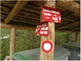 2
2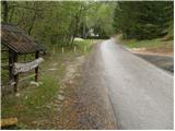 3
3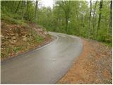 4
4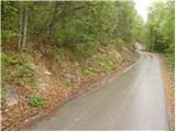 5
5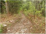 6
6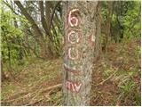 7
7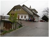 8
8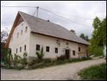 9
9 10
10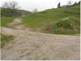 11
11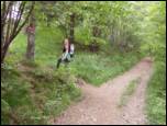 12
12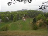 13
13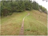 14
14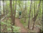 15
15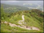 16
16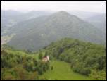 17
17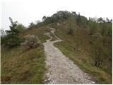 18
18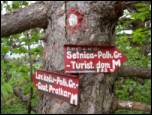 19
19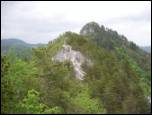 20
20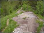 21
21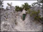 22
22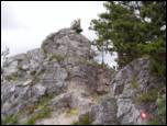 23
23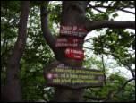 24
24 25
25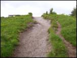 26
26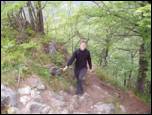 27
27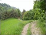 28
28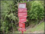 29
29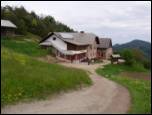 30
30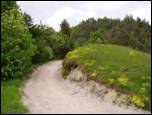 31
31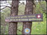 32
32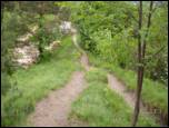 33
33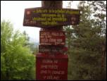 34
34 35
35
Discussion about the trip Polhov Gradec - Tošč (via Grmada)
To post a comment you must log in:
If you do not yet have a username, you must first
register.