Starting point: Poljana (620 m)
| Latitude/Longitude: | 46,40720°N 14,14610°E |
| |
Walking time: 1 h 15 min
Difficulty: easy unmarked way
Elevation gain: 455 m
Elevation difference along the route: 455 m
Map: Karavanke - osrednji del 1 : 50.000
Recommended equipment (summer):
Recommended equipment (winter): ice axe, crampons
Views: 10.470
 | 3 people like this post |
Access to starting point:
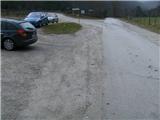
From the highway Ljubljana - Jesenice we go to the exit Lesce, where at the roundabout, we go on the old road in the direction of Žirovnica and Jesenice. After a few km of driving, we drive past a crossroad, where the road branches off to the right to Žirovnica. When we drive past the viaduct Završnica, we notice on the right side a turn off, on which we go (we turn sharply right). Immediately we run into a smaller crossroad, where we go left, and at the next (after approx. 50 m) right, in the direction of Završnica. After a short descent, the road for some time ascends a little, after that flattens, and it brings us to the spot, where the macadam branches off to the left towards the mountain hut Valvasorjev dom. Here, we park nearby.
Route description:
From the parking lot, we go on a macadam road which leads to the left towards the mountain hut Valvasorjev dom, and we follow it for a good 5 minutes, whereupon on the left side of the road, we get to a gate of a grazing fence, which the marked path on this spot crosses. So we go left through the pasture, where we soon cross the stream Rečica, and we continue towards the west through a meadow into the forest. Here the cart track at first for a short time quite steeply ascends, and when it flattens, we get to a signpost which points right on a somewhat narrower sandy path, which soon turns left towards the north. The path again widens and takes on the appearance of an old, hardened, rocky cart track. After approx. 45 minutes of walking, it brings us to the road, on which we continue left, in the direction of Potoška planina (signpost) for a further 5 minutes. When we get to a slightly bigger right turn, on both sides of the road, we notice two smaller yellow signs "pozor energetski kabel" (caution electric cable). Here, on the left we look for a forest footpath, we leave the road, and we descend a little on the path to a wide ridge, on which we quickly come below the peak of Smolnik. A few steps of ascent follow to an open grassy peak, where on a sunny spot there are two bigger benches.

Photos:
 1
1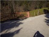 2
2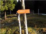 3
3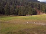 4
4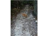 5
5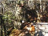 6
6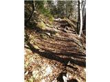 7
7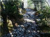 8
8 9
9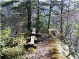 10
10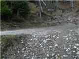 11
11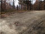 12
12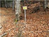 13
13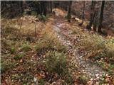 14
14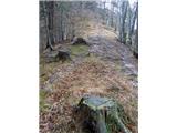 15
15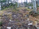 16
16 17
17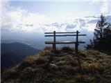 18
18 19
19 20
20
Discussion about the trip Poljana - Smolnik
To post a comment you must log in:
If you do not yet have a username, you must first
register.