Poljana - Smolnik (steep path)
Starting point: Poljana (620 m)
| Latitude/Longitude: | 46,40720°N 14,14610°E |
| |
Route name: steep path
Walking time: 1 h
Difficulty: easy unmarked way
Elevation gain: 455 m
Elevation difference along the route: 455 m
Map: Karavanke - osrednji del 1 : 50.000
Recommended equipment (summer):
Recommended equipment (winter): ice axe, crampons
Views: 14.252
 | 4 people like this post |
Access to starting point:
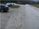
From the Ljubljana - Jesenice highway we take the Lesce exit, where at the roundabout we head onto the old road in the direction of Žirovnica and Jesenice. After a few km of driving, we drive past an intersection, where the road to Žirovnica branches off to the right. When we drive past the Završnica viaduct, we notice on the right side a turn-off, onto which we go (turning sharply right). Immediately we encounter a smaller intersection, where we go left, and at the next (after approx. 50 m) right, in the direction of Završnica. After a short descent, the road ascends slightly for some time, then flattens, and brings us to the spot where the macadam branches off to the left towards Valvasorjev dom. Here, we park nearby. (New parking lot is located next to the accumulation lake on the right side of the road).
Route description:
From the starting point, we go on the macadam road which leads left uphill towards Valvasorjev dom, and follow it for a good 5 minutes, after which on the left side of the road we come to a gate (barrier) of the grazing fence, whose crossing is indicated by signs Valvasorjev dom. We leave the road and head left across the pasture, where the path soon crosses the Rečica stream. When on the other side of the stream we step onto the meadow, we turn right (straight marked path) across the pasture into a small valley towards the northwest. Soon we cross the grazing fence (if it is in place), and come to a trodden path in the forest, which turns slightly left. The path, which becomes gravelly, starts to ascend more steeply through occasionally sparse forest. After a while our path crosses a wider cart-track-like marked path Poljana - Valvasorjev dom, after which it turns slightly right onto the forested ridge, where it begins to ascend ever more steeply. Pleasant, occasionally scenic path overgrown with roots, which leads us uphill towards the north, sometimes flattening out completely and then ascending again. When the gradient eases for the third time, the last and steepest part of the ascent awaits (when descending in wet conditions or snow there is a risk of slipping). The path brings us just below the summit from the steep forested slope onto open ground, where near the precipitous edge we climb just a few more steps to the summit of Smolnik, where there are two benches and a nice view into the valley.

Photos:
 1
1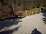 2
2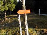 3
3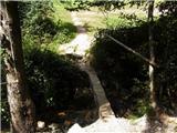 4
4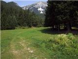 5
5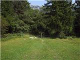 6
6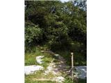 7
7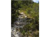 8
8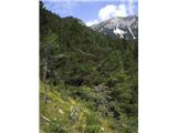 9
9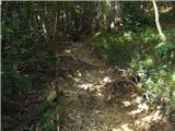 10
10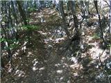 11
11 12
12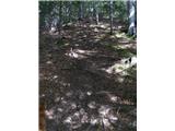 13
13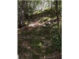 14
14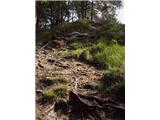 15
15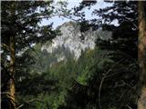 16
16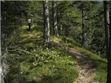 17
17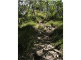 18
18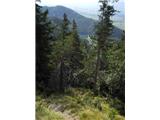 19
19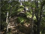 20
20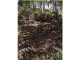 21
21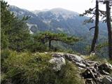 22
22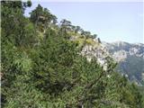 23
23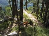 24
24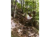 25
25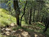 26
26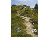 27
27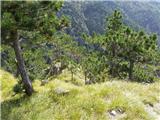 28
28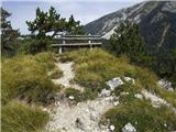 29
29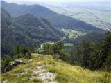 30
30
Discussion about the trip Poljana - Smolnik (steep path)
|
| ločanka14. 12. 2014 |
How to continue towards Ajdna?
|
|
|
|
| Majdag14. 12. 2014 |
....Descent on the other side, there are photos on the forum, to the forest road and left towards Potoška planina. In about 15 minutes you'll be at the junction for Ajdna. There are signposts on the right side and left on the tree. Then you're almost at the goal, čav there are photos on the forum, to the forest road and left towards Potoška planina. In about 15 minutes you'll be at the junction for Ajdna. There are signposts on the right side and left on the tree. Then you're almost at the goal, čav
|
|
|
|
| ločanka21. 12. 2014 |
This excursion impressed me extraordinarily. Also in connection further with Ajdna and Valvazor. Summit for meditation, with exceptional view, especially when the mountains in front of it are snow-covered. Smolnik gives you wings!
Highly recommend!
|
|
|
|
| Jusk20. 12. 2019 |
Today this path is slippery and muddy, but still pleasant, steep.. just right to get warmed up return by road to Završnica. Regards
|
|
|
|
| AndrejK28. 12. 2019 |
What is the continuation towards Valvazor?
Thanks!
|
|
|
|
| Majdag21. 01. 2021 |
Not exactly on this path, because I didn't see it. But it's routed from the last wooden pole - (for electricity), straight up to the ridge and then to Smolnik. From the top, the path is visible. The path through the forest is widely trodden, on the road they are sinking, not passable for cars. At Valvasor during the week there's no crowd, but on the weekend it's all full of tin in the valley.
https://jelenkamenmajdag.blogspot.com/2021/01/smolnik-in-valvasor.html
|
|
|
|
| grega_p14. 12. 2024 23:11:05 |
What a beautiful mountain loner sprinkled with pines is this Smolnik. There are quite a few more in the area. I recommend!
|
|
|
To post a comment you must log in:
If you do not yet have a username, you must first
register.