Poljana (Završnica) - Sveti Lovrenc above Zabreznica (via Mali vrh)
Starting point: Poljana (Završnica) (640 m)
| Latitude/Longitude: | 46,40720°N 14,14610°E |
| |
Route name: via Mali vrh
Walking time: 1 h
Difficulty: easy unmarked way
Elevation gain: 85 m
Elevation difference along the route: 215 m
Map: Karavanke - osrednji del 1 : 50.000
Recommended equipment (summer):
Recommended equipment (winter): ice axe, crampons
Views: 4.321
 | 3 people like this post |
Access to starting point:
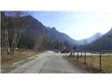
From the highway Ljubljana - Jesenice, we first take the exit Lesce, and then at the roundabout onto the old road in the direction of Žirovnica and Jesenice. After a few km of driving, we drive past the junction where the road towards the center of the settlement Žirovnica branches off to the right. When we drive past the viaduct Završnica, we come to the right turn-off, where we head (turn sharply right). Immediately afterwards, at the smaller junction we turn left, in the next one (after 50 m) right, in the direction of Završnica. After a short descent, the road briefly rises slightly and then levels out, and leads us to the spot where a macadam road towards Valvasorjev dom branches off to the left. We park at the new parking lot, which is located nearby, next to the reservoir lake, on the right side of the road.
Route description:
From the parking lot, we head over the bridge on the dam of the reservoir lake, and on the other side turn left. We walk along the wide path that leads first along the lake and then further along the slope on the right, straight towards the meadow. In the middle of the latter, on the edge of the forest on the right, we look for the path that turns sharply right onto the northern slope of Melega vrh. The wider, ascending path brings us to the ridge of Brezniških peči to an unmarked junction of paths. Here we head left, towards the east, onto the ridge path. This steeply ascends at first, and then for some time runs along the precipitous edge of the ridge, where we can enjoy the view into the Završnica valley and towards the slopes of Stol. The steepness briefly eases, after which a moderate ascent towards the summit of the 863 m high Mali vrh follows again. A little before reaching it, on the gentler part of the ridge we come to a barely noticeable right turn-off towards the church of Sveti Lovrenc. For orientation, the directional sign on the tree with the inscription "Lipje Gosjak" serves us, in front of which we will discover the path on the right. This descends quite steeply down the slope, due to the apparent left turn-off we follow the trodden direction. Lower down, we come to a section of the path with a wooden fence that leads from the village, but which is not in use due to fallen trees. Here we notice the sign "Brin vrh" and turn left. After a short descent and slight ascent, we arrive near the church of Sveti Lovrenc, where we take a rest and enjoy the nice view. The logbook is located by the wish bell at the entrance to the church.

Photos:
 1
1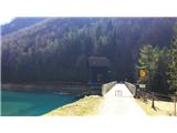 2
2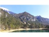 3
3 4
4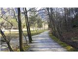 5
5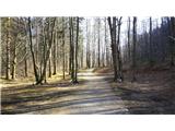 6
6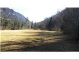 7
7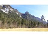 8
8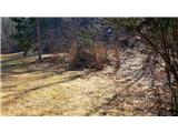 9
9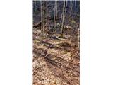 10
10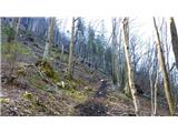 11
11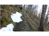 12
12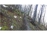 13
13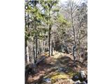 14
14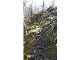 15
15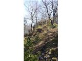 16
16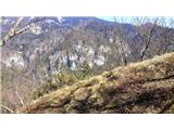 17
17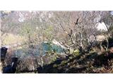 18
18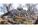 19
19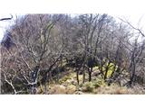 20
20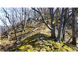 21
21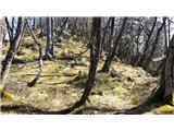 22
22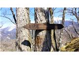 23
23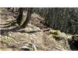 24
24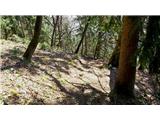 25
25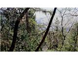 26
26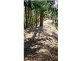 27
27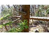 28
28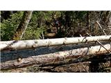 29
29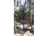 30
30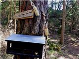 31
31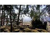 32
32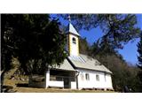 33
33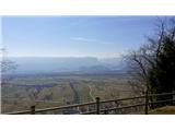 34
34 35
35
Discussion about the trip Poljana (Završnica) - Sveti Lovrenc above Zabreznica (via Mali vrh)
To post a comment you must log in:
If you do not yet have a username, you must first
register.