Poljane nad Škofjo Loko - Lubnik (via Gabrška gora)
Starting point: Poljane nad Škofjo Loko (385 m)
| Latitude/Longitude: | 46,12370°N 14,18425°E |
| |
Route name: via Gabrška gora
Walking time: 3 h 45 min
Difficulty: easy marked way
Elevation gain: 640 m
Elevation difference along the route: 725 m
Map: Škofjeloško in Cerkljansko hribovje 1:50.000
Recommended equipment (summer):
Recommended equipment (winter):
Views: 5.240
 | 3 people like this post |
Access to starting point:
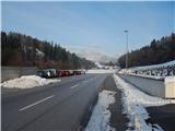
A) First, we drive to Škofja Loka, then we continue driving towards Gorenja vas and Žiri. When we arrive in Poljane nad Škofjo Loko, at the traffic-light intersection we turn right towards the center of the settlement. From the intersection, we drive another good 200 meters, then we park on the parking lot by the cemetery.
B) From Polhov Gradec or Horjul, Žiri or Cerkno, we drive to Gorenja vas in Poljanska dolina, then we continue driving towards Škofja Loka. When we arrive in Poljane nad Škofjo Loko, at the traffic-light intersection we turn left towards the center of the settlement. From the intersection, we drive another good 200 meters, then we park on the parking lot by the cemetery.
Route description:
From the cemetery we return a little back along the sidewalk, or more precisely to the second turn-off of the hiking path to Gabrška gora (the first turn-off of the path leads along the road). From the second turn-off we start to ascend along a narrower asphalt road, which leads us past a few houses, then before the last house we continue straight onto a cart track, which ascends through a panoramic meadow to the other asphalt road, where we join the first path to Gabrška gora.
For a short time we ascend along the asphalt road, then the signs for Gabrška gora direct us left onto a marked footpath, which starts to ascend through the forest. Through the forest the path leads us over several junctions, and we follow the blazes or signs for Gabrška gora. Higher the path brings us to the upper edge of a panoramic hayfield, from where a nice view opens up on part of Poljanska dolina and Polhograjsko hribovje. Above the mentioned section the path temporarily returns to the forest, then during the ascent over the next hayfield a nice view opens up to the left side, where we can clearly see Blegoš and a few neighboring peaks. When the path enters the forest again, a path from the hamlet Smoldno joins us from the right, and we continue straight past the shrine onto the path, which continues along a cart track. From the cart track we soon go left, then a few minutes of steeper ascent follow and the path brings us to the church of St. Primož and Felicijan on Gabrška gora.
From the church we continue across a panoramic meadow, then the marked path enters a strip of forest, behind which we step onto a road, which we follow right in the direction of Lubnik. Further the road leads us past individual houses in the settlement Gabrška Gora, and at intersections we follow the blazes, or go slightly left to the homestead Pešar. We bypass the homestead on the left side and continue the path along a cart track, at the junction we go left. Further we ascend over a panoramic hayfield, then the path takes us into the forest, through which it continues along the ridge, occasionally also along the slopes of Lovričkov vrh, later Plešavnikov vrh. Since the path through the forest has a few junctions, we carefully follow the blazes, and the path with a few shorter ascents and descents brings us to the road, which we follow slightly left (to the right homesteads Čude and Plešavnik, the road descends into Sopotniška grapa).
The path ahead leads us along the road, which past the NOB monument brings us to the intersection in the area named Vrhovčevo, and the intersection is located at an altitude of 834 meters.
From the mentioned intersection we continue right (left Zapreval and Stari vrh) and continue the path along a gentle macadam road, which bypasses Vrhovčev grič and Tavčarjev vrh on the right side, then past the abandoned homestead Dolinček brings us to the slopes of the peak Pleše, which the road also bypasses on the right side. The road then leads us past two more NOB monuments, then at the smaller intersection we continue slightly left in the direction of the homestead pri Zalubnikarju. About 100 meters further we arrive at a smaller saddle, where we join the path from the settlement Praprotno.
We continue right in the direction of Lubnik, along the path which quickly brings us to another macadam road, along which we continue the gentle ascent in the already familiar direction towards Lubnik. The macadam road then enters the forest, where it crosses the slopes to the right. A little higher a marked path from Breznica pod Lubnikom also joins from the right, and we continue slightly left along the increasingly worse, partly already cart track road. We continue the ascent along the ever worse and gradually also steeper cart track, but we also leave this and continue the ascent along the marked mountain path (due to the numerous cart tracks the orientation is somewhat more difficult at some places). Higher a few more mountain paths join from the right, and we follow the occasionally steeper path all the way to the summit of Lubnik, from which a nice view opens up.
Poljane - sv. Primož 1:20, sv. Primož - Vrhovčevo 1:00, Vrhovčevo - Lubnik 1:25.

Photos:
 1
1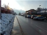 2
2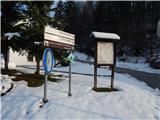 3
3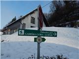 4
4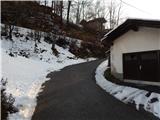 5
5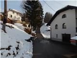 6
6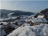 7
7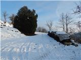 8
8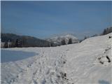 9
9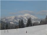 10
10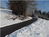 11
11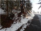 12
12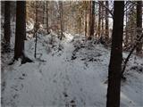 13
13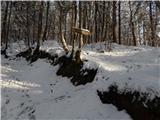 14
14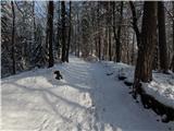 15
15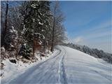 16
16 17
17 18
18 19
19 20
20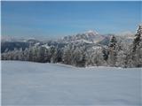 21
21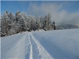 22
22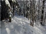 23
23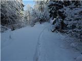 24
24 25
25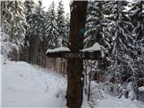 26
26 27
27 28
28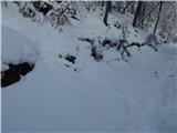 29
29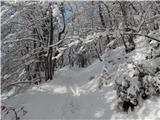 30
30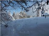 31
31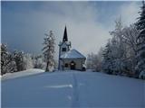 32
32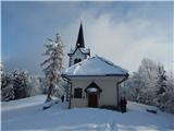 33
33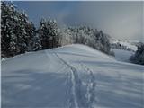 34
34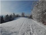 35
35 36
36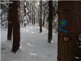 37
37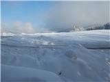 38
38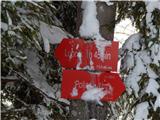 39
39 40
40 41
41 42
42 43
43 44
44 45
45 46
46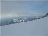 47
47 48
48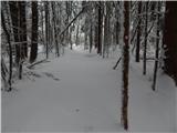 49
49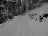 50
50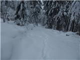 51
51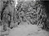 52
52 53
53 54
54 55
55 56
56 57
57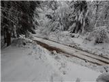 58
58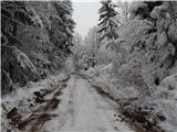 59
59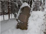 60
60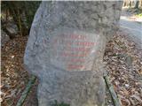 61
61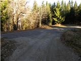 62
62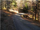 63
63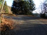 64
64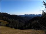 65
65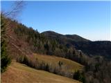 66
66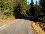 67
67 68
68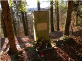 69
69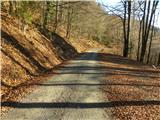 70
70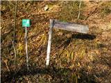 71
71 72
72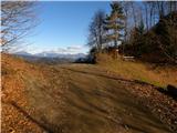 73
73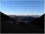 74
74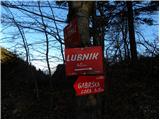 75
75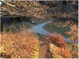 76
76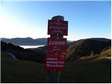 77
77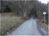 78
78 79
79 80
80 81
81 82
82 83
83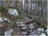 84
84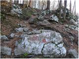 85
85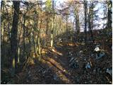 86
86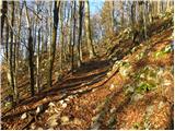 87
87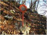 88
88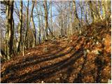 89
89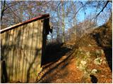 90
90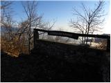 91
91 92
92 93
93 94
94
Discussion about the trip Poljane nad Škofjo Loko - Lubnik (via Gabrška gora)
|
| ločanka7. 11. 2020 |
Yesterday first time on this path. Really nice hike, which takes preferably a bit more than stated. But worth it, in this time nicely colorful. Sometimes at intersections a bit in dilemma, markings are insufficient. We missed twice, but always found the right path afterwards. But this way we saw many things we wouldn't otherwise. Definitely satisfied that we went on this path, which is worth repeating. It's already agreed ! !
|
|
|
To post a comment you must log in:
If you do not yet have a username, you must first
register.