Poljčane - Cerkev sv. Treh kraljev v Ješovcu
Starting point: Poljčane (261 m)
| Latitude/Longitude: | 46,31426°N 15,57820°E |
| |
Walking time: 2 h 15 min
Difficulty: easy marked way
Elevation gain: 59 m
Elevation difference along the route: 250 m
Map:
Recommended equipment (summer):
Recommended equipment (winter):
Views: 22
 | 1 person like this post |
Access to starting point:
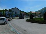
We drive to Poljčane, where in the town centre between the Tuš and Mercator stores we park at the public parking lot. The parking lots next to the stores are intended for customers. We can also park at any other public parking lot in the settlement.
Route description:
At the Tuš store in Poljčane we notice red mountain trail signs that direct us onto a side road which bypasses the store on its southern side and continues eastwards. A little further ahead, at the cross, we go slightly right onto the road next to which there is a sign indicating a dead end and next to which the markings continue. The mentioned road ends at the last houses in the street, but we continue along the paved marked path which starts to climb more steeply through the forest. When we leave the forest a few minutes higher up, at the next cross we reach an asphalt road and follow it left uphill.
We continue past a few houses; when the road levels out the markings direct us right onto a road which starts to descend, but we do not follow it for long as we soon go left.
Here the junction from the road is not marked and the path continuing along the pasture fence is also not easy to follow. When we reach the forest a little lower down we find the cart track along which the marked path continues. Lower down we temporarily leave the forest and cross a grassy valley, then we begin to climb again through the forest. A few minutes of ascent through the forest follow; higher up, by the meadow and field, we reach the nearby farm which we bypass on the right side; the cart track widens into a rougher road along which we continue to the Španring Chapel, where we go right onto the asphalt road behind it.
The path continues along the asphalt road, along which we mostly descend gently to moderately; at a few intersections, mainly turn-offs to homesteads, we follow the markings.
When we later reach the marked junction south of Janžev vrh, we go left behind the nearest house onto a cart track which first descends transversely across the hay meadow, then enters the forest where it continues descending. A few minutes further we leave the cart track left onto an initially parallel marked path which then turns left and descends a little more. When we leave the forest the path levels out and we continue across the meadow where we bypass the hunting observation hut on the left side, then along an indistinct grassy cart track we climb to the next farm.
We continue across the yard, then along the access gravel road to the next house which we bypass slightly to the left; in the forest strip we reach an asphalt road which we follow to the right.
We continue through the forest without major elevation changes, then go right onto the road along which the markings and LPP path signs continue. When we leave the forest a little further a nice view opens up to the nearby Boč on the right side; from the intersection by the chapel we go slightly left. We continue past a few houses, then the road turns left and descends to an intersection where we go sharply right. An ascent to the Korošec farm follows, which we bypass on the left side, and we continue along the asphalt road with the path. After crossing a forest strip we reach a somewhat wider road where we go slightly left, then soon slightly right onto another side road.
Further on the road leads us past individual houses and we follow the asphalt road to the information board located below the church of the Three Kings.
Here we go left and quickly ascend to the church along the access gravel path.
The description and photos refer to the conditions in April 2026.

Along the route: Spodnji Čretnik (316m), Čretnik (320m), Španringova kapelica (340m), Janžev vrh (319m), Zasedi (307m), Korošec (318m)
Photos:
 1
1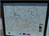 2
2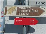 3
3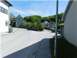 4
4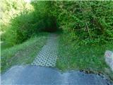 5
5 6
6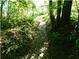 7
7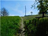 8
8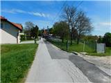 9
9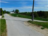 10
10 11
11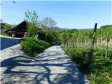 12
12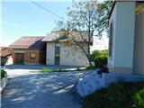 13
13 14
14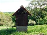 15
15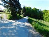 16
16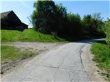 17
17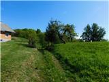 18
18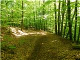 19
19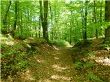 20
20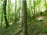 21
21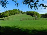 22
22 23
23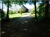 24
24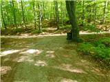 25
25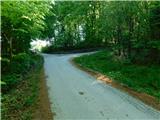 26
26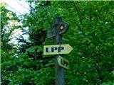 27
27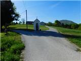 28
28 29
29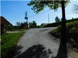 30
30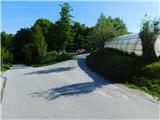 31
31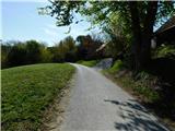 32
32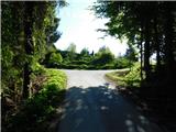 33
33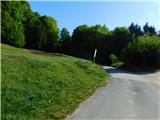 34
34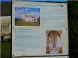 35
35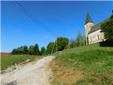 36
36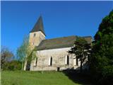 37
37
Discussion about the trip Poljčane - Cerkev sv. Treh kraljev v Ješovcu
To post a comment you must log in:
If you do not yet have a username, you must first
register.