Poljšica pri Gorjah (Zatrata) - Hotunjski vrh (on footpath)
Starting point: Poljšica pri Gorjah (Zatrata) (660 m)
| Latitude/Longitude: | 46,37110°N 14,06940°E |
| |
Route name: on footpath
Walking time: 1 h 30 min
Difficulty: easy unmarked way
Elevation gain: 447 m
Elevation difference along the route: 475 m
Map: TNP 1:50.000
Recommended equipment (summer):
Recommended equipment (winter):
Views: 3.910
 | 1 person like this post |
Access to starting point:
A) We drive to Bled, then continue driving in the direction of Pokljuka. When we arrive in Zgornje Gorje, at the intersection by the church we turn left towards Poljšica. We then drive along a narrow road past the church, and at the nearby intersection behind the chapel we turn right. A little further on, at the next intersection we go left towards Poljšica, and when we arrive in the mentioned settlement we turn right at the first intersection, then after about 10 meters left towards the hamlet Zatrata. We park in a suitable spot at the start of the mentioned hamlet, where we notice the signs for Riklijeva pot, which branches off to the right from the road.
B) We leave the Gorenjska motorway at the Lipce exit, then follow the signs for the settlement Kočna and later Spodnje Gorje. In Spodnje Gorje we join the road from Bled, and continue in the direction of Pokljuka. When we arrive in Zgornje Gorje, at the intersection by the church we turn left towards Poljšica. We then drive along a narrow road past the church, and at the nearby intersection behind the chapel we turn right. A little further on, at the next intersection we go left towards Poljšica, and when we arrive in the mentioned settlement we turn right at the first intersection, then after about 10 meters left towards the hamlet Zatrata. We park in a suitable spot at the start of the mentioned hamlet, where we notice the signs for Riklijeva pot, which branches off to the right from the road.
Route description:
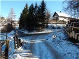
From the starting point, where there is also a smaller intersection of several roads, we continue in the direction of Riklijeva pot, whose signs direct us slightly right onto a narrower macadam road that gently ascends along the pasture fence. At first, a beautiful view opens up towards the Karawanks, then the road turns left and after a short ascent temporarily descends. In a small valley we leave the poorer road and continue the ascent left onto a cart track in the direction of Riklijeva pot. We continue along the cart track, which proceeds through the forest; at junctions we follow the signs for Riklijeva pot. Higher up, a beautiful view opens up on the Kamnik Savinja Alps, and the path then returns to the forest and gradually brings us to a forested ridge. Along the ridge we first ascend, then descend along it to a forest road, which we follow in the direction of the mountain pasture Rčitno.
Further on, as we walk along the road, we are also accompanied by Knafelc blazes. A fairly gentle road that for some time runs through a small valley, higher up turns right and becomes steeper and increasingly similar to a wide cart track. During the ascent along the poorer road, some views temporarily open up in the direction of Galetovec, and when the path returns to dense forest, it also splits.
We continue slightly right onto the ascending cart track (straight to mountain pasture Rčitno - 5 minutes), which bypasses the mountain pasture Rčitno on the right side. During the traverse ascent, some views temporarily open up towards the mentioned mountain pasture, and the cart track soon enters dense forest; at the nearby junction we choose the right cart track, which further on is quite eroded by torrents. We then follow the mentioned cart track all the way to the macadam road, which we follow to the right. Along the road we ascend easily for a few minutes, and when the road begins to descend, we leave it (we leave the road at the point where it starts descending, or possibly a minute further at the ruins of the former Posavc homestead) and continue left into the forest, where after a minute or two we reach the former ski slope of the Zatrnik ski area.
We continue the ascent along the former ski slope, which turns left, then with ever better views we arrive at the upper station of the abandoned drag lift, from which only a few dozen steps along the ridge separate us from the summit of Hotunjski vrh.
Description and pictures refer to the condition in 2017 (January).

Photos:
 1
1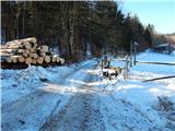 2
2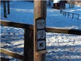 3
3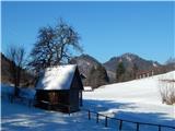 4
4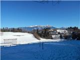 5
5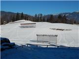 6
6 7
7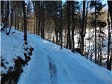 8
8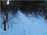 9
9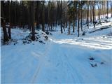 10
10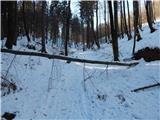 11
11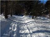 12
12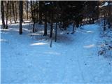 13
13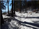 14
14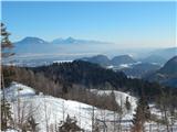 15
15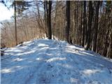 16
16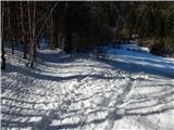 17
17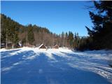 18
18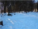 19
19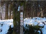 20
20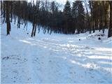 21
21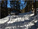 22
22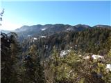 23
23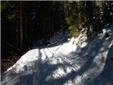 24
24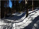 25
25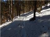 26
26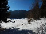 27
27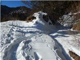 28
28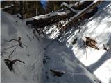 29
29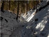 30
30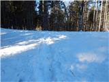 31
31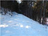 32
32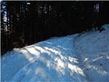 33
33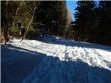 34
34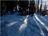 35
35 36
36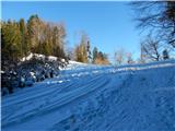 37
37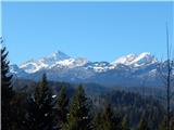 38
38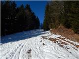 39
39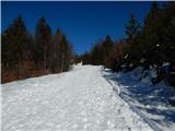 40
40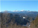 41
41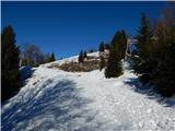 42
42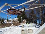 43
43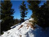 44
44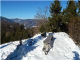 45
45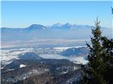 46
46 47
47
Discussion about the trip Poljšica pri Gorjah (Zatrata) - Hotunjski vrh (on footpath)
|
| čomolungma18. 05. 2020 |
The weather forecast promised afternoon clearing, and expecting nice views from Hotunjski vrh, I chose this path yesterday. In the first part, you need to watch carefully for the markers of Riklijeva pot. After reaching the road, the path is marked and there are no issues; but they appear at planina Rčitno. I couldn't find the junction at all, the cart track to the right soon became a dead end  After some wandering around the planina and realizing there won't be any views anyway, I finally gave up. Next time After some wandering around the planina and realizing there won't be any views anyway, I finally gave up. Next time 
|
|
|
|
| bumbi19. 05. 2020 |
Up to Himalaja there are still many forks, some have an exit, otherwise you turn back. And try again, and even little HV can become a demanding mountain. The view from the top is worth the effort.
|
|
|
|
| bumbi19. 05. 2020 |
Up to Himalaja there are still many forks, some have an exit, otherwise you turn back. And try again, and even little HV can become a demanding mountain. The view from the top is worth the effort.
|
|
|
|
| Zemlja19. 05. 2020 |
This junction looks at first like a slightly more overgrown cart track, then more like a logging trail. But it is right at the right edge of planina Rčitno.
|
|
|
To post a comment you must log in:
If you do not yet have a username, you must first
register.