Polomova rajda - Koča Antona Bavčerja na Čavnu (by road)
Starting point: Polomova rajda (1023 m)
| Latitude/Longitude: | 45,95600°N 13,85410°E |
| |
Route name: by road
Walking time: 1 h
Difficulty: easy marked way
Elevation gain: 219 m
Elevation difference along the route: 240 m
Map: Goriška 1:50.000
Recommended equipment (summer):
Recommended equipment (winter):
Views: 33.397
 | 3 people like this post |
Access to starting point:
a) We drive to Col, then follow the road in the direction of Otlica and Predmeja. This is followed by driving across the Gora plateau, where the road leads us through several villages; when at Predmeja we join the road from Ajdovščina, we go right in the direction of the settlement Lokve. The road ahead leads us through a little valley, where first a marked path branches off to the right towards Golakov, a little further ahead the road turns left and from the little valley passes onto the slope. When higher up the road turns right, we turn left onto the side road, along which there are signs for Čaven. We park a bit further ahead at a suitable place by the road.
b) We drive to Ajdovščina, then follow the signs for Lokavec and Predmeja. This is followed by a fairly steep ascent along the road to Predmeja, where we continue straight in the direction of the settlement Lokve. The road ahead leads us through a little valley, where first a marked path branches off to the right towards Golakov, a little further ahead the road turns left and from the little valley passes onto the slope. When higher up the road turns right, we turn left onto the side road, along which there are signs for Čaven. We park a bit further ahead at a suitable place by the road.
Route description:
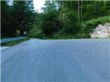
We start the path along the forest road in the direction of Čavn and ascend gently to moderately along it towards the left, while individual Knafelc markings accompany us along the way. Later, at a small junction, we continue along the left lower road, along which there are signs for Čaven, then past the NOB monument we arrive at a marked junction, where we join the marked path from Predmeja. The path ahead still leads along the forest road, which becomes asphalted on a shorter section; when the forest on the left ends, a nice view opens up from the viewpoint onto the surroundings, where Nanos and part of the Vipavska dolina are nicely visible.
After the viewpoint we continue straight ahead (right one of the paths to Veliki Modrasovec) and in a few minutes of further walking we arrive at the Koča Antona Bavčerja na Čavnu.
Description and photos refer to the conditions in July 2025.
Photos:
 1
1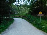 2
2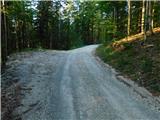 3
3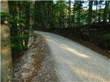 4
4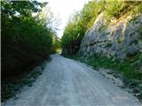 5
5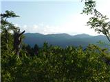 6
6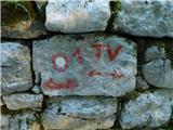 7
7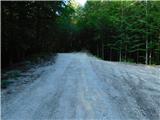 8
8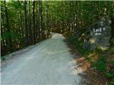 9
9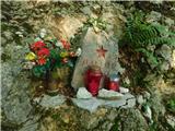 10
10 11
11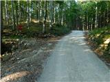 12
12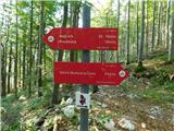 13
13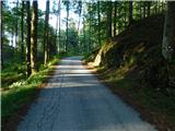 14
14 15
15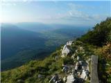 16
16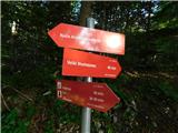 17
17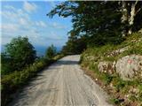 18
18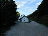 19
19 20
20
Discussion about the trip Polomova rajda - Koča Antona Bavčerja na Čavnu (by road)
|
| NEIC00823. 03. 2009 |
Wonderful view just before arriving at the hut.. Too bad I was the only visitor. 
|
|
|
|
| Ronaldinho8225. 09. 2014 |
Has anyone stayed overnight in this hut? Any experiences, friendliness etc? Thanks for any information.
|
|
|
|
| mili26. 09. 2014 |
I stayed overnight in this hut twice. The caretaker is very friendly, I can only praise him. The sanitary facilities are OK too, good food, comfortable beds. If one isn't too spoiled, of course. Best regards.
|
|
|
|
| Ruzowski18. 02. 2015 |
On Sunday afternoon I ski up the road with cross-country skis. A couple of minutes from the lokve čaven junction the path is practically unrecognizable. I don't remember so much snow. The path isn't plowed and probably won't be for a good while. Phenomenal conditions! 
|
|
|
|
| mobl19. 02. 2015 |
Ruzowski you're exaggerating a bit, no hard feelings . Snow is like (almost) every year, nothing special for winter on Gori. Road is really a bit poorly plowed but you can go nicely. Otherwise really phenomenal, make the most of these nice days.
|
|
|
|
| mobl19. 02. 2015 |
P.S. Road is plowed up to below the second left turnoff for Čaven. (Pic 3 above). But you can walk nicely further too. Best regards.
|
|
|
|
| Tadej5. 08. 2025 12:55:59 |
The above description has been updated, and the images have also been replaced.
Image 3 from mobl-a's comment is now image 8.
|
|
|
To post a comment you must log in:
If you do not yet have a username, you must first
register.