Polomova rajda - Mali Modrasovec (via Koča na Čavnu)
Starting point: Polomova rajda (1023 m)
| Latitude/Longitude: | 45,95600°N 13,85410°E |
| |
Route name: via Koča na Čavnu
Walking time: 1 h 10 min
Difficulty: easy marked way, easy unmarked way
Elevation gain: 282 m
Elevation difference along the route: 300 m
Map: Goriška 1:50.000
Recommended equipment (summer):
Recommended equipment (winter): ice axe, crampons
Views: 6.962
 | 1 person like this post |
Access to starting point:
a) We drive to Col, then follow the road in the direction of Otlice and Predmeja. This is followed by driving across the Gora plateau, where the road leads us through several villages; when at Predmeja we join the road from Ajdovščina, we go right in the direction of the settlement Lokve. The road further leads us through a small valley, where first to the right one of the marked paths branches off towards Golakov, a little further the road turns left and from the small valley passes to the slope. When higher the road turns right, we head left onto the side road, along which there are signs for Čaven. We park a little further at a suitable place by the road.
b) We drive to Ajdovščina, then follow the signs for Lokavec and Predmeja. This is followed by a fairly steep ascent along the road to Predmeja, where we continue straight in the direction of the settlement Lokve. The road further leads us through a small valley, where first to the right one of the marked paths branches off towards Golakov, a little further the road turns left and from the small valley passes to the slope. When higher the road turns right, we head left onto the side road, along which there are signs for Čaven. We park a little further at a suitable place by the road.
Route description:
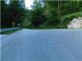
From the parking lot, we start on a forest road towards Čaven. The road gently to moderately ascends towards the left, accompanied by individual Knafelc markings. Later, at a small crossroad, we continue on the left lower road, along which there are signs for Čaven, then past the NOB monument we reach a marked junction, where we join the marked path from Predmeja. The path continues on the forest road, which becomes asphalted on a short section; when the forest on the left ends, a nice view opens from the viewpoint to the surroundings, where Nanos and part of the Vipavska dolina are clearly visible.
Beyond the viewpoint, we continue straight (right one of the paths to Veliki Modrasovec) and in a few minutes of further walking we reach Koča Antona Bavčerja na Čavnu.
Behind the hut, the signs for Veliki Modrasovec, Mali Golak and Koča pod Golaki direct us right onto a path that ascends transversely across the meadow, then enters the forest where it levels out. We walk shortly through the forest and reach a junction, where the inscription on the rock for Golake points straight, but we go right onto a trodden but unmarked path that ascends through the forest, a little further it joins a cart track, along which we quickly ascend to the summit of Mali Modrasovec.
Starting point - Koča na Čavnu 1:00, Koča na Čavnu - Mali Modrasovec 0:10.
Description and images refer to the state in July 2025.

Photos:
 1
1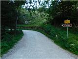 2
2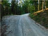 3
3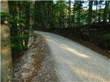 4
4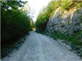 5
5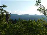 6
6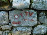 7
7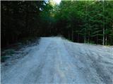 8
8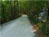 9
9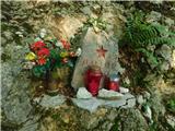 10
10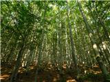 11
11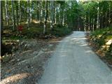 12
12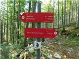 13
13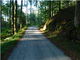 14
14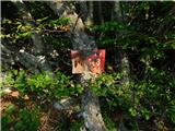 15
15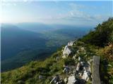 16
16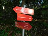 17
17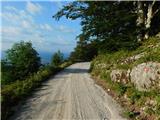 18
18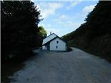 19
19 20
20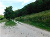 21
21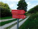 22
22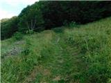 23
23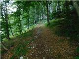 24
24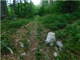 25
25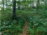 26
26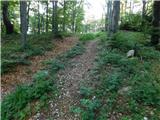 27
27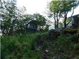 28
28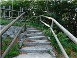 29
29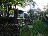 30
30
Discussion about the trip Polomova rajda - Mali Modrasovec (via Koča na Čavnu)
To post a comment you must log in:
If you do not yet have a username, you must first
register.