Ponova vas - Tabor Cerovo
Starting point: Ponova vas (390 m)
| Latitude/Longitude: | 45,93000°N 14,63370°E |
| |
Walking time: 20 min
Difficulty: easy marked way
Elevation gain: 103 m
Elevation difference along the route: 103 m
Map:
Recommended equipment (summer):
Recommended equipment (winter):
Views: 1.680
 | 2 people like this post |
Access to starting point:
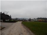
First, we drive to Grosuplje, and then we continue driving in the direction of Turjak and Županova jama cave. In Ponova vas, behind the chapel we leave the main road towards Turjak and Županova jama cave and we continue driving slightly left, on a narrower road in the direction which still continues through the mentioned village. A little further, the road splits, and we continue slightly right (slightly left Cerovo), and at the next crossroad we go straight. When the village ends, the road passes into the forest, and then we park on an appropriate place by the road.
Route description:
From the starting point, we continue on a macadam road which is ascending through the forest. Higher, the road flattens, and after a few minutes of additional walking brings us to a smaller crossroad, where the road branches off to the right towards the nearby military area, and only a few meters ahead we continue left, on a footpath towards Tabor Cerovo. The path ahead leads us above the chapel of St. Anthony the Hermit and ascends diagonally towards Tabor Cerovo, which we reach after a few minutes of additional walking. When we get to the wall, we walk to the nearby logbook box, and to see the interior of the tabor it is necessary to pay an entrance fee, namely 2 eur adults and 1 eur kids (regular tours from July to October between 16 and 18 (data from the year 2016)).
Photos:
 1
1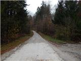 2
2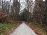 3
3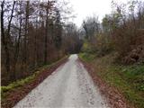 4
4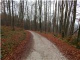 5
5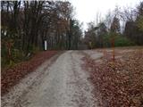 6
6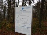 7
7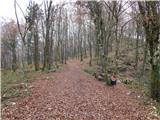 8
8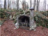 9
9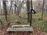 10
10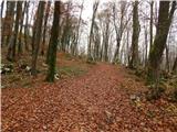 11
11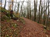 12
12 13
13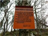 14
14 15
15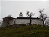 16
16 17
17
Discussion about the trip Ponova vas - Tabor Cerovo
To post a comment you must log in:
If you do not yet have a username, you must first
register.