Potoče - Javorov vrh (via Potoška gora)
Starting point: Potoče (520 m)
| Latitude/Longitude: | 46,30580°N 14,43200°E |
| |
Route name: via Potoška gora
Walking time: 2 h 45 min
Difficulty: easy marked way
Elevation gain: 914 m
Elevation difference along the route: 1000 m
Map: Karavanke - osrednji del 1:50.000
Recommended equipment (summer):
Recommended equipment (winter): ice axe, crampons
Views: 12.994
 | 3 people like this post |
Access to starting point:
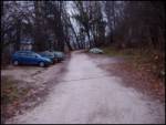
A) From the Ljubljana - Jesenice highway, take the Kranj - east exit, then continue driving towards Jezersko. When we arrive in Preddvor, leave the main road and continue driving left, then after some 10 m, opposite the Jelovica company, continue right towards the village Potoče, St. Jakob and Potoška gora and lake Črnava. Further, the road leads us through the settlement Hrib, above which we arrive at a crossroads, where we continue straight (left Hotel Bor and lake Črnava, right Senior Citizens' Home Preddvor). There follows a good 100 m of gentle ascent to the chapel, where the road turns right, and we drive along it past a few more houses, then before the Senior Citizens' Home turn left onto a larger macadam parking lot.
B) From the Jesenice - Ljubljana highway, take the Kranj - west exit and at the first crossroads continue left. Further, we drive through the underpass under the highway, then arrive at a roundabout, from which we continue driving towards Golnik. The road ahead leads through the settlement Mlaka pri Kranju, and at the end of the settlement we continue right towards the settlement Srakovlje. This is followed by driving through Srakovlje, Spodnja Bela, Srednja Bela to Zgornja Bela, where we continue right towards Preddvor. At the end of Preddvor, just some 10 m before the road joins the main road Zgornje Jezersko - Kranj, we continue left towards the village Potoče, St. Jakob and Potoška gora and lake Črnava. Further, the road leads us through the settlement Hrib, above which we arrive at a crossroads, where we continue straight (left Hotel Bor and lake Črnava, right Senior Citizens' Home Preddvor). There follows a good 100 m of gentle ascent to the chapel, where the road turns right, and we drive along it past a few more houses, then before the Senior Citizens' Home turn left onto a larger macadam parking lot.
Route description:
At the beginning of the parking lot, we head to the footpath that goes along the fence of the seniors' home upwards. The path steeply ascends through the forest and brings us to the shelter Josipine Turnograjske in five minutes. Here there is a logbook and some benches.
The path ahead slightly descends and brings us to a cart track. We follow the well-marked cart track for another five minutes to the place where we reach the road at the Mimi refreshment stand. Here we go straight upwards in the direction of Novi grad and Jakob. The path brings us to a junction already after some ten meters, where we go right. The left path goes to Novi grad. We follow the right path ahead through the forest for a few more minutes, then we cross the cart track, which also leads to Jakob. Further ahead the path ascends through the forest and brings us again to a junction. We go right onto a less trodden path (well marked). If we go straight, we reach the cart track. Our path then crosses the cart track again after approximately five minutes. The path ahead ascends somewhat more steeply and completely approaches the cart track at the cross. Further on we stay on the footpath, which runs just slightly left of the cart track. Then we again reach a junction, where we go right. The left path goes to the hut pri Franciju. Our right path brings us to a cart track in a few minutes, where we go left. We follow this cart track for approximately five minutes all the way to the Iskra hut on Jakob.
Between the hut and the church there are signposts that direct us along the northern side of the church ahead in the direction of Potoška gora. After a short descent the path starts ascending through the forest and brings us to a junction after approximately 15 minutes. Here we go right in the direction of Potoška gora. The straight path goes to Javorov vrh. We follow the right path ahead and it brings us into occasionally sparse forest with some views. But the path soon goes back into dense forest and hides the nice view. The path continues moderately ascending and brings us to the summit, where a bench is placed (Potoška gora).
From the summit we descend along the marked path down approximately 10 minutes to a junction. Here the direct path from Jakob joins us from the left side, and from the right side the path from Dom Čemšenik joins us. Here we continue straight in the direction of Javorov vrh and Srednji vrh. After a few minutes the path running through the forest brings us to the next junction. Here we take the right path (straight Srednji vrh), which leads to Javorov vrh. Here the path starts ascending again and continues through the forest. Orientation ahead is not particularly difficult as the path mostly follows the ridge and leaves it only occasionally. After 15 minutes the path brings us again to a junction. Here we go right and the path continues mostly following the ridge. After another 15 minutes we reach the logbook. From here we have only another 10 m of walking to the summit, which is not covered with forest.
Starting point - Jakob 1:15, Jakob - Potoška gora 45 minutes, Potoška gora - Javorov vrh 45 minutes.

Photos:
 1
1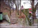 2
2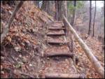 3
3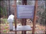 4
4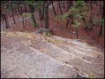 5
5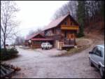 6
6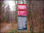 7
7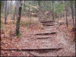 8
8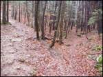 9
9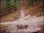 10
10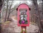 11
11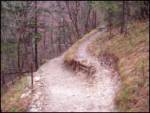 12
12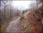 13
13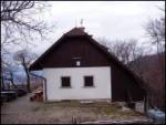 14
14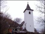 15
15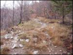 16
16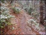 17
17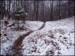 18
18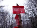 19
19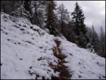 20
20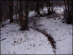 21
21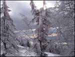 22
22 23
23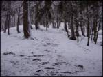 24
24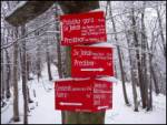 25
25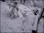 26
26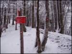 27
27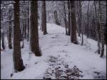 28
28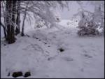 29
29 30
30
Discussion about the trip Potoče - Javorov vrh (via Potoška gora)
|
| klavdy623. 05. 2009 |
It is best to choose this path with a stop at Potoška gora. Before Sv. Jakob, you can also see the ruins of Novi grad (marked).
|
|
|
To post a comment you must log in:
If you do not yet have a username, you must first
register.